

THE RAILWAY VIADUCT AT LES GRANGES DE XERTIGNY
No reviews yet
Have you flown here? Share your experience with other pilots.
+ Write the first reviewDescription
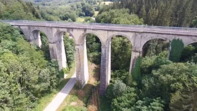
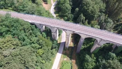
Looking back on my flight yesterday, above and below the railway viaduct at Les Granges de Xertigny (Vosges) Regulatory scenario: S1 Viaduct height: 38 meters Maximum flight height: 120 meters Maximum operating radius: 200 meters Special precaution taken: Do not fly over the viaduct while trains are passing.
The Granges viaduct is a magnificent structure made up of 9 cut-stone arches, 38 m high and 108 m long. By spanning the Cône valley at this height, it allowed the railway line linking Epinal to Belfort to run in a continuous straight line. Construction of the structure was completed in 1862, and in more than 150 years it has gone through quite a few ups and downs. - On October 13, 1870, during the Franco-Prussian War, the day after the Prussians had occupied Epinal, French engineers blew up the middle pier to cut off the strategic rail traffic. The Prussians then built a temporary wooden arch and, from December, were able to transport the equipment needed for the siege of Belfort (shells, mortars, etc.). The viaduct was fully restored in 1874. - In 1944, near the end of the Second World War, German soldiers in turn wanted to hold back the Allied advance and prepared mine holes in the structure. These were blocked by the FFI (Forces Françaises de l'Intérieur, bringing together the resistance movements) with scrap metal and cement. Nevertheless, on September 15, 1944, they blew up the 2 central arches. The US Army engineers managed to reinforce the structure and allow traffic on one track. Service was fully restored on January 21, 1948. - A tragic accident took place in May 1982 on the viaduct, when two trains collided. One locomotive fell 35 m, while the other remained balanced on the viaduct. The accident killed 2 people and injured 7 others. By taking trail no. 08 called "Le Hazot", you can admire the architecture of this beautiful, now historic structure. Today, the Epinal-Belfort line, after some concerns about its survival, fortunately continues to operate.
Map and restricted areas
Open in the main mapNearby aerodromes
Open aerodromes within 25 km of the spot, heliports included, with their distance and direction from the spot. Near an aerodrome, drone flying is prohibited or height-limited: check the UAS zones map.
| Aerodrome | Type | Distance | Elevation | Difference |
|---|---|---|---|---|
| Épinal Dogneville Airfield | Aerodrome | 17 km N | 317 m | spot 85 m higher |
Aviation weather (METAR and TAF)
LFSX – Luxeuil-Saint-Sauveur (BA 116) Air Base VFR
METAR
METAR LFSX 210630Z AUTO 23003KT 9999 FEW016/// SCT027/// BKN032/// ///TCU 07/06 Q1019
- Wind
- 230°, 6 km/h
- Visibility
- 10 km or more
- Clouds
- Few (1-2/8) at 1,600 ft (490 m) ; Scattered (3-4/8) at 2,700 ft (820 m) ; Broken (5-7/8) at 3,200 ft (980 m)
- Temperature
- 7 °C, dew point 6 °C
- QNH
- 1019 hPa
- Flight category
- VFR: ceiling > 3,000 ft and visibility > 5 mi
TAF
Weather and Kp index
Sunrise and sunset
| Day | Dawn | Sunrise | Golden hour | Sunset | Dusk | Day length |
|---|---|---|---|---|---|---|
| Sat 21 Nov | 07:15 | 07:50 | 07:50–08:39 · 16:01–16:51 | 16:51 | 17:25 | 9 h 00 |
| Sun 22 Nov | 07:17 | 07:51 | 07:51–08:41 · 16:00–16:50 | 16:50 | 17:24 | 8 h 58 |
| Mon 23 Nov | 07:18 | 07:53 | 07:53–08:43 · 15:59–16:49 | 16:49 | 17:24 | 8 h 56 |
| Tue 24 Nov | 07:19 | 07:54 | 07:54–08:44 · 15:58–16:48 | 16:48 | 17:23 | 8 h 54 |
| Wed 25 Nov | 07:21 | 07:55 | 07:55–08:46 · 15:57–16:47 | 16:47 | 17:22 | 8 h 51 |
| Thu 26 Nov | 07:22 | 07:57 | 07:57–08:48 · 15:56–16:47 | 16:47 | 17:22 | 8 h 49 |
| Fri 27 Nov | 07:23 | 07:58 | 07:58–08:49 · 15:55–16:46 | 16:46 | 17:21 | 8 h 47 |



Reviews
Log in to review this spot. Log in · Create a free account
No reviews yet. Share yours!