

Fort Barraux
No reviews yet
Have you flown here? Share your experience with other pilots.
+ Write the first reviewDescription
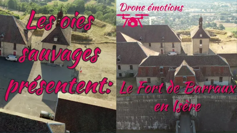
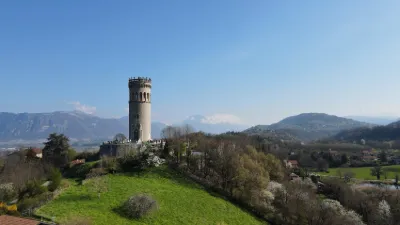
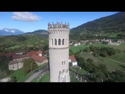
Created in 1597 by the Italian engineer Ercole Negro, Fort Barraux was built on the orders of Charles-Emmanuel I, Duke of Savoy, out of sheer provocation towards King Henri IV of France, and above all towards Constable Lesdiguières, the Protestant governor of Dauphiné. The fort, quadrangular with six bastions with orillons and three demi-lunes and parade grounds, was built fairly quickly. Some of the stones probably came from two older fortifications, Bellecombe and La Buissière, abandoned twenty years earlier. On 15 March 1598, the construction work had barely finished when Lesdiguières seized the fort, justifying the capture by the need for a fort to defend the Grésivaudan route to Grenoble, since the kingdom's finances did not allow for such a development. As soon as it was taken, Fort Barraux was redeveloped by the engineers of Henri IV and Lesdiguières. The first of them was Jean de Bien. His contribution was to move the main gate of the fort, originally placed in the Savoy front, and reinstall it in the Grenoble front, where the orillon of the King's bastion could easily cover it. He also built the Governor's residence and the lower forts, which form a fausse braie. The engineer Camus then reinforced the defenses to the north by enlarging the Savoy demi-lune, which he linked to the fort by an open-air caponier. Camus also transformed the southern lower forts into bastions to make them more effective. The interior buildings were then scattered around the parade ground, with no concern for layout. A barracks, numbered 28, was built shortly before 1692 and later refurbished. In 1689, the engineer de Lagrune prepared an improvement project that was never carried out, but whose main idea Vauban took up: moving the entrance to the Barraux front. Vauban visited Fort Barraux in 1692, shortly after the incursion of Duke Victor-Amadeus of Savoy into Isère. He then drew up a major works program that profoundly changed the fort, both in its fortified works and in its interior layout. The ditches were dug a fathom deeper, the tips of the bastions were raised for better defilade, and the bastions were fitted with underground casemates for crossfire. The gate was moved to the Barraux front, and a demi-lune and a detached lunette were built in front of it. Three drawbridges and one fixed bridge must be crossed to reach the gateway, which is fitted with two studded doors separated by portcullis-like organ-gun bars descending from the upper floor. Two other lunettes were added to cover the two curtain walls of the Isère front, and a tenaille reinforced the one serving the Queen's and Lesdiguières bastions. The covered ways were rebuilt and fitted with traverses with chicanes and with reentrant or salient places of arms. Redoubts were planned on the capitals of the bastions, as well as an entrenchment on the Furet river below the fort, a bridge defended by redoubts over the Isère, and obstacles on the Chartreuse. But these last works were never carried out. Inside, the fort's courtyard was leveled, allowing an orderly urban plan. A central parade ground was laid out and bordered by buildings on three sides. New barracks of two or three levels, an officers' building, a two-story arsenal, a new chapel, a new underground powder magazine (the large one) and a bombproof vaulted well were planned in Vauban's projects from 1692, but were built gradually, as funds allowed. The small powder magazine, which existed before 1692, was straightened up as best as possible. The gate was moved once again, to be installed in the west front. At the beginning of the 19th century, modifications were made to the fort: first by building a casemated artillery cavalier on the Grenoble front, then by adding a counterguard fitted with countermines under the glacis of the Savoy front. The outlines of these works had already been envisaged in 1791 by the engineer Le Michaud d'Arçon.
Current state Fort Barraux and all its military buildings still exist. However, they have deteriorated considerably since the army abandoned the site in 1986, after it had served as an ammunition depot and a prison. In 1993 an orillon collapsed, and a curtain wall in 1995. To remedy this, major restoration work is under way, carried out by volunteers and young people undergoing social and professional reintegration. The fort can be visited freely from May to September, and with guided and/or theatrical tours all year round, by reservation with the Association de sauvegarde et de valorisation du fort Barraux, which regularly organizes exhibitions and various cultural events there.
Map and restricted areas
Open in the main mapNearby aerodromes
Open aerodromes within 25 km of the spot, heliports included, with their distance and direction from the spot. Near an aerodrome, drone flying is prohibited or height-limited: check the UAS zones map.
| Aerodrome | Type | Distance | Elevation | Difference |
|---|---|---|---|---|
| Aérodrome de Chambéry Challes-les-Eaux | Aerodrome | 14 km N | 297 m | spot 36 m higher |
| Centre Hospitalier Heliport | Heliport | 16 km N | 319 m | spot 13 m higher |
| Saint Rémy de Maurienne | Aerodrome | 23 km E | 426 m | spot 94 m lower |
| Chambéry-Savoie Airport | Airport | 24 km N | 237 m | spot 95 m higher |
Aviation weather (METAR and TAF)
LFLB – Chambéry-Savoie Airport VFR
METAR
METAR LFLB 210700Z AUTO 19006KT 9999 FEW029 SCT048 BKN054 09/08 Q1021 NOSIG
- Wind
- 190°, 11 km/h
- Visibility
- 10 km or more
- Clouds
- Few (1-2/8) at 2,900 ft (880 m) ; Scattered (3-4/8) at 4,800 ft (1460 m) ; Broken (5-7/8) at 5,400 ft (1650 m)
- Temperature
- 9 °C, dew point 8 °C
- QNH
- 1021 hPa
- Flight category
- VFR: ceiling > 3,000 ft and visibility > 5 mi
TAF
TAF LFLB 210200Z 2103/2203 17008KT 9999 BKN050 PROB40 TEMPO 2103/2106 4000 -SHRA SCT040TCU BKN050 TEMPO 2200/2203 4000 RA
| Period (local time) | Change | Wind | Visibility | Weather | Clouds |
|---|---|---|---|---|---|
| 21/11 04:00 → 22/11 04:00 | Initial conditions | 170°, 15 km/h | 10 km or more | Broken (5-7/8) at 5,000 ft (1520 m) | |
| 21/11 04:00 → 21/11 07:00 | Temporarily, probability 40% | 4.0 km | Showers of rain light | Scattered (3-4/8) at 4,000 ft (1220 m) (towering cumulus) ; Broken (5-7/8) at 5,000 ft (1520 m) | |
| 22/11 01:00 → 22/11 04:00 | Temporarily | 4.0 km | Rain |
Weather and Kp index
| Day | Weather | Temp. min. / max. | Wind | Rain | Max Kp |
|---|---|---|---|---|---|
| Sat 21 Nov | Clear sky | 6° / 14° | 5 km/h NE | 0.1 mm | 2 |
| Sun 22 Nov | Rain | 7° / 12° | 11 km/h SW | 42 mm | 2 |
| Mon 23 Nov | Rain | 5° / 8° | 8 km/h SW | 12 mm | 4 |
| Tue 24 Nov | Cloudy | 1° / 9° | 5 km/h S | – | 2 |
| Wed 25 Nov | Rain | 4° / 8° | 4 km/h SE | 12 mm | – |
| Thu 26 Nov | Cloudy | 4° / 8° | 4 km/h SE | 1.0 mm | – |
| Fri 27 Nov | Fair | 2° / 9° | 4 km/h S | – | – |
Hour by hour: Saturday 21 November
| Time | Weather | Temp. | Wind | Rain | Clouds | Kp |
|---|---|---|---|---|---|---|
| 08:00 | Partly cloudy | 9° | 3 km/h SW | – | 73 % | 2 |
| 09:00 | Showers | 9° | 3 km/h S | 0.1 mm | 77 % | 2 |
| 10:00 | Partly cloudy | 11° | 4 km/h S | – | 58 % | 2 |
| 11:00 | Fair | 12° | 4 km/h E | – | 25 % | 2 |
| 12:00 | Clear sky | 13° | 4 km/h NE | – | 6 % | 2 |
| 13:00 | Clear sky | 14° | 5 km/h NE | – | 10 % | 1 |
| 14:00 | Clear sky | 14° | 5 km/h NE | – | 12 % | 1 |
| 15:00 | Partly cloudy | 14° | 5 km/h NE | – | 68 % | 1 |
| 16:00 | Partly cloudy | 13° | 3 km/h NE | – | 80 % | 2 |
| 17:00 | Partly cloudy | 11° | 3 km/h SE | – | 84 % | 2 |
| 18:00 | Cloudy | 9° | 4 km/h SE | – | 90 % | 2 |
| 19:00 | Partly cloudy | 7° | 5 km/h S | – | 90 % | 2 |
| 20:00 | Partly cloudy | 6° | 5 km/h S | – | 91 % | 2 |
| 21:00 | Cloudy | 8° | 5 km/h S | – | 90 % | 2 |
| 22:00 | Cloudy | 8° | 5 km/h S | – | 96 % | 2 |
Hour by hour: Sunday 22 November
| Time | Weather | Temp. | Wind | Rain | Clouds | Kp |
|---|---|---|---|---|---|---|
| 06:00 | Heavy rain | 9° | 7 km/h SE | 2.6 mm | 100 % | 2 |
| 07:00 | Heavy rain | 9° | 7 km/h SE | 2.0 mm | 100 % | 2 |
| 08:00 | Heavy rain | 9° | 7 km/h SE | 2.5 mm | 100 % | 2 |
| 09:00 | Heavy rain | 10° | 6 km/h S | 3.0 mm | 100 % | 2 |
| 10:00 | Heavy rain | 11° | 9 km/h S | 4.2 mm | 100 % | 2 |
| 11:00 | Heavy rain | 12° | 11 km/h SW | 2.6 mm | 100 % | 2 |
| 12:00 | Heavy rain | 11° | 9 km/h SW | 2.1 mm | 100 % | 2 |
| 13:00 | Rain | 11° | 9 km/h SW | 0.8 mm | 100 % | 2 |
| 14:00 | Heavy rain | 11° | 9 km/h SW | 1.4 mm | 90 % | 2 |
| 15:00 | Heavy rain | 11° | 9 km/h SW | 1.4 mm | 100 % | 2 |
| 16:00 | Heavy rain | 10° | 10 km/h SW | 1.3 mm | 99 % | 2 |
| 17:00 | Heavy rain | 10° | 6 km/h SW | 1.7 mm | 93 % | 2 |
| 18:00 | Rain | 9° | 9 km/h SW | 0.5 mm | 91 % | 2 |
| 19:00 | Showers | 8° | 7 km/h SW | 1.4 mm | 80 % | 2 |
| 20:00 | Showers | 8° | 6 km/h SW | 3.2 mm | 80 % | 2 |
| 21:00 | Heavy rain | 7° | 7 km/h SW | 2.1 mm | 100 % | 2 |
| 22:00 | Heavy rain | 8° | 7 km/h SW | 2.7 mm | 100 % | 2 |
Sunrise and sunset
| Day | Dawn | Sunrise | Golden hour | Sunset | Dusk | Day length |
|---|---|---|---|---|---|---|
| Sat 21 Nov | 07:10 | 07:43 | 07:43–08:29 · 16:15–17:01 | 17:01 | 17:33 | 9 h 17 |
| Sun 22 Nov | 07:12 | 07:44 | 07:44–08:31 · 16:14–17:00 | 17:00 | 17:33 | 9 h 15 |
| Mon 23 Nov | 07:13 | 07:46 | 07:46–08:32 · 16:13–16:59 | 16:59 | 17:32 | 9 h 13 |
| Tue 24 Nov | 07:14 | 07:47 | 07:47–08:34 · 16:12–16:59 | 16:59 | 17:31 | 9 h 11 |
| Wed 25 Nov | 07:15 | 07:48 | 07:48–08:35 · 16:11–16:58 | 16:58 | 17:31 | 9 h 09 |
| Thu 26 Nov | 07:16 | 07:49 | 07:49–08:37 · 16:10–16:57 | 16:57 | 17:30 | 9 h 07 |
| Fri 27 Nov | 07:18 | 07:51 | 07:51–08:38 · 16:09–16:57 | 16:57 | 17:30 | 9 h 06 |
Reviews
Log in to review this spot. Log in · Create a free account
No reviews yet. Share yours!