

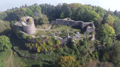
Château du Haut-Koenigsbourg
No reviews yet
Have you flown here? Share your experience with other pilots.
+ Write the first reviewDescription
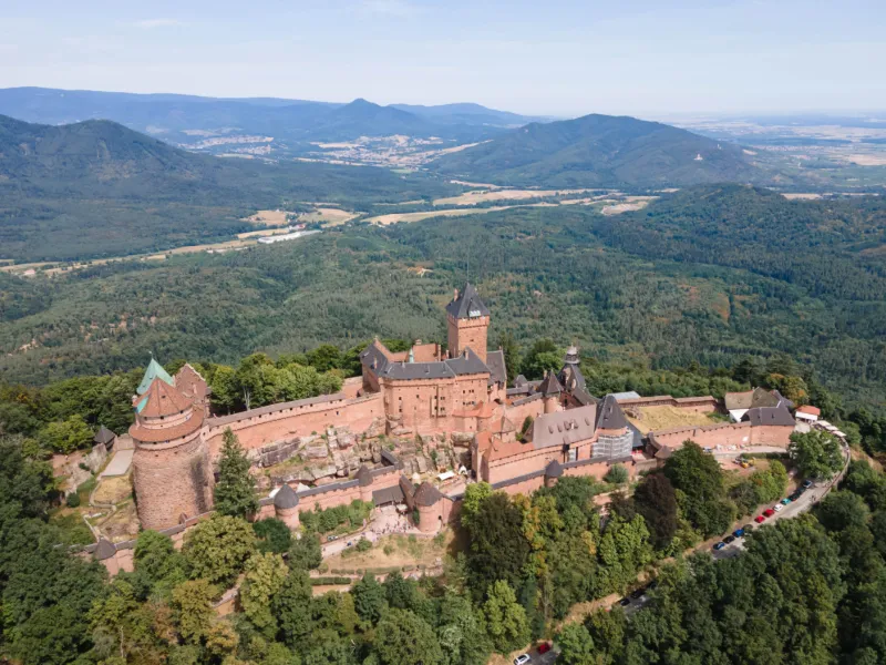
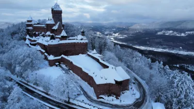
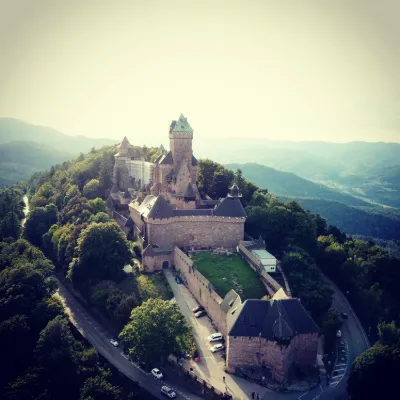
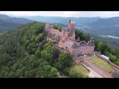
Château du Haut-Koenigsbourg, Alsace /!\ WARNING: the castle is close to the eagle falconry! Always keep an eye on your drone (regulations) and be ready to avoid an attack by a bird of prey: this is their hunting territory. Indeed, a bird of prey approached my drone right after I took this photo. I was glad I had reviewed the avoidance tactics you can find on YouTube. I made 5 evasive maneuvers (sport mode on) before finding my drone near the landing point (which, by the way, is marked out and indicated by warning signs like a heliport for tourists), stuck between the castle and the forest: the bird of prey gave up because there was no longer enough space for its run-ups in a big circle around the drone. Techniques used: - crab flight (unexpected and loud in sport mode, which scares the bird of prey): because it was impossible to climb above 120m - while it circled to dive at the drone: quick descent in steps of 20m - quick climb: the bird of prey loses too much energy regaining altitude - in the end: 5 steps of 20m to be able to land
In the end, a lot of stress and a big adrenaline rush, but everyone came out fine: I got my drone back without an accident, and the bird of prey wasn't hurt.
Video
Map and restricted areas
Open in the main mapNearby aerodromes
Open aerodromes within 25 km of the spot, heliports included, with their distance and direction from the spot. Near an aerodrome, drone flying is prohibited or height-limited: check the UAS zones map.
| Aerodrome | Type | Distance | Elevation | Difference |
|---|---|---|---|---|
| Aérodrome d'Albé - Val de Villé | Aerodrome | 11 km N | 380 m | spot 297 m higher |
| Colmar-Houssen Airport | Airport | 15 km S | 191 m | spot 486 m higher |
| Club ULM de Kogenheim | Aerodrome | 16 km NE | 161 m | spot 516 m higher |
| Envol ULM Alsace | Aerodrome | 18 km SE | 176 m | spot 502 m higher |
| Hôpital Pasteur Heliport | Heliport | 19 km S | 201 m | spot 476 m higher |
Aviation weather (METAR and TAF)
LFGA – Colmar-Houssen Airport MVFR
METAR
METAR LFGA 211130Z AUTO VRB01KT 9999 BKN012 OVC040 09/06 Q1020
- Wind
- Variable, 2 km/h
- Visibility
- 10 km or more
- Clouds
- Broken (5-7/8) at 1,200 ft (370 m) ; Overcast (8/8) at 4,000 ft (1220 m)
- Temperature
- 9 °C, dew point 6 °C
- QNH
- 1020 hPa
- Flight category
- MVFR: ceiling 1,000–3,000 ft or visibility 3–5 mi
TAF
Weather and Kp index
| Day | Weather | Temp. min. / max. | Wind | Rain | Max Kp |
|---|---|---|---|---|---|
| Sat 21 Nov | Rain | 2° / 7° | 7 km/h W | 2.1 mm | 2 |
| Sun 22 Nov | Heavy rain | 2° / 4° | 10 km/h N | 14 mm | 2 |
| Mon 23 Nov | Cloudy | -5° / 2° | 13 km/h NE | – | 4 |
| Tue 24 Nov | Partly cloudy | -5° / 2° | 8 km/h NE | – | 2 |
| Wed 25 Nov | Partly cloudy | -3° / 2° | 8 km/h NE | 0.1 mm | – |
| Thu 26 Nov | Cloudy | -2° / -1° | 8 km/h NE | 0.7 mm | – |
| Fri 27 Nov | Cloudy | -2° / 1° | 5 km/h S | 0.3 mm | – |
Hour by hour: Saturday 21 November
| Time | Weather | Temp. | Wind | Rain | Clouds | Kp |
|---|---|---|---|---|---|---|
| 12:00 | Rain | 7° | 6 km/h W | 0.5 mm | 94 % | 2 |
| 13:00 | Rain | 7° | 7 km/h W | 0.9 mm | 88 % | 1 |
| 14:00 | Showers | 7° | 7 km/h W | 0.4 mm | 79 % | 1 |
| 15:00 | Showers | 7° | 6 km/h NW | 0.3 mm | 66 % | 1 |
| 16:00 | Partly cloudy | 6° | 3 km/h SW | – | 80 % | 2 |
| 17:00 | Partly cloudy | 5° | 3 km/h NE | – | 84 % | 2 |
| 18:00 | Fog | 5° | 2 km/h NE | – | 99 % | 2 |
| 19:00 | Fog | 4° | 3 km/h W | – | 98 % | 2 |
| 20:00 | Fog | 4° | 4 km/h NW | – | 100 % | 2 |
| 21:00 | Fog | 3° | 4 km/h NW | – | 98 % | 2 |
| 22:00 | Fog | 3° | 3 km/h NW | – | 92 % | 2 |
Hour by hour: Sunday 22 November
| Time | Weather | Temp. | Wind | Rain | Clouds | Kp |
|---|---|---|---|---|---|---|
| 06:00 | Fog | 3° | 6 km/h E | – | 100 % | 2 |
| 07:00 | Fog | 3° | 6 km/h SE | – | 100 % | 2 |
| 08:00 | Light rain | 3° | 6 km/h E | 0.2 mm | 100 % | 2 |
| 09:00 | Light rain | 3° | 7 km/h E | 0.4 mm | 100 % | 2 |
| 10:00 | Rain | 3° | 6 km/h E | 0.5 mm | 100 % | 2 |
| 11:00 | Heavy rain | 3° | 6 km/h E | 1.1 mm | 100 % | 2 |
| 12:00 | Heavy rain | 3° | 6 km/h SE | 1.7 mm | 100 % | 2 |
| 13:00 | Heavy rain | 3° | 7 km/h SE | 1.8 mm | 100 % | 2 |
| 14:00 | Heavy rain | 3° | 7 km/h E | 1.5 mm | 100 % | 2 |
| 15:00 | Heavy rain | 3° | 8 km/h E | 1.3 mm | 100 % | 2 |
| 16:00 | Heavy rain | 3° | 7 km/h E | 1.3 mm | 100 % | 2 |
| 17:00 | Heavy rain | 2° | 8 km/h E | 1.3 mm | 100 % | 2 |
| 18:00 | Heavy rain | 2° | 8 km/h NE | 1.1 mm | 100 % | 2 |
| 19:00 | Rain | 2° | 7 km/h NE | 0.9 mm | 100 % | 2 |
| 20:00 | Rain | 2° | 8 km/h N | 0.7 mm | 100 % | 2 |
| 21:00 | Light rain | 2° | 9 km/h N | 0.3 mm | 100 % | 2 |
| 22:00 | Light rain | 2° | 10 km/h N | 0.1 mm | 100 % | 2 |
Sunrise and sunset
| Day | Dawn | Sunrise | Golden hour | Sunset | Dusk | Day length |
|---|---|---|---|---|---|---|
| Sat 21 Nov | 07:12 | 07:47 | 07:47–08:37 · 15:56–16:46 | 16:46 | 17:21 | 8 h 59 |
| Sun 22 Nov | 07:13 | 07:48 | 07:48–08:38 · 15:55–16:45 | 16:45 | 17:20 | 8 h 57 |
| Mon 23 Nov | 07:15 | 07:49 | 07:49–08:40 · 15:54–16:45 | 16:45 | 17:19 | 8 h 55 |
| Tue 24 Nov | 07:16 | 07:51 | 07:51–08:42 · 15:53–16:44 | 16:44 | 17:19 | 8 h 52 |
| Wed 25 Nov | 07:17 | 07:52 | 07:52–08:43 · 15:52–16:43 | 16:43 | 17:18 | 8 h 50 |
| Thu 26 Nov | 07:19 | 07:54 | 07:54–08:45 · 15:51–16:42 | 16:42 | 17:17 | 8 h 48 |
| Fri 27 Nov | 07:20 | 07:55 | 07:55–08:46 · 15:50–16:41 | 16:41 | 17:17 | 8 h 46 |


Reviews
Log in to review this spot. Log in · Create a free account
No reviews yet. Share yours!