

Coteau des Verts Galants in Etrechy
No reviews yet
Have you flown here? Share your experience with other pilots.
+ Write the first reviewDescription
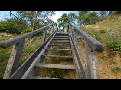
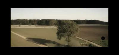
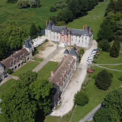
This spot is great, with a big elevation change over a small area: Coteau des Verts Galants in Etrechy Several staircases with railings, cliffs and a few obstacles, all topped by a terrace with a very nice view and access to the fields.
FlySpot : 48.49787185702485, 2.1751768150306363
My 4th flight, on the way home from work. In discovery mode. First time I've used Gyroflow to stabilize the video in post-production.
Equipment: DJI AVATA DJI Goggles 2 DJI motion controller Transmission with FCC hack
Unedited video, default "Wide" setting and stabilized with Gyroflow (https://gyroflow.xyz)
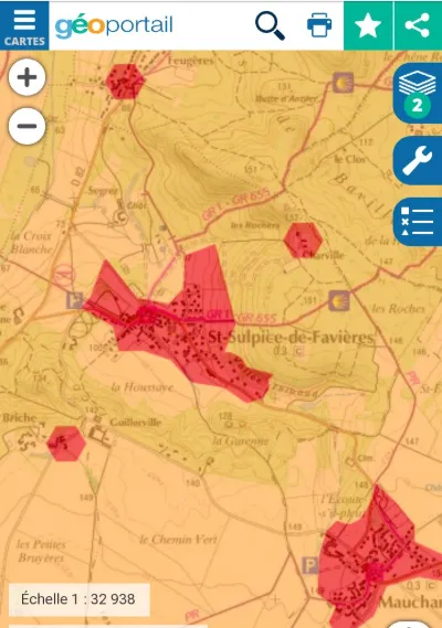
Map and restricted areas
Open in the main mapNearby aerodromes
Open aerodromes within 25 km of the spot, heliports included, with their distance and direction from the spot. Near an aerodrome, drone flying is prohibited or height-limited: check the UAS zones map.
| Aerodrome | Type | Distance | Elevation | Difference |
|---|---|---|---|---|
| Cerny-La Ferté Alais Airfield | Aerodrome | 12 km E | 138 m | spot 18 m lower |
| Aérodrome d'Étampes-Mondésir | Aerodrome | 15 km SW | 151 m | spot 30 m lower |
| Base ULM de Genevrelle à Maisse | Aerodrome | 18 km SE | 128 m | spot 8 m lower |
| Base Paramoteurs de Boigny-Méréville | Aerodrome | 20 km S | 133 m | spot 13 m lower |
| Buno Bonnevaux Airfield | Aerodrome | 25 km SE | 128 m | spot 8 m lower |
Aviation weather (METAR and TAF)
LFPN – Toussus-le-Noble Airport IFR
METAR
METAR LFPN 211100Z AUTO 17005KT 140V200 9999 OVC007 09/08 Q1018 BECMG BKN012
- Wind
- 170°, 9 km/h
- Visibility
- 10 km or more
- Clouds
- Overcast (8/8) at 700 ft (210 m)
- Temperature
- 9 °C, dew point 8 °C
- QNH
- 1018 hPa
- Flight category
- IFR: ceiling 500–1,000 ft or visibility 1–3 mi
TAF
TAF LFPN 211100Z 2112/2121 17005KT 9999 BKN012 PROB40 TEMPO 2112/2114 OVC008 BECMG 2114/2116 SCT020
| Period (local time) | Change | Wind | Visibility | Weather | Clouds |
|---|---|---|---|---|---|
| 21/11 13:00 → 21/11 15:00 | Initial conditions | 170°, 9 km/h | 10 km or more | Broken (5-7/8) at 1,200 ft (370 m) | |
| 21/11 13:00 → 21/11 15:00 | Temporarily, probability 40% | Overcast (8/8) at 800 ft (240 m) | |||
| 21/11 15:00 → 21/11 22:00 | Becoming | 170°, 9 km/h | 10 km or more | Scattered (3-4/8) at 2,000 ft (610 m) |
Weather and Kp index
Sunrise and sunset
| Day | Dawn | Sunrise | Golden hour | Sunset | Dusk | Day length |
|---|---|---|---|---|---|---|
| Sat 21 Nov | 07:33 | 08:08 | 08:08–08:59 · 16:16–17:06 | 17:06 | 17:41 | 8 h 57 |
| Sun 22 Nov | 07:35 | 08:10 | 08:10–09:00 · 16:15–17:05 | 17:05 | 17:40 | 8 h 55 |
| Mon 23 Nov | 07:36 | 08:11 | 08:11–09:02 · 16:13–17:04 | 17:04 | 17:39 | 8 h 53 |
| Tue 24 Nov | 07:37 | 08:12 | 08:12–09:04 · 16:12–17:03 | 17:03 | 17:39 | 8 h 50 |
| Wed 25 Nov | 07:39 | 08:14 | 08:14–09:05 · 16:11–17:03 | 17:03 | 17:38 | 8 h 48 |
| Thu 26 Nov | 07:40 | 08:15 | 08:15–09:07 · 16:10–17:02 | 17:02 | 17:37 | 8 h 46 |
| Fri 27 Nov | 07:41 | 08:17 | 08:17–09:08 · 16:09–17:01 | 17:01 | 17:37 | 8 h 44 |

Reviews
Log in to review this spot. Log in · Create a free account
No reviews yet. Share yours!