

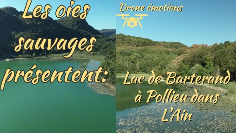
The Lac de Barterand in Pollieu
No reviews yet
Have you flown here? Share your experience with other pilots.
+ Write the first reviewDescription
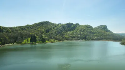
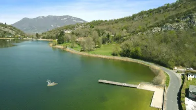
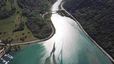
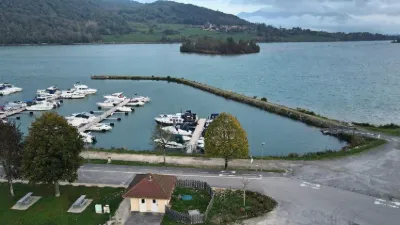
This natural lake, which looks a bit wild in winter and is a popular fishing spot for enthusiasts, takes on the feel of a little Côte d'Azur once the good weather arrives, with its swimming area.
Swimming is supervised in July and August (paid beach). Paddleboarding and canoeing/kayaking are not allowed. A 7 km (2 h) walking trail goes around the lake and lets you admire along the way the legends of the Bugey carved right into the rock: Gargantua and La Vouivre.
The Lac de Barterand was awarded the "ENS" label by the Département de l'Ain in 2017. True natural and scenic gems of the Département de l'Ain, the sites with the ENS label ("Espaces naturels sensibles", or sensitive natural areas) are managed to preserve the biodiversity they host and are developed for public access (except in cases where the environment is too fragile).
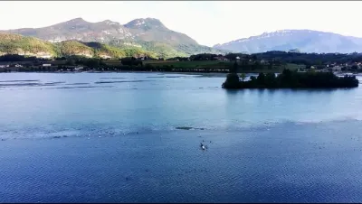
Glacial in origin, the Lac de Barterand and the Saint-Champ wetland lie in a former lake basin that is now two-thirds covered by marsh. This site is a natural area of the Bugey with major ecological value. This sensitive natural area is made up of a mosaic of natural habitats hosting an exceptional diversity of species. The lake also offers pleasant moments of leisure and relaxation.
Opening period Accessible year-round. Supervised swimming in July-August (paid beach).
Prices Adult: €2 Child under 12: €1 25-entry card: €25 On sale at the restaurant La Plage
Map and restricted areas
Open in the main mapNearby aerodromes
Open aerodromes within 25 km of the spot, heliports included, with their distance and direction from the spot. Near an aerodrome, drone flying is prohibited or height-limited: check the UAS zones map.
| Aerodrome | Type | Distance | Elevation | Difference |
|---|---|---|---|---|
| Lavours | Aerodrome | 2.4 km E | 234 m | spot 70 m higher |
| Base Hydro-ULM Rhône Lavours | Seaplane base | 3.6 km NE | 239 m | spot 65 m higher |
| Grand Colombier Heliport | Heliport | 9.9 km N | 1,437 m | spot 1,134 m lower |
| Belley - Peyrieu Airfield | Aerodrome | 12 km S | 225 m | spot 79 m higher |
| Hôtel Ariana Heliport | Heliport | 18 km SE | 247 m | spot 57 m higher |
Aviation weather (METAR and TAF)
LFLB – Chambéry-Savoie Airport VFR
METAR
METAR LFLB 210730Z AUTO VRB03KT 9999 BKN050 BKN066 OVC086 09/08 Q1021 NOSIG
- Wind
- Variable, 6 km/h
- Visibility
- 10 km or more
- Clouds
- Broken (5-7/8) at 5,000 ft (1520 m) ; Broken (5-7/8) at 6,600 ft (2010 m) ; Overcast (8/8) at 8,600 ft (2620 m)
- Temperature
- 9 °C, dew point 8 °C
- QNH
- 1021 hPa
- Flight category
- VFR: ceiling > 3,000 ft and visibility > 5 mi
TAF
TAF LFLB 210200Z 2103/2203 17008KT 9999 BKN050 PROB40 TEMPO 2103/2106 4000 -SHRA SCT040TCU BKN050 TEMPO 2200/2203 4000 RA
| Period (local time) | Change | Wind | Visibility | Weather | Clouds |
|---|---|---|---|---|---|
| 21/11 04:00 → 22/11 04:00 | Initial conditions | 170°, 15 km/h | 10 km or more | Broken (5-7/8) at 5,000 ft (1520 m) | |
| 21/11 04:00 → 21/11 07:00 | Temporarily, probability 40% | 4.0 km | Showers of rain light | Scattered (3-4/8) at 4,000 ft (1220 m) (towering cumulus) ; Broken (5-7/8) at 5,000 ft (1520 m) | |
| 22/11 01:00 → 22/11 04:00 | Temporarily | 4.0 km | Rain |
Weather and Kp index
Sunrise and sunset
| Day | Dawn | Sunrise | Golden hour | Sunset | Dusk | Day length |
|---|---|---|---|---|---|---|
| Sat 21 Nov | 07:12 | 07:45 | 07:45–08:32 · 16:14–17:01 | 17:01 | 17:33 | 9 h 15 |
| Sun 22 Nov | 07:14 | 07:46 | 07:46–08:33 · 16:13–17:00 | 17:00 | 17:33 | 9 h 13 |
| Mon 23 Nov | 07:15 | 07:48 | 07:48–08:35 · 16:12–16:59 | 16:59 | 17:32 | 9 h 11 |
| Tue 24 Nov | 07:16 | 07:49 | 07:49–08:36 · 16:11–16:58 | 16:58 | 17:31 | 9 h 09 |
| Wed 25 Nov | 07:17 | 07:50 | 07:50–08:38 · 16:10–16:58 | 16:58 | 17:31 | 9 h 07 |
| Thu 26 Nov | 07:18 | 07:52 | 07:52–08:39 · 16:09–16:57 | 16:57 | 17:30 | 9 h 05 |
| Fri 27 Nov | 07:20 | 07:53 | 07:53–08:41 · 16:09–16:56 | 16:56 | 17:30 | 9 h 03 |
Reviews
Log in to review this spot. Log in · Create a free account
No reviews yet. Share yours!