

Water
Scheendijk | Holland

No reviews yet
Have you flown here? Share your experience with other pilots.
+ Write the first reviewDescription
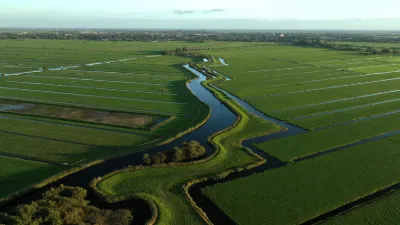
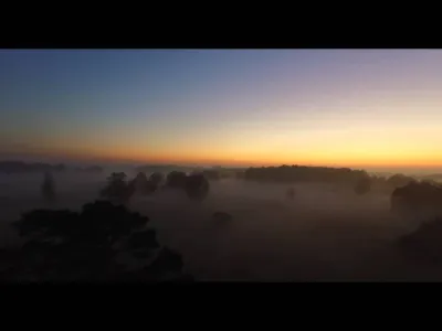
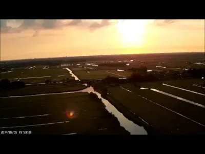
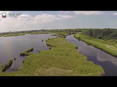
Scheendijk is in a region known for its lakes and ribbed sand islands, called the Loosdrechtse Plassen, which many tourists visit every year. The lake area is dotted with houses along the embankments, with marinas.
Map and restricted areas
Open in the main mapAviation weather (METAR and TAF)
EHAM – Amsterdam Airport Schiphol VFR
METAR
METAR EHAM 211125Z 22007KT 170V280 9999 -SHRA FEW020CB SCT040 08/06 Q1018 TEMPO 28012KT 7000
- Wind
- 220°, 13 km/h
- Visibility
- 10 km or more
- Weather
- Showers of rain light
- Clouds
- Few (1-2/8) at 2,000 ft (610 m) ; Scattered (3-4/8) at 4,000 ft (1220 m)
- Temperature
- 8 °C, dew point 6 °C
- QNH
- 1018 hPa
- Flight category
- VFR: ceiling > 3,000 ft and visibility > 5 mi
TAF
TAF EHAM 211120Z 2112/2218 27008KT 9999 SCT030 PROB40 TEMPO 2112/2116 28013KT 7000 SHRA FEW025CB BKN030 BECMG 2122/2201 VRB02KT 4000 BR MIFG TEMPO 2201/2209 1200 BCFG PROB30 TEMPO 2203/2208 0600 FG VV001 BECMG 2209/2212 08007KT 9999 NSW
| Period (local time) | Change | Wind | Visibility | Weather | Clouds |
|---|---|---|---|---|---|
| 21/11 13:00 → 21/11 23:00 | Initial conditions | 270°, 15 km/h | 10 km or more | Scattered (3-4/8) at 3,000 ft (910 m) | |
| 21/11 13:00 → 21/11 17:00 | Temporarily, probability 40% | 280°, 24 km/h | 7 km | Showers of rain | Few (1-2/8) at 2,500 ft (760 m) (cumulonimbus) ; Broken (5-7/8) at 3,000 ft (910 m) |
| 21/11 23:00 → 22/11 10:00 | Becoming | Variable, 4 km/h | 4.0 km | Mist ; shallow fog | Scattered (3-4/8) at 3,000 ft (910 m) |
| 22/11 02:00 → 22/11 10:00 | Temporarily | 1.2 km | Patches of fog | ||
| 22/11 04:00 → 22/11 09:00 | Temporarily, probability 30% | 600 m | Fog | Sky obscured ; Sky obscured, vertical visibility 100 ft (30 m) | |
| 22/11 10:00 → 22/11 19:00 | Becoming | 080°, 13 km/h | 10 km or more | No significant weather | Scattered (3-4/8) at 3,000 ft (910 m) |
Weather and Kp index
Sunrise and sunset
| Day | Dawn | Sunrise | Golden hour | Sunset | Dusk | Day length |
|---|---|---|---|---|---|---|
| Sat 21 Nov | 07:33 | 08:11 | 08:11–09:08 · 15:44–16:41 | 16:41 | 17:19 | 8 h 29 |
| Sun 22 Nov | 07:34 | 08:13 | 08:13–09:10 · 15:42–16:40 | 16:40 | 17:18 | 8 h 26 |
| Mon 23 Nov | 07:36 | 08:15 | 08:15–09:12 · 15:41–16:39 | 16:39 | 17:17 | 8 h 24 |
| Tue 24 Nov | 07:37 | 08:16 | 08:16–09:14 · 15:39–16:38 | 16:38 | 17:16 | 8 h 21 |
| Wed 25 Nov | 07:39 | 08:18 | 08:18–09:16 · 15:38–16:37 | 16:37 | 17:16 | 8 h 18 |
| Thu 26 Nov | 07:40 | 08:19 | 08:19–09:18 · 15:37–16:36 | 16:36 | 17:15 | 8 h 16 |
| Fri 27 Nov | 07:42 | 08:21 | 08:21–09:20 · 15:36–16:35 | 16:35 | 17:14 | 8 h 13 |


Reviews
Log in to review this spot. Log in · Create a free account
No reviews yet. Share yours!