Skip to content
Water

Doolough Valley
Ireland

The video is only loaded from YouTube (youtube-nocookie.com) when you start it.

No reviews yet

Have you flown here? Share your experience with other pilots.

+ Write the first review

Description

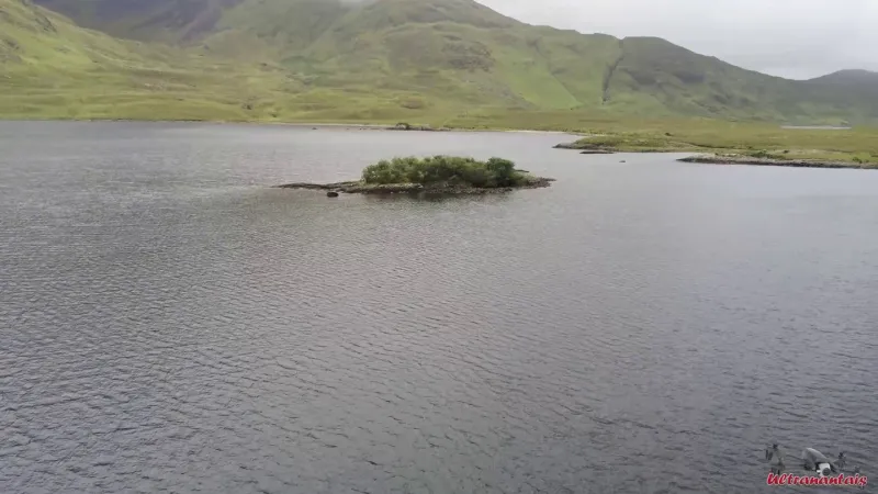
Doolough is an Irish lake in County Mayo, north of Delphi Pass, a mountain pass in the region. An ideal base for trout fishing, it is also a perfect spot to relax in the middle of wild nature.

Automatic translation.

Plan the light

Weather and Kp index

Loading forecast…

Sunrise and sunset

Local times at the spot (UTC). The golden hour, the warm, low light sought after for photos and videos, runs from sunrise until the sun reaches 6° above the horizon, and in the evening from 6° until sunset.

Day Dawn Sunrise Golden hour Sunset Dusk Day length
Sat 21 Nov07:36 08:16 08:16–09:17 · 15:33–16:33 16:33 17:148 h 17
Sun 22 Nov07:38 08:18 08:18–09:19 · 15:31–16:32 16:32 17:128 h 14
Mon 23 Nov07:39 08:20 08:20–09:21 · 15:30–16:31 16:31 17:118 h 11
Tue 24 Nov07:41 08:22 08:22–09:23 · 15:28–16:30 16:30 17:108 h 08
Wed 25 Nov07:43 08:23 08:23–09:25 · 15:27–16:29 16:29 17:108 h 05
Thu 26 Nov07:44 08:25 08:25–09:27 · 15:25–16:28 16:28 17:098 h 02
Fri 27 Nov07:46 08:27 08:27–09:29 · 15:24–16:27 16:27 17:088 h 00

Nearby on Wikipedia

  • Doo Lough · 0.3 km away

    Le Doo Lough ou Dhulough ou Duloch en irlandais est un lac au nord de Delphi pass, dans le comté de Mayo, en Irlande. (...)

  • Col Delphi · 2.6 km away

    Le col Delphi, en anglais Delphi Pass, est un col du comté de Mayo en Irlande. Il est traversé par la R335 qui relie Leenaun et le fjord de Killary Harbour à Louisburgh. Le col sépare les Mweelrea Mountains (803 m) à l'ouest de Ben Gorm (700 m) à l'est (...)

  • FIN · 4.1 km away

    FIN, sigle de trois lettres, est un code, qui signifie : * Finlande ; ** selon la norme ISO 3166-1 alpha-3 (liste des codes pays), ** selon la liste des codes pays du CIO, ** selon la liste des codes internationaux des plaques minéralogiques, ** selon la liste des codes pays utilisés par l'OTAN, ** (...)

  • Mweelrea · 4.7 km away

    Mweelrea ou Cnoc Maol Réidh (la « colline grise chauve ») est une montagne de la chaîne des Mweelrea mountains ou Sleibhte Cnoc Maol Réidh située dans le comté de Mayo, en République d'Irlande. Culminant à une hauteur de , il domine la fjord de Killary Harbour.

  • Killary Harbour · 6.0 km away

    Killary Harbour ou An Caolaire Rua est le plus long fjord d'Irlande. Il se situe entre le Comté de Mayo et la région du Connemara (comté de Galway) au sud. Il est long de pour une largeur de 500 à . Il est dominé au nord par l'imposante falaise des Mweelrea Mountains culminant à (...)

Articles found by GeoNames from the spot's position.

Reviews

Log in to review this spot. Log in · Create a free account

No reviews yet. Share yours!

Connection to the site lost. Trying again…

The site is not responding. Trying again in seconds.

The site is no longer responding.

The site has been updated. Reloading the page…

This page has expired.

Resuming failed. Please reload the page.

The site is no longer responding.