

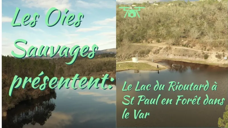
Lac du Rioutard
1 pilot review
“Salut, bien toute tes vidéos continue , dommage avec ton speudo on ne te trouve pas sur yo…” — jypai83, 3 years ago
Read the reviews + Write my reviewDescription
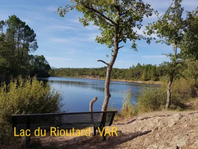
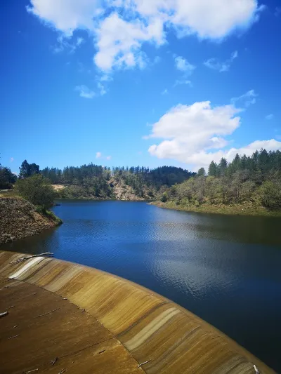
A small road lined with maritime pines and cork oaks leads to Lac du Rioutard, around which a botanical trail has been laid out, showcasing the tree species found in Provence.
It's an easy walk, doable with young children. Located near the village of Saint Paul en Forêt, this hard-to-reach body of water is nestled deep in the forest. Bordered by a small path, it is well suited to roving lure fishing for the few predator species present.
A few clear spots also allow other techniques such as coarse fishing, feeder fishing or English-style float fishing. It's a very calm and wild place, perfect for enjoying fishing in excellent conditions.
Map and restricted areas
Open in the main mapNearby aerodromes
Open aerodromes within 25 km of the spot, heliports included, with their distance and direction from the spot. Near an aerodrome, drone flying is prohibited or height-limited: check the UAS zones map.
| Aerodrome | Type | Distance | Elevation | Difference |
|---|---|---|---|---|
| Fayence Glider Field | Aerodrome | 6.3 km N | 226 m | spot 33 m higher |
| Hôpital Bonnet Heliport | Heliport | 14 km S | 21 m | spot 238 m higher |
| Hôpital Clavary Heliport | Heliport | 21 km E | 168 m | spot 91 m higher |
| Cannes-Mandelieu Airport | Airport | 21 km E | 4 m | spot 255 m higher |
Aviation weather (METAR and TAF)
LFMD – Cannes-Mandelieu Airport VFR
METAR
METAR LFMD 211030Z AUTO 12006KT 070V160 CAVOK 17/07 Q1016 BECMG 26010G20KT
- Wind
- 120°, 11 km/h
- Visibility
- 10 km or more
- Clouds
- –
- Temperature
- 17 °C, dew point 7 °C
- QNH
- 1016 hPa
- Flight category
- VFR: ceiling > 3,000 ft and visibility > 5 mi
TAF
TAF LFMD 210800Z 2109/2209 26010G20KT CAVOK PROB30 TEMPO 2109/2111 VRB02KT BECMG 2120/2122 VRB02KT TEMPO 2122/2209 4000 RA BKN010 SCT030TCU
| Period (local time) | Change | Wind | Visibility | Weather | Clouds |
|---|---|---|---|---|---|
| 21/11 10:00 → 21/11 21:00 | Initial conditions | 260°, 19 km/h, gusts 37 km/h | 10 km or more | No significant weather | No significant cloud |
| 21/11 10:00 → 21/11 12:00 | Temporarily, probability 30% | Variable, 4 km/h | |||
| 21/11 21:00 → 22/11 10:00 | Becoming | Variable, 4 km/h | 10 km or more | No significant weather | No significant cloud |
| 21/11 23:00 → 22/11 10:00 | Temporarily | 4.0 km | Rain | Broken (5-7/8) at 1,000 ft (300 m) ; Scattered (3-4/8) at 3,000 ft (910 m) (towering cumulus) |
Weather and Kp index
Sunrise and sunset
| Day | Dawn | Sunrise | Golden hour | Sunset | Dusk | Day length |
|---|---|---|---|---|---|---|
| Sat 21 Nov | 07:03 | 07:35 | 07:35–08:19 · 16:19–17:04 | 17:04 | 17:35 | 9 h 28 |
| Sun 22 Nov | 07:05 | 07:36 | 07:36–08:20 · 16:19–17:03 | 17:03 | 17:34 | 9 h 26 |
| Mon 23 Nov | 07:06 | 07:37 | 07:37–08:22 · 16:18–17:02 | 17:02 | 17:34 | 9 h 25 |
| Tue 24 Nov | 07:07 | 07:38 | 07:38–08:23 · 16:17–17:02 | 17:02 | 17:33 | 9 h 23 |
| Wed 25 Nov | 07:08 | 07:39 | 07:39–08:24 · 16:16–17:01 | 17:01 | 17:32 | 9 h 21 |
| Thu 26 Nov | 07:09 | 07:41 | 07:41–08:26 · 16:15–17:00 | 17:00 | 17:32 | 9 h 19 |
| Fri 27 Nov | 07:10 | 07:42 | 07:42–08:27 · 16:15–17:00 | 17:00 | 17:32 | 9 h 17 |
Reviews
Log in to review this spot. Log in · Create a free account
jypai83
Salut, bien toute tes vidéos continue , dommage avec ton speudo on ne te trouve pas sur youtube. Le bonjour du Var