

Sainte Croix du Verdon
No reviews yet
Have you flown here? Share your experience with other pilots.
+ Write the first reviewDescription
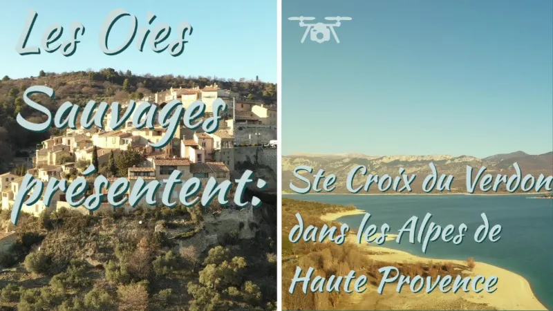
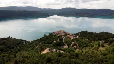
Beyond the waters The village of Sainte Croix, at an altitude of 513m, overlooks the lake from a rocky spur. A charming town that is a pleasure to wander around, Sainte Croix is made up of pretty typical houses, a 16th-century church and the remains of a medieval castle.
Distant origins Human presence in this part of Provence is very ancient. A few prehistoric and ancient remains attest to it. But the place name "Sainte Croix" seems to appear only in the Middle Ages. The name most likely comes from its church, which then claimed to hold a relic of the cross of Christ. The village's activity then developed mainly in the valley, while the dwellings were located on the hillsides. And until recently, the valley was used to living in self-sufficiency. The village itself was lively and grew considerably until the 19th century. But after the Second World War, the village's evolution was closely tied to rural depopulation and to the filling of the dam reservoir in the early 1970s.
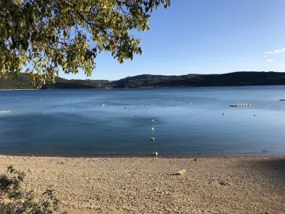
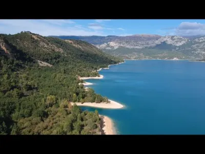
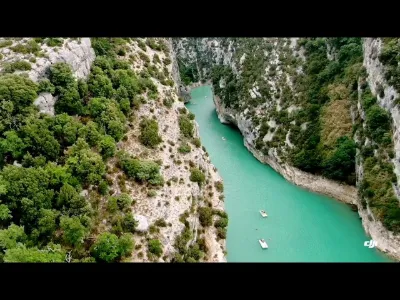
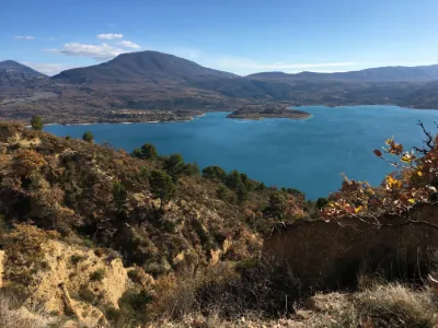
Feet in the water Although the village was spared, the municipality still saw the disappearance of its farmsteads and its Romanesque church. Today, the village's economy is devoted to tourism. While maintaining a respectful relationship with the environment, Sainte Croix has become a well-known holiday destination. Nestled on a promontory at the entrance to the Baudinard gorges, the village enjoys very beautiful views of the lake.
Map and restricted areas
Open in the main mapNearby aerodromes
Open aerodromes within 25 km of the spot, heliports included, with their distance and direction from the spot. Near an aerodrome, drone flying is prohibited or height-limited: check the UAS zones map.
| Aerodrome | Type | Distance | Elevation | Difference |
|---|---|---|---|---|
| Puimoisson Airfield | Aerodrome | 12 km N | 769 m | spot 280 m lower |
Aviation weather (METAR and TAF)
LFMC – Le Luc-Le Cannet Airport VFR
METAR
METAR LFMC 210630Z AUTO 32012KT CAVOK 11/06 Q1018
- Wind
- 320°, 22 km/h
- Visibility
- 10 km or more
- Clouds
- –
- Temperature
- 11 °C, dew point 6 °C
- QNH
- 1018 hPa
- Flight category
- VFR: ceiling > 3,000 ft and visibility > 5 mi
TAF
Weather and Kp index
| Day | Weather | Temp. min. / max. | Wind | Rain | Max Kp |
|---|---|---|---|---|---|
| Sat 21 Nov | Partly cloudy | 7° / 14° | 20 km/h N | 0.1 mm | 2 |
| Sun 22 Nov | Showers | 6° / 12° | 30 km/h NW | 16 mm | 2 |
| Mon 23 Nov | Partly cloudy | 5° / 10° | 35 km/h NW | – | 4 |
| Tue 24 Nov | Cloudy | 3° / 12° | 16 km/h SE | 0.4 mm | 2 |
| Wed 25 Nov | Light rain | 7° / 8° | 33 km/h E | 16 mm | – |
| Thu 26 Nov | Fair | 2° / 9° | 8 km/h N | 14 mm | – |
| Fri 27 Nov | Clear sky | 2° / 10° | 4 km/h NE | – | – |
Hour by hour: Saturday 21 November
| Time | Weather | Temp. | Wind | Rain | Clouds | Kp |
|---|---|---|---|---|---|---|
| 08:00 | Partly cloudy | 7° | 20 km/h N | – | 71 % | 2 |
| 09:00 | Partly cloudy | 9° | 20 km/h N | – | 75 % | 2 |
| 10:00 | Cloudy | 11° | 15 km/h N | – | 88 % | 2 |
| 11:00 | Partly cloudy | 12° | 14 km/h NW | – | 71 % | 2 |
| 12:00 | Partly cloudy | 13° | 14 km/h NW | – | 66 % | 2 |
| 13:00 | Partly cloudy | 14° | 14 km/h NW | – | 55 % | 1 |
| 14:00 | Partly cloudy | 14° | 15 km/h W | – | 66 % | 1 |
| 15:00 | Partly cloudy | 13° | 15 km/h W | – | 77 % | 1 |
| 16:00 | Partly cloudy | 12° | 14 km/h W | – | 50 % | 2 |
| 17:00 | Partly cloudy | 9° | 7 km/h W | – | 56 % | 2 |
| 18:00 | Partly cloudy | 8° | 6 km/h NE | – | 62 % | 2 |
| 19:00 | Partly cloudy | 8° | 6 km/h NE | – | 72 % | 2 |
| 20:00 | Cloudy | 8° | 6 km/h NE | – | 97 % | 2 |
| 21:00 | Cloudy | 7° | 6 km/h E | – | 100 % | 2 |
| 22:00 | Cloudy | 8° | 6 km/h E | – | 99 % | 2 |
Hour by hour: Sunday 22 November
| Time | Weather | Temp. | Wind | Rain | Clouds | Kp |
|---|---|---|---|---|---|---|
| 06:00 | Rain | 11° | 21 km/h SE | 0.4 mm | 100 % | 2 |
| 07:00 | Heavy rain | 12° | 20 km/h SE | 1.3 mm | 100 % | 2 |
| 08:00 | Heavy rain | 12° | 19 km/h SE | 2.1 mm | 100 % | 2 |
| 09:00 | Heavy rain | 12° | 19 km/h S | 1.1 mm | 100 % | 2 |
| 10:00 | Rain | 12° | 16 km/h SW | 0.9 mm | 100 % | 2 |
| 11:00 | Rain | 12° | 29 km/h W | 0.4 mm | 100 % | 2 |
| 12:00 | Light rain | 12° | 27 km/h W | 0.3 mm | 99 % | 2 |
| 13:00 | Showers | 11° | 27 km/h W | 1.7 mm | 54 % | 2 |
| 14:00 | Showers | 10° | 28 km/h NW | 0.1 mm | 25 % | 2 |
| 15:00 | Showers | 12° | 30 km/h NW | 0.5 mm | 37 % | 2 |
| 16:00 | Showers | 10° | 30 km/h NW | 0.4 mm | 24 % | 2 |
| 17:00 | Showers | 9° | 28 km/h NW | 0.8 mm | 40 % | 2 |
| 18:00 | Fair | 8° | 24 km/h NW | – | 30 % | 2 |
| 19:00 | Fair | 8° | 23 km/h NW | – | 20 % | 2 |
| 20:00 | Fair | 7° | 23 km/h W | – | 23 % | 2 |
| 21:00 | Fair | 7° | 24 km/h NW | – | 29 % | 2 |
| 22:00 | Fair | 6° | 25 km/h NW | – | 30 % | 2 |
Sunrise and sunset
| Day | Dawn | Sunrise | Golden hour | Sunset | Dusk | Day length |
|---|---|---|---|---|---|---|
| Sat 21 Nov | 07:06 | 07:37 | 07:37–08:22 · 16:21–17:05 | 17:05 | 17:36 | 9 h 27 |
| Sun 22 Nov | 07:07 | 07:39 | 07:39–08:23 · 16:20–17:04 | 17:04 | 17:36 | 9 h 25 |
| Mon 23 Nov | 07:08 | 07:40 | 07:40–08:25 · 16:19–17:04 | 17:04 | 17:35 | 9 h 23 |
| Tue 24 Nov | 07:09 | 07:41 | 07:41–08:26 · 16:18–17:03 | 17:03 | 17:35 | 9 h 21 |
| Wed 25 Nov | 07:11 | 07:42 | 07:42–08:27 · 16:17–17:02 | 17:02 | 17:34 | 9 h 20 |
| Thu 26 Nov | 07:12 | 07:43 | 07:43–08:29 · 16:17–17:02 | 17:02 | 17:34 | 9 h 18 |
| Fri 27 Nov | 07:13 | 07:45 | 07:45–08:30 · 16:16–17:01 | 17:01 | 17:33 | 9 h 16 |

Reviews
Log in to review this spot. Log in · Create a free account
No reviews yet. Share yours!