

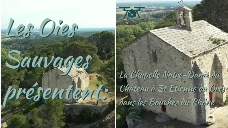
St Etienne du Grés, the N.D du Château chapel
No reviews yet
Have you flown here? Share your experience with other pilots.
+ Write the first reviewDescription
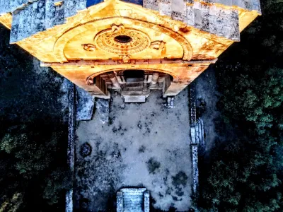
Set on top of the hill, the Romanesque chapel dates from the 12th century. A polychrome wooden Virgin, La Belle Briançonne, is the origin of this pilgrimage. She came from the small village of Saint-Martin-de-Queyrières, south of Briançon, and was brought to Tarascon in 1350 by a hermit to protect her from the Waldensians. It was also a thank-you to Martha of Bethany for having saved the Gavots from the Black Death. The first documented pilgrimage dates from 1420 and is a symbol of a very old religious and popular tradition. Today the Confrérie des prieurs de Notre Dame du Château safeguards the tradition through its priors, elected each year. In more modern and recent times, the chapel of Notre-Dame-du-Château was restored in 1859 following a bequest and declared a chapel of ease by decree of May 25 of the same year. It was listed as a Historic Monument in 1926.
Map and restricted areas
Open in the main mapNearby aerodromes
Open aerodromes within 25 km of the spot, heliports included, with their distance and direction from the spot. Near an aerodrome, drone flying is prohibited or height-limited: check the UAS zones map.
| Aerodrome | Type | Distance | Elevation | Difference |
|---|---|---|---|---|
| Le Mazet De Romanin Airfield | Aerodrome | 12 km E | 118 m | spot 16 m lower |
| Centre Hospitalier Heliport | Heliport | 16 km N | 21 m | spot 81 m higher |
| Avignon-Caumont Airport | Airport | 19 km NE | 38 m | spot 64 m higher |
| Aérodrome d'Avignon-Pujaut | Aerodrome | 24 km N | 45 m | spot 57 m higher |
Aviation weather (METAR and TAF)
LFMV – Avignon-Caumont Airport VFR
METAR
METAR LFMV 221900Z AUTO 29010KT 260V320 CAVOK 13/04 Q1016 NOSIG
- Wind
- 290°, 19 km/h
- Visibility
- 10 km or more
- Clouds
- –
- Temperature
- 13 °C, dew point 4 °C
- QNH
- 1016 hPa
- Flight category
- VFR: ceiling > 3,000 ft and visibility > 5 mi
TAF
TAF AMD LFMV 221541Z 2215/2315 30016KT CAVOK BECMG 2223/2302 33006KT
| Period (local time) | Change | Wind | Visibility | Weather | Clouds |
|---|---|---|---|---|---|
| 22/11 16:00 → 23/11 00:00 | Initial conditions | 300°, 30 km/h | 10 km or more | No significant weather | No significant cloud |
| 23/11 00:00 → 23/11 16:00 | Becoming | 330°, 11 km/h | 10 km or more | No significant weather | No significant cloud |
Weather and Kp index
Sunrise and sunset
| Day | Dawn | Sunrise | Golden hour | Sunset | Dusk | Day length |
|---|---|---|---|---|---|---|
| Sun 22 Nov | 07:13 | 07:44 | 07:44–08:29 · 16:25–17:10 | 17:10 | 17:41 | 9 h 25 |
| Mon 23 Nov | 07:14 | 07:46 | 07:46–08:30 · 16:25–17:09 | 17:09 | 17:41 | 9 h 23 |
| Tue 24 Nov | 07:15 | 07:47 | 07:47–08:32 · 16:24–17:09 | 17:09 | 17:40 | 9 h 21 |
| Wed 25 Nov | 07:16 | 07:48 | 07:48–08:33 · 16:23–17:08 | 17:08 | 17:40 | 9 h 20 |
| Thu 26 Nov | 07:17 | 07:49 | 07:49–08:34 · 16:22–17:07 | 17:07 | 17:39 | 9 h 18 |
| Fri 27 Nov | 07:18 | 07:50 | 07:50–08:36 · 16:22–17:07 | 17:07 | 17:39 | 9 h 16 |
| Sat 28 Nov | 07:20 | 07:51 | 07:51–08:37 · 16:21–17:06 | 17:06 | 17:38 | 9 h 14 |

Reviews
Log in to review this spot. Log in · Create a free account
No reviews yet. Share yours!