

The Étang de la Comtesse, Sanchey
No reviews yet
Have you flown here? Share your experience with other pilots.
+ Write the first reviewDescription
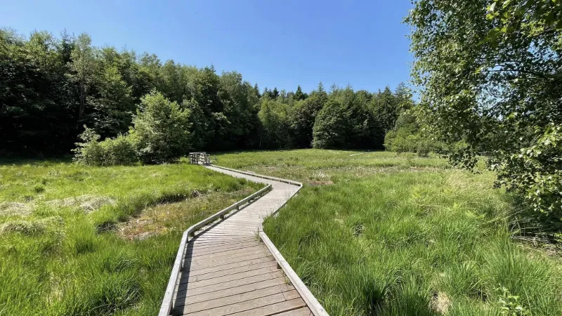
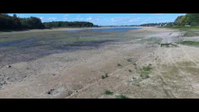
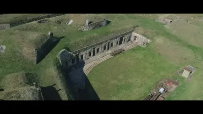
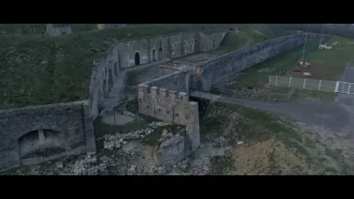
A short compilation of my raw footage shot at the Étang de la Comtesse in the municipality of Sanchey, in the Vosges department. 88 on June 5, 2023
Notes: 1/ Scenario S1, no flight restrictions, open category. But the pond is a protected area and must be respected!
2/ The RTBA network is distant from and parallel to the pond. But be careful: military aircraft sometimes fly over this site! Because the canopy made it hard to watch the airspace around me, I preferred not to go much above it (30 m), and I was right to do so! A Mirage III flew over me, 20 m above the trees, while my drone was 100 meters in front of me.
Reminder: The forecast AZBA information does not replace the information issued via NOTAM, SUP AIP and AIP. Outside the RTBA network's activity periods, civil or military aircraft may fly there at low altitude.
Map and restricted areas
Open in the main mapNearby aerodromes
Open aerodromes within 25 km of the spot, heliports included, with their distance and direction from the spot. Near an aerodrome, drone flying is prohibited or height-limited: check the UAS zones map.
| Aerodrome | Type | Distance | Elevation | Difference |
|---|---|---|---|---|
| Épinal Dogneville Airfield | Aerodrome | 7.5 km NE | 317 m | spot 65 m higher |
Aviation weather (METAR and TAF)
LFSG – Épinal-Mirecourt Airport VFR
METAR
METAR LFSG 211100Z AUTO 20004KT 9999 -RA SCT011/// SCT019/// OVC038/// ///TCU 09/07 Q1019
- Wind
- 200°, 7 km/h
- Visibility
- 10 km or more
- Weather
- Rain light
- Clouds
- Scattered (3-4/8) at 1,100 ft (340 m) ; Scattered (3-4/8) at 1,900 ft (580 m) ; Overcast (8/8) at 3,800 ft (1160 m)
- Temperature
- 9 °C, dew point 7 °C
- QNH
- 1019 hPa
- Flight category
- VFR: ceiling > 3,000 ft and visibility > 5 mi
TAF
Weather and Kp index
| Day | Weather | Temp. min. / max. | Wind | Rain | Max Kp |
|---|---|---|---|---|---|
| Sat 21 Nov | Cloudy | 2° / 9° | 10 km/h SW | 0.3 mm | 2 |
| Sun 22 Nov | Heavy rain | 2° / 6° | 16 km/h SE | 18 mm | 2 |
| Mon 23 Nov | Cloudy | -3° / 4° | 16 km/h NE | – | 4 |
| Tue 24 Nov | Clear sky | -4° / 4° | 11 km/h NE | – | 2 |
| Wed 25 Nov | Cloudy | -4° / 4° | 11 km/h NE | – | – |
| Thu 26 Nov | Cloudy | -2° / 1° | 7 km/h N | 0.5 mm | – |
| Fri 27 Nov | Cloudy | 1° / 6° | 10 km/h SW | 0.2 mm | – |
Hour by hour: Saturday 21 November
| Time | Weather | Temp. | Wind | Rain | Clouds | Kp |
|---|---|---|---|---|---|---|
| 12:00 | Cloudy | 8° | 10 km/h SW | – | 100 % | 2 |
| 13:00 | Cloudy | 9° | 9 km/h SW | – | 93 % | 1 |
| 14:00 | Showers | 9° | 9 km/h SW | 0.1 mm | 56 % | 1 |
| 15:00 | Showers | 9° | 9 km/h SW | 0.2 mm | 60 % | 1 |
| 16:00 | Partly cloudy | 8° | 8 km/h SW | – | 50 % | 2 |
| 17:00 | Fair | 6° | 6 km/h S | – | 32 % | 2 |
| 18:00 | Partly cloudy | 6° | 8 km/h S | – | 61 % | 2 |
| 19:00 | Cloudy | 5° | 9 km/h S | – | 93 % | 2 |
| 20:00 | Partly cloudy | 5° | 8 km/h SE | – | 98 % | 2 |
| 21:00 | Partly cloudy | 4° | 7 km/h SE | – | 96 % | 2 |
| 22:00 | Partly cloudy | 3° | 8 km/h SE | – | 98 % | 2 |
Hour by hour: Sunday 22 November
| Time | Weather | Temp. | Wind | Rain | Clouds | Kp |
|---|---|---|---|---|---|---|
| 06:00 | Cloudy | 4° | 10 km/h E | – | 100 % | 2 |
| 07:00 | Light rain | 4° | 9 km/h E | 0.4 mm | 100 % | 2 |
| 08:00 | Rain | 4° | 9 km/h SE | 0.9 mm | 100 % | 2 |
| 09:00 | Heavy rain | 5° | 14 km/h S | 1.6 mm | 100 % | 2 |
| 10:00 | Heavy rain | 6° | 16 km/h SE | 2.1 mm | 100 % | 2 |
| 11:00 | Heavy rain | 6° | 15 km/h SE | 2.6 mm | 100 % | 2 |
| 12:00 | Heavy rain | 6° | 15 km/h E | 2.2 mm | 100 % | 2 |
| 13:00 | Heavy rain | 6° | 14 km/h E | 1.4 mm | 100 % | 2 |
| 14:00 | Heavy rain | 6° | 14 km/h E | 1.2 mm | 100 % | 2 |
| 15:00 | Heavy rain | 6° | 13 km/h NE | 1.5 mm | 100 % | 2 |
| 16:00 | Heavy rain | 5° | 13 km/h NE | 1.4 mm | 100 % | 2 |
| 17:00 | Rain | 5° | 14 km/h NE | 0.9 mm | 100 % | 2 |
| 18:00 | Rain | 5° | 13 km/h NE | 0.7 mm | 100 % | 2 |
| 19:00 | Light rain | 4° | 13 km/h N | 0.4 mm | 100 % | 2 |
| 20:00 | Light rain | 4° | 12 km/h N | 0.3 mm | 100 % | 2 |
| 21:00 | Light rain | 4° | 14 km/h N | 0.2 mm | 100 % | 2 |
| 22:00 | Cloudy | 4° | 16 km/h N | – | 100 % | 2 |
Sunrise and sunset
| Day | Dawn | Sunrise | Golden hour | Sunset | Dusk | Day length |
|---|---|---|---|---|---|---|
| Sat 21 Nov | 07:16 | 07:50 | 07:50–08:40 · 16:01–16:50 | 16:50 | 17:25 | 9 h 00 |
| Sun 22 Nov | 07:17 | 07:52 | 07:52–08:42 · 15:59–16:50 | 16:50 | 17:24 | 8 h 57 |
| Mon 23 Nov | 07:18 | 07:53 | 07:53–08:43 · 15:58–16:49 | 16:49 | 17:23 | 8 h 55 |
| Tue 24 Nov | 07:20 | 07:54 | 07:54–08:45 · 15:57–16:48 | 16:48 | 17:23 | 8 h 53 |
| Wed 25 Nov | 07:21 | 07:56 | 07:56–08:47 · 15:56–16:47 | 16:47 | 17:22 | 8 h 51 |
| Thu 26 Nov | 07:22 | 07:57 | 07:57–08:48 · 15:55–16:46 | 16:46 | 17:21 | 8 h 49 |
| Fri 27 Nov | 07:23 | 07:59 | 07:59–08:50 · 15:54–16:46 | 16:46 | 17:21 | 8 h 47 |


Reviews
Log in to review this spot. Log in · Create a free account
No reviews yet. Share yours!