

Fort d'Ambleteuse
No reviews yet
Have you flown here? Share your experience with other pilots.
+ Write the first reviewDescription
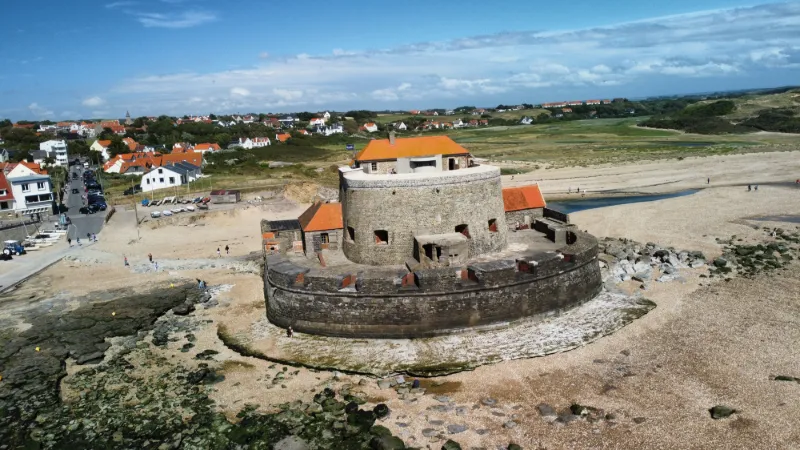
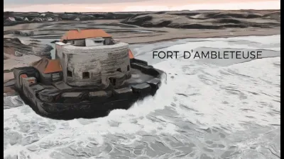
The Fort of Ambleteuse was built at the end of the 17th century, in 1680, at the mouth of the Slack. It is a Vauban construction.
During the Second World War, the fort was used to imprison foreign forced laborers[2].
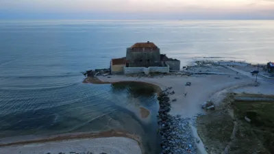
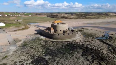
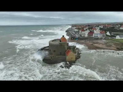
The fort is sometimes surrounded by the sea at high spring tide and can be reached on foot at low tide. It is the only fort on the coast that has been preserved, thanks to the restorations promoted by Dr. Jacques Méreau and the geologist Destombes, who, with a team of volunteers, founded the "Association des amis du fort d'Ambleteuse" in 1967 for this purpose; the association bought it for a symbolic franc.
The only sea fort still standing from Cherbourg to the Belgian border, it is also a very rare example of a historic monument of this importance owned by an association that alone bears the running costs and expenses.
It has since been restored, developed and opened to the public. The restorations were carried out in three major projects: the rampart, funded by the State; the outbuildings, restored with help from the State, the Pas-de-Calais departmental council, Crédit agricole, the commune and the owner association; and, in 2010, a series of works on all the buildings, including the large roof, undertaken with the State's participation and with help from Crédit agricole and the Fondation du patrimoine.
The fort was listed as a historic monument on 19 October 1965[1]. The order specifies: Fort d'Ambleteuse, also sometimes called Fort Mahon. This is where the erroneous name that circulates from time to time comes from. The owner association sticks to the official name, Fort d'Ambleteuse
Map and restricted areas
Open in the main mapNearby aerodromes
Open aerodromes within 25 km of the spot, heliports included, with their distance and direction from the spot. Near an aerodrome, drone flying is prohibited or height-limited: check the UAS zones map.
| Aerodrome | Type | Distance | Elevation | Difference |
|---|---|---|---|---|
| Boulogne Sur Mer Centre Hospitalier Heliport | Heliport | 9.4 km S | 85 m | spot 84 m lower |
| Saint-Inglevert Aerodrome | Aerodrome | 13 km NE | 117 m | spot 116 m lower |
| Coquelles Eurotunnel Heliport | Heliport | 19 km NE | 9 m | spot 9 m lower |
Aviation weather (METAR and TAF)
LFAC – Calais-Dunkerque Airport VFR
METAR
METAR LFAC 211130Z AUTO 11004KT CAVOK 10/04 Q1019
- Wind
- 110°, 7 km/h
- Visibility
- 10 km or more
- Clouds
- –
- Temperature
- 10 °C, dew point 4 °C
- QNH
- 1019 hPa
- Flight category
- VFR: ceiling > 3,000 ft and visibility > 5 mi
TAF
Weather and Kp index
| Day | Weather | Temp. min. / max. | Wind | Rain | Max Kp |
|---|---|---|---|---|---|
| Sat 21 Nov | Clear sky | 6° / 10° | 22 km/h E | – | 2 |
| Sun 22 Nov | Cloudy | 4° / 7° | 35 km/h E | – | 2 |
| Mon 23 Nov | Clear sky | 2° / 5° | 30 km/h E | – | 4 |
| Tue 24 Nov | Clear sky | 1° / 4° | 26 km/h SE | – | 2 |
| Wed 25 Nov | Partly cloudy | -0° / 3° | 30 km/h E | – | – |
| Thu 26 Nov | Fair | -1° / 1° | 28 km/h NE | – | – |
| Fri 27 Nov | Partly cloudy | -1° / 2° | 19 km/h E | – | – |
Hour by hour: Saturday 21 November
| Time | Weather | Temp. | Wind | Rain | Clouds | Kp |
|---|---|---|---|---|---|---|
| 13:00 | Clear sky | 9° | 12 km/h SE | – | 12 % | 2 |
| 14:00 | Clear sky | 10° | 10 km/h SE | – | 7 % | 2 |
| 15:00 | Clear sky | 10° | 10 km/h SE | – | 4 % | 2 |
| 16:00 | Clear sky | 10° | 16 km/h E | – | 2 % | 2 |
| 17:00 | Clear sky | 8° | 21 km/h E | – | 0 % | 2 |
| 18:00 | Clear sky | 7° | 21 km/h SE | – | 7 % | 2 |
| 19:00 | Clear sky | 7° | 19 km/h SE | – | 1 % | 2 |
| 20:00 | Clear sky | 6° | 19 km/h SE | – | 4 % | 2 |
| 21:00 | Partly cloudy | 6° | 19 km/h SE | – | 51 % | 2 |
| 22:00 | Partly cloudy | 6° | 21 km/h E | – | 75 % | 2 |
Hour by hour: Sunday 22 November
| Time | Weather | Temp. | Wind | Rain | Clouds | Kp |
|---|---|---|---|---|---|---|
| 06:00 | Cloudy | 5° | 29 km/h E | – | 100 % | 2 |
| 07:00 | Cloudy | 5° | 30 km/h E | – | 100 % | 2 |
| 08:00 | Cloudy | 5° | 30 km/h E | – | 100 % | 2 |
| 09:00 | Cloudy | 5° | 32 km/h E | – | 100 % | 2 |
| 10:00 | Cloudy | 5° | 32 km/h E | – | 99 % | 2 |
| 11:00 | Cloudy | 6° | 34 km/h E | – | 100 % | 2 |
| 12:00 | Cloudy | 6° | 32 km/h E | – | 99 % | 2 |
| 13:00 | Cloudy | 6° | 33 km/h E | – | 100 % | 2 |
| 14:00 | Cloudy | 7° | 34 km/h NE | – | 100 % | 2 |
| 15:00 | Cloudy | 7° | 34 km/h NE | – | 99 % | 2 |
| 16:00 | Cloudy | 7° | 33 km/h E | – | 100 % | 2 |
| 17:00 | Cloudy | 6° | 33 km/h E | – | 100 % | 2 |
| 18:00 | Cloudy | 6° | 34 km/h E | – | 100 % | 2 |
| 19:00 | Cloudy | 6° | 35 km/h E | – | 100 % | 2 |
| 20:00 | Cloudy | 6° | 34 km/h E | – | 100 % | 2 |
| 21:00 | Cloudy | 5° | 33 km/h E | – | 100 % | 2 |
| 22:00 | Cloudy | 5° | 32 km/h E | – | 99 % | 2 |
Sunrise and sunset
| Day | Dawn | Sunrise | Golden hour | Sunset | Dusk | Day length |
|---|---|---|---|---|---|---|
| Sat 21 Nov | 07:42 | 08:19 | 08:19–09:13 · 16:06–17:00 | 17:00 | 17:37 | 8 h 41 |
| Sun 22 Nov | 07:43 | 08:21 | 08:21–09:15 · 16:04–16:59 | 16:59 | 17:36 | 8 h 38 |
| Mon 23 Nov | 07:45 | 08:22 | 08:22–09:17 · 16:03–16:58 | 16:58 | 17:35 | 8 h 35 |
| Tue 24 Nov | 07:46 | 08:24 | 08:24–09:19 · 16:02–16:57 | 16:57 | 17:34 | 8 h 33 |
| Wed 25 Nov | 07:48 | 08:25 | 08:25–09:21 · 16:01–16:56 | 16:56 | 17:33 | 8 h 30 |
| Thu 26 Nov | 07:49 | 08:27 | 08:27–09:22 · 15:59–16:55 | 16:55 | 17:33 | 8 h 28 |
| Fri 27 Nov | 07:50 | 08:28 | 08:28–09:24 · 15:58–16:54 | 16:54 | 17:32 | 8 h 26 |
Reviews
Log in to review this spot. Log in · Create a free account
No reviews yet. Share yours!