Skip to content
Water

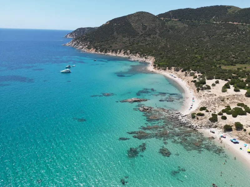
spiaggia di porto sa ruxi
Italy

We have no zone data for this country: ask the local authority before flying.Official zones map (Italy)

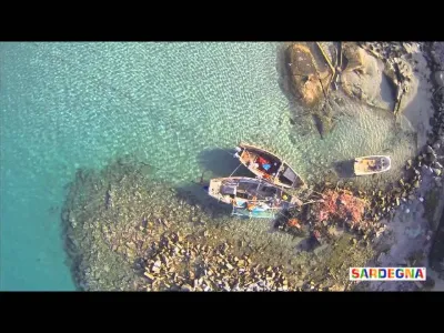
spiaggia di porto sa ruxi – photo 1

No reviews yet

Have you flown here? Share your experience with other pilots.

+ Write the first review

Description

Magnificent spot where you can swim without too many people around

Automatic translation.

Aviation weather (METAR and TAF)

LIEE – Cagliari Elmas Airport · 36 km W VFR

METAR

Observed 21/11 13:20 · 15 min ago

METAR LIEE 211220Z 32008KT 9999 FEW035 21/10 Q1021

Wind
320°, 15 km/h
Visibility
10 km or more
Clouds
Few (1-2/8) at 3,500 ft (1070 m)
Temperature
21 °C, dew point 10 °C
QNH
1021 hPa
Flight category
VFR: ceiling > 3,000 ft and visibility > 5 mi

TAF

Issued 21/11 12:00 · valid from 21/11 13:00 to 22/11 13:00

TAF LIEE 211100Z 2112/2212 31010KT CAVOK BECMG 2116/2118 VRB05KT BECMG 2210/2212 33016KT

Period (local time) Change Wind Visibility Weather Clouds
21/11 13:00 → 21/11 17:00 Initial conditions 310°, 19 km/h 10 km or more No significant weather No significant cloud
21/11 17:00 → 22/11 11:00 Becoming Variable, 9 km/h 10 km or more No significant weather No significant cloud
22/11 11:00 → 22/11 13:00 Becoming 330°, 30 km/h 10 km or more No significant weather No significant cloud

Empty cell: no change forecast for that element.

METAR and TAF from NOAA (Aviation Weather Center), for guidance only: they do not replace flight planning with official sources (SIA, Météo-France). Nearest station that issues a METAR, not necessarily the nearest aerodrome.

Plan the light

Weather and Kp index

Loading forecast…

Sunrise and sunset

Local times at the spot (UTC+01:00). The golden hour, the warm, low light sought after for photos and videos, runs from sunrise until the sun reaches 6° above the horizon, and in the evening from 6° until sunset.

Day Dawn Sunrise Golden hour Sunset Dusk Day length
Sat 21 Nov06:43 07:12 07:12–07:52 · 16:24–17:04 17:04 17:339 h 52
Sun 22 Nov06:44 07:13 07:13–07:53 · 16:23–17:04 17:04 17:339 h 50
Mon 23 Nov06:45 07:14 07:14–07:55 · 16:23–17:03 17:03 17:329 h 48
Tue 24 Nov06:46 07:15 07:15–07:56 · 16:22–17:03 17:03 17:329 h 47
Wed 25 Nov06:47 07:16 07:16–07:57 · 16:21–17:02 17:02 17:319 h 45
Thu 26 Nov06:48 07:17 07:17–07:58 · 16:21–17:02 17:02 17:319 h 44
Fri 27 Nov06:49 07:18 07:18–07:59 · 16:20–17:01 17:01 17:319 h 43

Nearby on Wikipedia

  • Villasimius · 5.3 km away

    Villasimius est une commune italienne d'environ habitants, située dans la province du Sud-Sardaigne, dans la région Sardaigne en Italie. (...)

  • Phare du cap Carbonara · 5.9 km away

    Le phare du cap Carbonara (en Italien :Faro di Capo Carbonara) est un phare situé à l'extrémité du cap Carbonara. Il appartient à la commune de Villasimius en mer Tyrrhénienne, dans la Province du Sud-Sardaigne (Sardaigne), en Italie. (...)

  • Cap Carbonara · 7.0 km away

    Le Cap Carbonara est une presqu'île rocheuse située sur le territoire communal de Villasimius dans la province du Sud-Sardaigne au sud-est de la Sardaigne. (...)

  • Phare d'Isola dei Cavoli · 8.2 km away

    Le phare d'Isola dei Cavoli (en italien : Faro di Isola dei Cavoli) est un phare situé sur la petite île des Choux au large du cap Carbonara. Il appartient à la commune de Villasimius en mer Tyrrhénienne, dans la Province du Sud-Sardaigne (Sardaigne), en Italie. (...)

  • Île des Choux · 8.2 km away

    Lîle des Choux ou en italien isola dei Cavoli est une île d'Italie en mer Tyrrhénienne en Sardaigne du Sud appartenant administrativement à Villasimius. (...)

Articles found by GeoNames from the spot's position.

Nearby spots

Reviews

Log in to review this spot. Log in · Create a free account

No reviews yet. Share yours!

Connection to the site lost. Trying again…

The site is not responding. Trying again in seconds.

The site is no longer responding.

The site has been updated. Reloading the page…

This page has expired.

Resuming failed. Please reload the page.

The site is no longer responding.