

Ile de Renote
No reviews yet
Have you flown here? Share your experience with other pilots.
+ Write the first reviewDescription
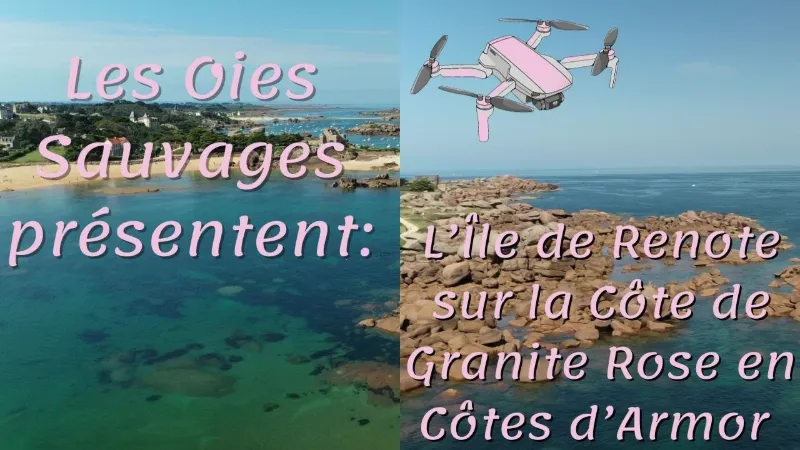
The Renote peninsula is located in the commune of Trégastel in the Côtes-d'Armor department in Brittany. It lies on the Pink Granite Coast near Perros-Guirec and opposite Ploumanac'h. It is surrounded by beaches and hiking trails.
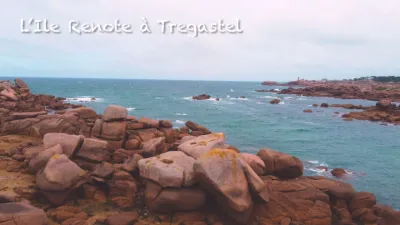
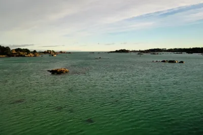
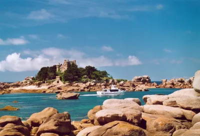
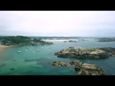
The view from the peninsula, called Renote Island, is particularly beautiful and lets you admire the pink granite rocks, the beaches and the surrounding coasts. The Renote peninsula is a remarkable natural site in the region and is very popular with visitors.
The Renote peninsula is a protected natural site, accessible on foot from the parking lot at the entrance. It is located in a protected coastal zone of the Pink Granite Coast. It offers a panoramic view of the sea and the pink granite rocks that dot the coast. The Renote peninsula is also known for its fine sand beaches, such as the Ti Al Lia beach dotted with huge pink rocks, its hiking trail that goes around the island (2.1 km) and its water activities. It is a popular destination for vacationers in summer, but also for hikers and nature lovers all year round.
Because of its ecological importance, it is important to respect environmental protection rules when visiting the Renote peninsula. Visitors must stay on the marked trails and not disturb the local fauna and flora. HISTORY OF RENOTE ISLAND Renote Island was settled very early on, and you can read its history here. But I will skip centuries of history and go straight to the beginning of the 20th century and the construction of the first holiday homes in 1902, when a Parisian came to spend a few days of vacation at the Castel Sainte-Anne and fell in love with the place. He therefore acquired a (very good) plot of land on the island and had a neo-Gothic manor built, to the great delight of his wife. PRACTICAL INFORMATION FOR VISITING RENOTE ISLAND Nothing could be simpler: to visit Renote Island, you just park in the parking lot at the entrance to the island and set off on the very visible coastal path. You simply choose the direction: left or right. On the left, you will discover the superb big beach, while heading right you can observe the coast beyond the island.
If you come to visit the Renote peninsula in summer, you may not find a spot in the parking lot at the entrance to the island, but there is another one 300 meters before. You can't miss it: just search for "ile renote" on your GPS and you will drive past it.
Here is some more practical information for exploring Renote Island in Trégastel:
The complete loop of the island is 2.1 km and takes 30 to 45 minutes. I recommend allowing more time, because you will very likely stop many times to admire the landscape and the pink granite rocks, it is truly magnificent! The most beautiful spot on the island, with the most pink granite rocks, is right at the far end. It is a fantastic place for a picnic with a view of the sea. The trail is flat and well maintained: it is suitable for everyone, including strollers. It is accessible free of charge all year round, at both high and low tide. There is a small caravan in the parking lot that offers crêpes and drinks. Don't forget your camera, you are in for a feast for the eyes! It is a hike, or rather a stroll, ideal for the whole family; your children will love scrambling over the rocks and playing on the beaches by the water. If you want to walk more, you can keep walking on the customs officers' trail after doing the loop of the island: on one side you can head to Ploumanac'h in 1h15, and on the other you can reach the Porz Cors beach in 15 minutes.
The complete loop of the island is 2.1 km and takes 30 to 45 minutes. I recommend allowing more time, because you will very likely stop many times to admire the landscape and the pink granite rocks, it is truly magnificent! The most beautiful spot on the island, with the most pink granite rocks, is right at the far end. It is a fantastic place for a picnic with a view of the sea. The trail is flat and well maintained: it is suitable for everyone, including strollers. It is accessible free of charge all year round, at both high and low tide. There is a small caravan in the parking lot that offers crêpes and drinks. Don't forget your camera, you are in for a feast for the eyes! It is a hike, or rather a stroll, ideal for the whole family; your children will love scrambling over the rocks and playing on the beaches by the water.
Map and restricted areas
Open in the main mapNearby aerodromes
Open aerodromes within 25 km of the spot, heliports included, with their distance and direction from the spot. Near an aerodrome, drone flying is prohibited or height-limited: check the UAS zones map.
| Aerodrome | Type | Distance | Elevation | Difference |
|---|---|---|---|---|
| Lannion-Côte de Granit Airport | Airport | 9.6 km S | 88 m | spot 82 m lower |
| Centre Hospitalier Heliport | Heliport | 13 km S | 28 m | spot 21 m lower |
Aviation weather (METAR and TAF)
LFRO – Lannion-Côte de Granit Airport MVFR
METAR
METAR LFRO 211100Z AUTO 13007KT 6000 2700 FEW002 BKN220 11/11 Q1014
- Wind
- 130°, 13 km/h
- Visibility
- 6 km
- Clouds
- Few (1-2/8) at 200 ft (60 m) ; Broken (5-7/8) at 22,000 ft (6710 m)
- Temperature
- 11 °C, dew point 11 °C
- QNH
- 1014 hPa
- Flight category
- MVFR: ceiling 1,000–3,000 ft or visibility 3–5 mi
TAF
Weather and Kp index
Sunrise and sunset
| Day | Dawn | Sunrise | Golden hour | Sunset | Dusk | Day length |
|---|---|---|---|---|---|---|
| Sat 21 Nov | 07:57 | 08:32 | 08:32–09:23 · 16:37–17:28 | 17:28 | 18:03 | 8 h 55 |
| Sun 22 Nov | 07:58 | 08:34 | 08:34–09:25 · 16:36–17:27 | 17:27 | 18:02 | 8 h 53 |
| Mon 23 Nov | 08:00 | 08:35 | 08:35–09:26 · 16:34–17:26 | 17:26 | 18:01 | 8 h 50 |
| Tue 24 Nov | 08:01 | 08:36 | 08:36–09:28 · 16:33–17:25 | 17:25 | 18:00 | 8 h 48 |
| Wed 25 Nov | 08:02 | 08:38 | 08:38–09:30 · 16:32–17:24 | 17:24 | 18:00 | 8 h 46 |
| Thu 26 Nov | 08:04 | 08:39 | 08:39–09:31 · 16:31–17:23 | 17:23 | 17:59 | 8 h 44 |
| Fri 27 Nov | 08:05 | 08:41 | 08:41–09:33 · 16:30–17:23 | 17:23 | 17:58 | 8 h 41 |

Reviews
Log in to review this spot. Log in · Create a free account
No reviews yet. Share yours!