

Lucainena de las Torres
No reviews yet
Have you flown here? Share your experience with other pilots.
+ Write the first reviewDescription
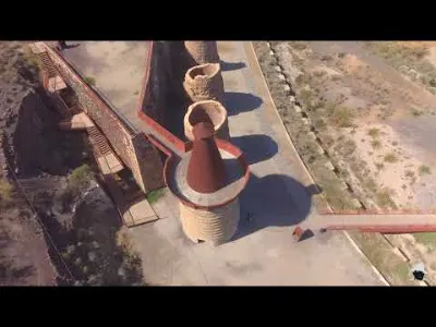
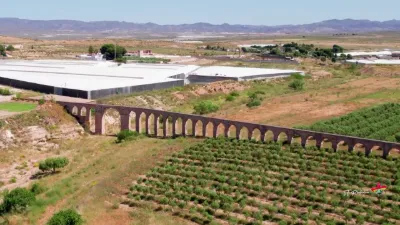
The Lucainena de las Torres Hornos de calcinación are a group of eight kilns used to process iron ore from the nearby mines of the Sierra Alhamilla. They were built between 1900 and 1901 by the Compañía Minera de la Sierra Alhamilla, a company founded by Ramón de la Sota, Otto Kreizner and Hermann Borner. The kilns were designed to heat the iron carbonate ore to a high temperature, making it lose carbon dioxide and water and increasing its iron content. This process was necessary to make the ore suitable for the steel industry, in particular for the Altos Hornos de Vizcaya in Bilbao, where most of the iron was exported. The kilns operated until 1930, when mining activity declined because of the economic crisis and competition from other sources of iron. The furnaces were abandoned and gradually deteriorated over time. In 1998, they were declared a Bien de Interés Cultural by the Andalusian government and restored between 2002 and 2004. Today, they are a tourist attraction and a symbol of the industrial heritage of Lucainena de las Torres.
Map and restricted areas
Open in the main mapAviation weather (METAR and TAF)
LEAM – Almería Airport VFR
METAR
METAR LEAM 211100Z 20003KT CAVOK 18/13 Q1021
- Wind
- 200°, 6 km/h
- Visibility
- 10 km or more
- Clouds
- –
- Temperature
- 18 °C, dew point 13 °C
- QNH
- 1021 hPa
- Flight category
- VFR: ceiling > 3,000 ft and visibility > 5 mi
TAF
TAF LEAM 210500Z 2106/2206 VRB03KT CAVOK TX21/2114Z TN15/2106Z BECMG 2120/2122 24012KT
| Period (local time) | Change | Wind | Visibility | Weather | Clouds |
|---|---|---|---|---|---|
| 21/11 07:00 → 21/11 21:00 | Initial conditions | Variable, 6 km/h | 10 km or more | No significant cloud | |
| 21/11 21:00 → 22/11 07:00 | Becoming | 240°, 22 km/h | 10 km or more | No significant cloud |
Weather and Kp index
Sunrise and sunset
| Day | Dawn | Sunrise | Golden hour | Sunset | Dusk | Day length |
|---|---|---|---|---|---|---|
| Sat 21 Nov | 07:26 | 07:54 | 07:54–08:32 · 17:17–17:56 | 17:56 | 18:24 | 10 h 02 |
| Sun 22 Nov | 07:27 | 07:55 | 07:55–08:34 · 17:16–17:55 | 17:55 | 18:23 | 10 h 00 |
| Mon 23 Nov | 07:28 | 07:56 | 07:56–08:35 · 17:16–17:55 | 17:55 | 18:23 | 9 h 59 |
| Tue 24 Nov | 07:29 | 07:57 | 07:57–08:36 · 17:15–17:54 | 17:54 | 18:22 | 9 h 57 |
| Wed 25 Nov | 07:30 | 07:58 | 07:58–08:37 · 17:15–17:54 | 17:54 | 18:22 | 9 h 56 |
| Thu 26 Nov | 07:30 | 07:59 | 07:59–08:38 · 17:14–17:54 | 17:54 | 18:22 | 9 h 54 |
| Fri 27 Nov | 07:31 | 08:00 | 08:00–08:39 · 17:14–17:53 | 17:53 | 18:22 | 9 h 53 |


Reviews
Log in to review this spot. Log in · Create a free account
No reviews yet. Share yours!