

The Rouget Waterfall Vallée du Giffre, 74740 Sixt-Fer-à-Cheval
No reviews yet
Have you flown here? Share your experience with other pilots.
+ Write the first reviewDescription
The Rouget Waterfall near Samoëns Vallée du Giffre, 74740 Sixt-Fer-à-Cheval
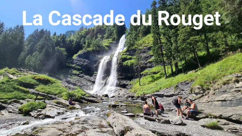
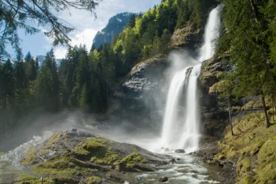
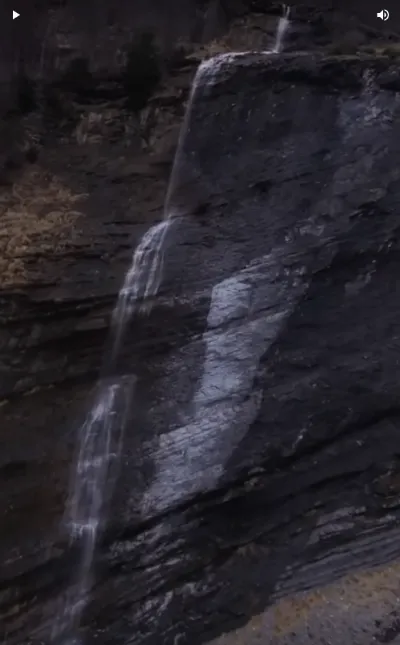
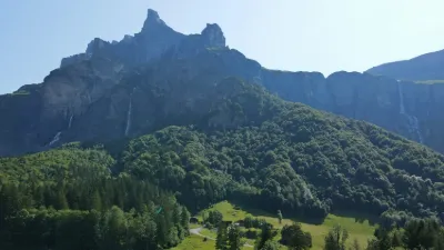
The Rouget waterfall is a waterfall in the Giffre Valley (France) that flows all year round from the Sales torrent upstream and joins the Giffre des Fonds downstream to form the Petit Giffre in the commune of Sixt-Fer-à-Cheval.
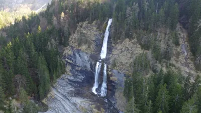
It consists of three drops: the first two upstream of the road, separated by a short flat section that forms the upper fall, and a last one downstream of the road after a short run of the torrent that forms the lower fall. The upper fall is about a hundred meters high with a step halfway down that can be impressive during the snowmelt because of the water bouncing off the stone slab. When the flow is strong, the water spray makes the rocks around it slippery, and accidents have already happened in these dangerous conditions.
It is directly accessible by a small road, which makes it a very popular tourist site despite the deteriorated road surface. It is one of the two listed sites of the commune, along with the Fer-à-Cheval cirque. Its nickname is "the queen of the Alps".
Popular tradition has credited it with powers of virility and fertility, to the point that locals still give newlyweds a flask of this water, although the qualities of this water have never been proven. In 2009, this waterfall was named the most beautiful waterfall in France.
Map and restricted areas
Open in the main mapNearby aerodromes
Open aerodromes within 25 km of the spot, heliports included, with their distance and direction from the spot. Near an aerodrome, drone flying is prohibited or height-limited: check the UAS zones map.
| Aerodrome | Type | Distance | Elevation | Difference |
|---|---|---|---|---|
| Flaine-Ete Heliport | Heliport | 6.4 km SW | 1,615 m | spot 625 m lower |
| Magland Heliport | Heliport | 6.5 km SW | 2,300 m | spot 1,310 m lower |
| Flaine-Hiver Heliport | Heliport | 6.8 km SW | 1,571 m | spot 581 m lower |
| Sécurité Heliport | Heliport | 14 km SE | 1,077 m | spot 87 m lower |
| Centre Hospitalier Heliport | Heliport | 14 km SW | 546 m | spot 444 m higher |
Aviation weather (METAR and TAF)
LSGS – Sion Airport VFR
METAR
METAR LSGS 211050Z VRB01KT 9999 SCT035 BKN090 10/07 Q1022
- Wind
- Variable, 2 km/h
- Visibility
- 10 km or more
- Clouds
- Scattered (3-4/8) at 3,500 ft (1070 m) ; Broken (5-7/8) at 9,000 ft (2740 m)
- Temperature
- 10 °C, dew point 7 °C
- QNH
- 1022 hPa
- Flight category
- VFR: ceiling > 3,000 ft and visibility > 5 mi
TAF
TAF LSGS 210840Z 2109/2118 VRB01KT 9999 -RA SCT065 BKN090
| Period (local time) | Change | Wind | Visibility | Weather | Clouds |
|---|---|---|---|---|---|
| 21/11 10:00 → 21/11 19:00 | Initial conditions | Variable, 2 km/h | 10 km or more | Rain light | Scattered (3-4/8) at 6,500 ft (1980 m) ; Broken (5-7/8) at 9,000 ft (2740 m) |
Weather and Kp index
Sunrise and sunset
| Day | Dawn | Sunrise | Golden hour | Sunset | Dusk | Day length |
|---|---|---|---|---|---|---|
| Sat 21 Nov | 07:09 | 07:42 | 07:42–08:29 · 16:09–16:56 | 16:56 | 17:29 | 9 h 14 |
| Sun 22 Nov | 07:10 | 07:43 | 07:43–08:30 · 16:08–16:55 | 16:55 | 17:28 | 9 h 12 |
| Mon 23 Nov | 07:11 | 07:44 | 07:44–08:32 · 16:07–16:54 | 16:54 | 17:27 | 9 h 09 |
| Tue 24 Nov | 07:12 | 07:46 | 07:46–08:33 · 16:06–16:54 | 16:54 | 17:27 | 9 h 07 |
| Wed 25 Nov | 07:14 | 07:47 | 07:47–08:35 · 16:05–16:53 | 16:53 | 17:26 | 9 h 05 |
| Thu 26 Nov | 07:15 | 07:48 | 07:48–08:36 · 16:04–16:52 | 16:52 | 17:26 | 9 h 03 |
| Fri 27 Nov | 07:16 | 07:49 | 07:49–08:38 · 16:03–16:52 | 16:52 | 17:25 | 9 h 02 |

Reviews
Log in to review this spot. Log in · Create a free account
No reviews yet. Share yours!