

Corsica - Lake Creno 1310m - The Water Lily Lake
No reviews yet
Have you flown here? Share your experience with other pilots.
+ Write the first reviewDescription
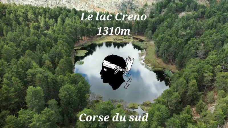
Lake Creno
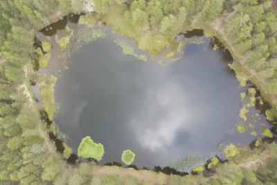
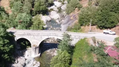
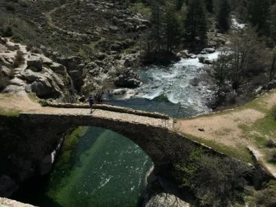
Located at 1,310 m altitude in the Monte Rotondo massif, in Corse-du-Sud, the magnificent Lake Creno is the only glacial lake in Corsica surrounded by a forest of laricio pines. This wooded setting and the water lilies partially covering it make it a truly different lake from the others, of incredible beauty.
This grand lake is reputed to be the easiest-to-reach mountain lake on the island, so it is very busy in the summer.
Relatively easy, this must-do family hike, taken from the book "30 balades en famille en Corse-du-Sud" by Laurent CHABOT, is one of the hikes not to be missed. It's really THE hike to do!
This charming lake is of course the idyllic spot for a picnic break, but beware of the wild pigs eager for food, known to lurk in this spot.
#drone #lac #corse #djimini2
Social Media Instagram : / pgdrone Youtube : / @pgdrone
Royalty-free music: Song: Markvard - Life Is a Moment Music provided by Vlog No Copyright Music. Video Link: https://bit.ly/3A03zO6
Map and restricted areas
Open in the main mapNearby aerodromes
Open aerodromes within 25 km of the spot, heliports included, with their distance and direction from the spot. Near an aerodrome, drone flying is prohibited or height-limited: check the UAS zones map.
| Aerodrome | Type | Distance | Elevation | Difference |
|---|---|---|---|---|
| Aérodrome de Corte | Aerodrome | 22 km NE | 345 m | spot 962 m higher |
Aviation weather (METAR and TAF)
LFKJ – Ajaccio-Napoléon Bonaparte Airport VFR
METAR
METAR LFKJ 211030Z AUTO 21004KT 160V250 9999 FEW035 SCT042 BKN052 20/12 Q1021 NOSIG
- Wind
- 210°, 7 km/h
- Visibility
- 10 km or more
- Clouds
- Few (1-2/8) at 3,500 ft (1070 m) ; Scattered (3-4/8) at 4,200 ft (1280 m) ; Broken (5-7/8) at 5,200 ft (1580 m)
- Temperature
- 20 °C, dew point 12 °C
- QNH
- 1021 hPa
- Flight category
- VFR: ceiling > 3,000 ft and visibility > 5 mi
TAF
TAF LFKJ 210800Z 2109/2209 06004KT 9999 BKN035 BECMG 2110/2112 24010KT BECMG 2116/2118 05005KT
| Period (local time) | Change | Wind | Visibility | Weather | Clouds |
|---|---|---|---|---|---|
| 21/11 10:00 → 21/11 11:00 | Initial conditions | 060°, 7 km/h | 10 km or more | Broken (5-7/8) at 3,500 ft (1070 m) | |
| 21/11 11:00 → 21/11 17:00 | Becoming | 240°, 19 km/h | 10 km or more | Broken (5-7/8) at 3,500 ft (1070 m) | |
| 21/11 17:00 → 22/11 10:00 | Becoming | 050°, 9 km/h | 10 km or more | Broken (5-7/8) at 3,500 ft (1070 m) |
Weather and Kp index
| Day | Weather | Temp. min. / max. | Wind | Rain | Max Kp |
|---|---|---|---|---|---|
| Sat 21 Nov | Partly cloudy | 4° / 10° | 16 km/h W | 0.1 mm | 2 |
| Sun 22 Nov | Heavy rain | 5° / 10° | 25 km/h W | 22 mm | 2 |
| Mon 23 Nov | Showers | 4° / 6° | 24 km/h W | 8.5 mm | 4 |
| Tue 24 Nov | Partly cloudy | 3° / 10° | 8 km/h SW | 0.1 mm | 2 |
| Wed 25 Nov | Heavy rain | 6° / 8° | 15 km/h SW | 22 mm | – |
| Thu 26 Nov | Light rain | 5° / 8° | 8 km/h SW | 8.2 mm | – |
| Fri 27 Nov | Showers | 4° / 8° | 4 km/h NE | 15 mm | – |
Hour by hour: Saturday 21 November
| Time | Weather | Temp. | Wind | Rain | Clouds | Kp |
|---|---|---|---|---|---|---|
| 11:00 | Showers | 9° | 16 km/h W | 0.1 mm | 74 % | 2 |
| 12:00 | Partly cloudy | 10° | 15 km/h W | – | 70 % | 2 |
| 13:00 | Partly cloudy | 10° | 15 km/h W | – | 75 % | 1 |
| 14:00 | Partly cloudy | 10° | 15 km/h W | – | 73 % | 1 |
| 15:00 | Partly cloudy | 9° | 13 km/h W | – | 59 % | 1 |
| 16:00 | Partly cloudy | 8° | 12 km/h SW | – | 68 % | 2 |
| 17:00 | Fog | 7° | 9 km/h SW | – | 76 % | 2 |
| 18:00 | Fog | 6° | 8 km/h SW | – | 94 % | 2 |
| 19:00 | Fog | 6° | 9 km/h W | – | 99 % | 2 |
| 20:00 | Fog | 5° | 9 km/h W | – | 94 % | 2 |
| 21:00 | Fog | 4° | 9 km/h W | – | 72 % | 2 |
| 22:00 | Fair | 4° | 9 km/h W | – | 34 % | 2 |
Hour by hour: Sunday 22 November
| Time | Weather | Temp. | Wind | Rain | Clouds | Kp |
|---|---|---|---|---|---|---|
| 06:00 | Cloudy | 7° | 10 km/h SW | – | 97 % | 2 |
| 07:00 | Cloudy | 7° | 10 km/h SW | – | 98 % | 2 |
| 08:00 | Cloudy | 8° | 12 km/h SW | – | 93 % | 2 |
| 09:00 | Showers | 9° | 14 km/h SW | 0.2 mm | 84 % | 2 |
| 10:00 | Heavy rain | 10° | 17 km/h SW | 1.3 mm | 100 % | 2 |
| 11:00 | Heavy rain | 10° | 17 km/h SW | 3.3 mm | 100 % | 2 |
| 12:00 | Heavy rain | 10° | 15 km/h SW | 5.3 mm | 100 % | 2 |
| 13:00 | Heavy rain | 10° | 21 km/h SW | 3.0 mm | 100 % | 2 |
| 14:00 | Rain | 10° | 22 km/h W | 0.4 mm | 100 % | 2 |
| 15:00 | Light rain | 8° | 20 km/h W | 0.2 mm | 100 % | 2 |
| 16:00 | Light rain | 7° | 23 km/h W | 0.2 mm | 100 % | 2 |
| 17:00 | Heavy rain | 7° | 25 km/h W | 1.1 mm | 100 % | 2 |
| 18:00 | Heavy rain | 7° | 24 km/h W | 1.1 mm | 100 % | 2 |
| 19:00 | Rain | 7° | 23 km/h W | 1.0 mm | 100 % | 2 |
| 20:00 | Heavy rain | 6° | 23 km/h W | 1.0 mm | 100 % | 2 |
| 21:00 | Heavy rain | 6° | 22 km/h W | 1.1 mm | 100 % | 2 |
| 22:00 | Heavy rain | 6° | 25 km/h W | 1.4 mm | 100 % | 2 |
Sunrise and sunset
| Day | Dawn | Sunrise | Golden hour | Sunset | Dusk | Day length |
|---|---|---|---|---|---|---|
| Sat 21 Nov | 06:51 | 07:22 | 07:22–08:05 · 16:15–16:58 | 16:58 | 17:29 | 9 h 36 |
| Sun 22 Nov | 06:53 | 07:23 | 07:23–08:06 · 16:15–16:58 | 16:58 | 17:28 | 9 h 34 |
| Mon 23 Nov | 06:54 | 07:24 | 07:24–08:07 · 16:14–16:57 | 16:57 | 17:28 | 9 h 32 |
| Tue 24 Nov | 06:55 | 07:25 | 07:25–08:09 · 16:13–16:56 | 16:56 | 17:27 | 9 h 31 |
| Wed 25 Nov | 06:56 | 07:27 | 07:27–08:10 · 16:12–16:56 | 16:56 | 17:27 | 9 h 29 |
| Thu 26 Nov | 06:57 | 07:28 | 07:28–08:11 · 16:12–16:55 | 16:55 | 17:26 | 9 h 27 |
| Fri 27 Nov | 06:58 | 07:29 | 07:29–08:12 · 16:11–16:55 | 16:55 | 17:26 | 9 h 26 |

Reviews
Log in to review this spot. Log in · Create a free account
No reviews yet. Share yours!