

Source of the Loue Painted by Gustave Courbet
No reviews yet
Have you flown here? Share your experience with other pilots.
+ Write the first reviewDescription
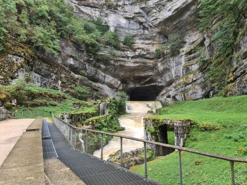
Source of the Loue or the Saracen Cave
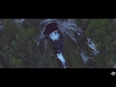
Gushing out of a cave 60 m wide and 30 m high carved into an overhanging wall more than 100 m high, the source of the Loue is none other than a majestic resurgence of the Doubs. Magic and grandeur reign over this "reculée" (closed cirque). It is one of the major natural sites of the Doubs, developed and enhanced with information panels to better understand the natural spectacle before your eyes. From the source, the trail lets you go down the deep gorges of the Loue, on the left bank, and reach the power plant and then the village of Mouthier-Haute-Pierre (6 km - about 2 h).
By car, take the R.D. 41 leading to Ouhans, starting from the R.N. 67, then before Ouhans take the road to the Source, or, for pedestrians, the picturesque G.R. 595 overlooking the Gorges de Noailles on the right bank (2 km).
Site accessible to people with reduced mobility on request at least one week in advance from the Communauté de Communes de Montbenoît.
Courbet, one of the first "realists"
The realist movement appeared in the second half of the 19th century, first in Europe before conquering the rest of the world. It showed up in literature with Honoré de Balzac, Champfleury (Jules François Félix Husson) and Louis Edmond Duranty, as well as in painting with a number of artists, among them Gustave Courbet. In a period marked by the opposition between romanticism and classicism, realism opened a new path by depicting reality without idealization and by addressing political or social themes.
Map and restricted areas
Open in the main mapNearby aerodromes
Open aerodromes within 25 km of the spot, heliports included, with their distance and direction from the spot. Near an aerodrome, drone flying is prohibited or height-limited: check the UAS zones map.
| Aerodrome | Type | Distance | Elevation | Difference |
|---|---|---|---|---|
| Pontarlier Airfield | Aerodrome | 12 km S | 818 m | spot 291 m lower |
| Centre Hospitalier Heliport | Heliport | 13 km S | 843 m | spot 316 m lower |
Aviation weather (METAR and TAF)
LSGC – Les Eplatures Airport MVFR
METAR
METAR LSGC 211150Z 24008KT 190V270 9999 SCT010 BKN015 BKN032 06/03 Q1019
- Wind
- 240°, 15 km/h
- Visibility
- 10 km or more
- Clouds
- Scattered (3-4/8) at 1,000 ft (300 m) ; Broken (5-7/8) at 1,500 ft (460 m) ; Broken (5-7/8) at 3,200 ft (980 m)
- Temperature
- 6 °C, dew point 3 °C
- QNH
- 1019 hPa
- Flight category
- MVFR: ceiling 1,000–3,000 ft or visibility 3–5 mi
TAF
TAF LSGC 211125Z 2112/2121 22007KT 9999 FEW020 SCT045
| Period (local time) | Change | Wind | Visibility | Weather | Clouds |
|---|---|---|---|---|---|
| 21/11 13:00 → 21/11 22:00 | Initial conditions | 220°, 13 km/h | 10 km or more | Few (1-2/8) at 2,000 ft (610 m) ; Scattered (3-4/8) at 4,500 ft (1370 m) |
Weather and Kp index
| Day | Weather | Temp. min. / max. | Wind | Rain | Max Kp |
|---|---|---|---|---|---|
| Sat 21 Nov | Partly cloudy | 3° / 9° | 16 km/h SW | – | 2 |
| Sun 22 Nov | Heavy rain | 4° / 7° | 33 km/h SW | 43 mm | 2 |
| Mon 23 Nov | Rain | 1° / 4° | 19 km/h NW | 13 mm | 4 |
| Tue 24 Nov | Cloudy | -1° / 5° | 18 km/h SE | – | 2 |
| Wed 25 Nov | Heavy rain | 2° / 3° | 14 km/h SE | 15 mm | – |
| Thu 26 Nov | Cloudy | 0° / 2° | 8 km/h NW | 2.2 mm | – |
| Fri 27 Nov | Cloudy | -1° / 3° | 13 km/h SW | 0.1 mm | – |
Hour by hour: Saturday 21 November
| Time | Weather | Temp. | Wind | Rain | Clouds | Kp |
|---|---|---|---|---|---|---|
| 13:00 | Partly cloudy | 8° | 16 km/h SW | – | 65 % | 2 |
| 14:00 | Partly cloudy | 9° | 15 km/h SW | – | 73 % | 2 |
| 15:00 | Partly cloudy | 9° | 11 km/h SW | – | 57 % | 2 |
| 16:00 | Partly cloudy | 8° | 6 km/h SW | – | 43 % | 2 |
| 17:00 | Partly cloudy | 6° | 1 km/h S | – | 98 % | 2 |
| 18:00 | Partly cloudy | 4° | 4 km/h SE | – | 84 % | 2 |
| 19:00 | Partly cloudy | 3° | 7 km/h SE | – | 100 % | 2 |
| 20:00 | Partly cloudy | 3° | 9 km/h SE | – | 98 % | 2 |
| 21:00 | Partly cloudy | 3° | 9 km/h SE | – | 99 % | 2 |
| 22:00 | Partly cloudy | 4° | 10 km/h SE | – | 100 % | 2 |
Hour by hour: Sunday 22 November
| Time | Weather | Temp. | Wind | Rain | Clouds | Kp |
|---|---|---|---|---|---|---|
| 06:00 | Heavy rain | 5° | 22 km/h SE | 2.9 mm | 100 % | 2 |
| 07:00 | Heavy rain | 5° | 24 km/h SE | 2.6 mm | 100 % | 2 |
| 08:00 | Heavy rain | 4° | 26 km/h SE | 2.4 mm | 100 % | 2 |
| 09:00 | Heavy rain | 4° | 24 km/h SE | 1.5 mm | 100 % | 2 |
| 10:00 | Heavy rain | 4° | 24 km/h SE | 1.7 mm | 100 % | 2 |
| 11:00 | Heavy rain | 5° | 26 km/h S | 2.4 mm | 100 % | 2 |
| 12:00 | Heavy rain | 7° | 28 km/h SW | 3.0 mm | 100 % | 2 |
| 13:00 | Heavy rain | 7° | 27 km/h SW | 3.2 mm | 100 % | 2 |
| 14:00 | Rain | 7° | 31 km/h SW | 0.7 mm | 100 % | 2 |
| 15:00 | Rain | 7° | 33 km/h SW | 0.8 mm | 100 % | 2 |
| 16:00 | Heavy rain | 7° | 32 km/h SW | 1.2 mm | 100 % | 2 |
| 17:00 | Heavy rain | 7° | 31 km/h SW | 2.3 mm | 100 % | 2 |
| 18:00 | Heavy rain | 7° | 28 km/h SW | 2.8 mm | 100 % | 2 |
| 19:00 | Heavy rain | 7° | 32 km/h SW | 2.6 mm | 100 % | 2 |
| 20:00 | Heavy rain | 6° | 33 km/h SW | 2.2 mm | 100 % | 2 |
| 21:00 | Heavy rain | 6° | 31 km/h SW | 2.8 mm | 100 % | 2 |
| 22:00 | Heavy rain | 6° | 29 km/h W | 3.0 mm | 100 % | 2 |
Sunrise and sunset
| Day | Dawn | Sunrise | Golden hour | Sunset | Dusk | Day length |
|---|---|---|---|---|---|---|
| Sat 21 Nov | 07:13 | 07:47 | 07:47–08:35 · 16:06–16:55 | 16:55 | 17:28 | 9 h 07 |
| Sun 22 Nov | 07:14 | 07:48 | 07:48–08:37 · 16:05–16:54 | 16:54 | 17:27 | 9 h 05 |
| Mon 23 Nov | 07:16 | 07:49 | 07:49–08:38 · 16:04–16:53 | 16:53 | 17:27 | 9 h 03 |
| Tue 24 Nov | 07:17 | 07:51 | 07:51–08:40 · 16:03–16:52 | 16:52 | 17:26 | 9 h 01 |
| Wed 25 Nov | 07:18 | 07:52 | 07:52–08:41 · 16:02–16:51 | 16:51 | 17:25 | 8 h 59 |
| Thu 26 Nov | 07:19 | 07:53 | 07:53–08:43 · 16:01–16:51 | 16:51 | 17:25 | 8 h 57 |
| Fri 27 Nov | 07:21 | 07:55 | 07:55–08:44 · 16:01–16:50 | 16:50 | 17:24 | 8 h 55 |
Reviews
Log in to review this spot. Log in · Create a free account
No reviews yet. Share yours!