

Saint Quay Portrieux, Île de la Comtesse
No reviews yet
Have you flown here? Share your experience with other pilots.
+ Write the first reviewDescription
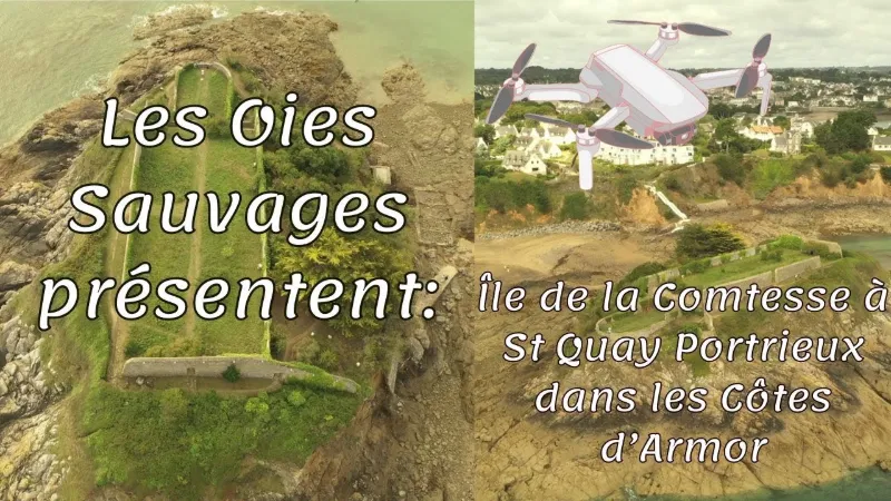
A bit of history Bequeathed to the Benedictine monks of Léhon in the 13th century by the Count of Avaugour, lord of Goëlo, it is said to have inherited the noble title of his wife.
In 1679, an inventory of the municipality's properties already used the name "Île de la Comtesse". "The Island of Terror" might also have suited it in the 19th century. Its owner, Countess Tranchant des Thuilais, had an irascible and vindictive character that got people talking for a long time. She claimed the shore surrounding the island and chased away anyone who came near it!
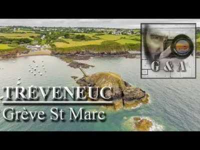
Since 1975, the island has been owned by the municipality. A small rock of ruins and greenery, it can be explored by anyone at low tide.
Area: 3,850 m2 Varied flora: tamarisks, fig trees, fruit trees, and other perennials... After the Revolution, a succession of owners followed. The island belonged to the family of Eugène Rimmel, the famous perfumer, who grew rare plant species there, along with lavender used in the making of aromatic substances. Did you know? On the island, buildings are still visible today. These walls were never the beginnings of a fortress or manor, as the legend says. They were built for the sole purpose of sheltering a botanical garden and a vegetable garden. Their U-shaped design was planned so that the base of the U is as wide as possible, protecting the island across its greatest width from the north / northwest winds.
Map and restricted areas
Open in the main mapNearby aerodromes
Open aerodromes within 25 km of the spot, heliports included, with their distance and direction from the spot. Near an aerodrome, drone flying is prohibited or height-limited: check the UAS zones map.
| Aerodrome | Type | Distance | Elevation | Difference |
|---|---|---|---|---|
| Saint-Brieuc-Armor Airport | Airport | 13 km S | 138 m | spot 138 m lower |
| Base ULM de Kerfot | Aerodrome | 17 km NW | 99 m | spot 99 m lower |
| Centre Hospitalier Heliport | Heliport | 19 km S | 108 m | spot 108 m lower |
Aviation weather (METAR and TAF)
LFRT – Saint-Brieuc-Armor Airport LIFR
METAR
METAR LFRT 211130Z AUTO 14005KT 090V200 9999 OVC003 11/10 Q1014
- Wind
- 140°, 9 km/h
- Visibility
- 10 km or more
- Clouds
- Overcast (8/8) at 300 ft (90 m)
- Temperature
- 11 °C, dew point 10 °C
- QNH
- 1014 hPa
- Flight category
- LIFR: ceiling < 500 ft or visibility < 1 mi
TAF
Weather and Kp index
Sunrise and sunset
| Day | Dawn | Sunrise | Golden hour | Sunset | Dusk | Day length |
|---|---|---|---|---|---|---|
| Sat 21 Nov | 07:54 | 08:29 | 08:29–09:19 · 16:35–17:26 | 17:26 | 18:01 | 8 h 56 |
| Sun 22 Nov | 07:55 | 08:30 | 08:30–09:21 · 16:34–17:25 | 17:25 | 18:00 | 8 h 54 |
| Mon 23 Nov | 07:57 | 08:32 | 08:32–09:23 · 16:33–17:24 | 17:24 | 17:59 | 8 h 52 |
| Tue 24 Nov | 07:58 | 08:33 | 08:33–09:24 · 16:32–17:23 | 17:23 | 17:58 | 8 h 49 |
| Wed 25 Nov | 07:59 | 08:34 | 08:34–09:26 · 16:31–17:22 | 17:22 | 17:57 | 8 h 47 |
| Thu 26 Nov | 08:00 | 08:36 | 08:36–09:28 · 16:30–17:21 | 17:21 | 17:57 | 8 h 45 |
| Fri 27 Nov | 08:02 | 08:37 | 08:37–09:29 · 16:29–17:21 | 17:21 | 17:56 | 8 h 43 |



Reviews
Log in to review this spot. Log in · Create a free account
No reviews yet. Share yours!