

Goðafoss







No reviews yet
Have you flown here? Share your experience with other pilots.
+ Write the first reviewDescription
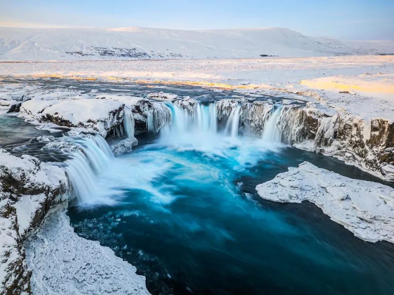
This waterfall takes its name from the following story: In the year 1000, the Icelandic parliament (the Alþing) decided to follow the advice given by the Lögsögumaður Þorgeir Þorkelsson, a pagan appointed to arbitrate on the choice of religion on the island in 999, and adopted Christianity (after a religious civil war, incidentally). On his way back to his region, he set an example by throwing his idols of the old Viking religion into this fall. This waterfall is one of the most famous in Iceland, standing 12 meters high and 30 meters wide.
Map and restricted areas
Open in the main mapAviation weather (METAR and TAF)
BIAR – Akureyri Airport VFR
METAR
METAR BIAR 211100Z 17008KT CAVOK M07/M09 Q1014
- Wind
- 170°, 15 km/h
- Visibility
- 10 km or more
- Clouds
- –
- Temperature
- -7 °C, dew point -9 °C
- QNH
- 1014 hPa
- Flight category
- VFR: ceiling > 3,000 ft and visibility > 5 mi
TAF
TAF BIAR 211055Z 2112/2212 16009KT 9999 BKN050 TX08/2210Z TNM06/2112Z BECMG 2120/2122 16016KT PROB40 TEMPO 2121/2202 3000 -RASN BKN012 OVC030
| Period (local time) | Change | Wind | Visibility | Weather | Clouds |
|---|---|---|---|---|---|
| 21/11 12:00 → 21/11 20:00 | Initial conditions | 160°, 17 km/h | 10 km or more | Broken (5-7/8) at 5,000 ft (1520 m) | |
| 21/11 20:00 → 22/11 12:00 | Becoming | 160°, 30 km/h | 10 km or more | Broken (5-7/8) at 5,000 ft (1520 m) | |
| 21/11 21:00 → 22/11 02:00 | Temporarily, probability 40% | 3.0 km | Rain light ; snow light | Broken (5-7/8) at 1,200 ft (370 m) ; Overcast (8/8) at 3,000 ft (910 m) |
Weather and Kp index
Sunrise and sunset
| Day | Dawn | Sunrise | Golden hour | Sunset | Dusk | Day length |
|---|---|---|---|---|---|---|
| Sat 21 Nov | 09:05 | 10:16 | All day | 15:36 | 16:47 | 5 h 19 |
| Sun 22 Nov | 09:08 | 10:20 | All day | 15:33 | 16:45 | 5 h 13 |
| Mon 23 Nov | 09:11 | 10:23 | All day | 15:30 | 16:42 | 5 h 06 |
| Tue 24 Nov | 09:13 | 10:27 | All day | 15:27 | 16:40 | 4 h 59 |
| Wed 25 Nov | 09:16 | 10:31 | All day | 15:24 | 16:38 | 4 h 53 |
| Thu 26 Nov | 09:19 | 10:34 | All day | 15:21 | 16:36 | 4 h 46 |
| Fri 27 Nov | 09:21 | 10:38 | All day | 15:18 | 16:35 | 4 h 40 |
Reviews
Log in to review this spot. Log in · Create a free account
No reviews yet. Share yours!