

Château de Crussol - St-Péray (07)

No reviews yet
Have you flown here? Share your experience with other pilots.
+ Write the first reviewDescription
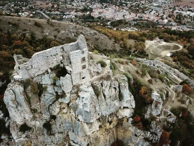
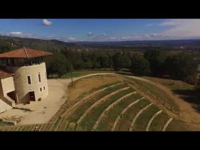
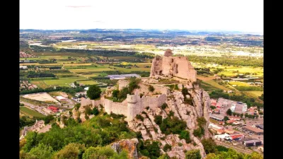
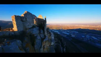
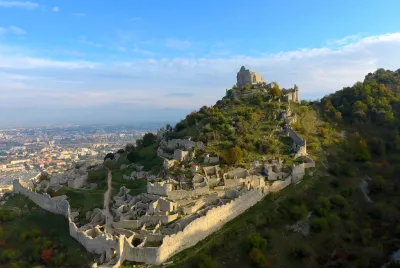
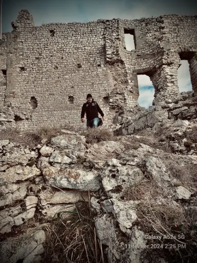
Now in ruins, Crussol Castle, located in the Ardèche, was built on a height overlooking the Rhône valley, facing the city of Valence in the Drôme. It stands on what was once an important river transport route and on the Way of St. James to Santiago de Compostela. Perched on the ridge of the Crussol mountain, on the edge of a plateau slope more than 200 meters high, the castle overlooks the towns of Saint-Péray to the west, and Guilherand-Granges and Valence to the east. It covers three hectares and includes "la Villette", a group of about 140 houses, as well as the castle itself at the top of the hill, all surrounded by ramparts that are still clearly visible, especially at the back where a tower rises.
Map and restricted areas
Open in the main mapNearby aerodromes
Open aerodromes within 25 km of the spot, heliports included, with their distance and direction from the spot. Near an aerodrome, drone flying is prohibited or height-limited: check the UAS zones map.
| Aerodrome | Type | Distance | Elevation | Difference |
|---|---|---|---|---|
| Centre Hospitalier Heliport | Heliport | 4.9 km SE | 148 m | spot 190 m higher |
| Valence-Chabeuil Airport | Airport | 9.4 km E | 160 m | spot 178 m higher |
| Relais Du Soleil Heliport | Heliport | 14 km E | 221 m | spot 118 m higher |
| Centre Hospitalier Heliport | Heliport | 18 km NE | 160 m | spot 178 m higher |
| Aérodrome de Romans - Saint-Paul | Aerodrome | 24 km NE | 181 m | spot 157 m higher |
Aviation weather (METAR and TAF)
LFLU – Valence-Chabeuil Airport VFR
METAR
METAR LFLU 210930Z AUTO VRB02KT CAVOK 11/09 Q1021
- Wind
- Variable, 4 km/h
- Visibility
- 10 km or more
- Clouds
- –
- Temperature
- 11 °C, dew point 9 °C
- QNH
- 1021 hPa
- Flight category
- VFR: ceiling > 3,000 ft and visibility > 5 mi
TAF
Weather and Kp index
| Day | Weather | Temp. min. / max. | Wind | Rain | Max Kp |
|---|---|---|---|---|---|
| Sat 21 Nov | Fair | 8° / 14° | 12 km/h SW | – | 2 |
| Sun 22 Nov | Showers | 9° / 14° | 20 km/h S | 12 mm | 2 |
| Mon 23 Nov | Cloudy | 6° / 10° | 16 km/h N | 0.2 mm | 4 |
| Tue 24 Nov | Cloudy | 1° / 6° | 17 km/h N | 0.9 mm | 2 |
| Wed 25 Nov | Heavy rain | 4° / 8° | 8 km/h NE | 32 mm | – |
| Thu 26 Nov | Partly cloudy | 5° / 9° | 5 km/h SW | 1.8 mm | – |
| Fri 27 Nov | Fair | 3° / 9° | 7 km/h NE | – | – |
Hour by hour: Saturday 21 November
| Time | Weather | Temp. | Wind | Rain | Clouds | Kp |
|---|---|---|---|---|---|---|
| 11:00 | Clear sky | 12° | 4 km/h N | – | 12 % | 2 |
| 12:00 | Fair | 13° | 6 km/h N | – | 29 % | 2 |
| 13:00 | Fair | 14° | 8 km/h N | – | 16 % | 1 |
| 14:00 | Partly cloudy | 14° | 8 km/h N | – | 39 % | 1 |
| 15:00 | Partly cloudy | 14° | 6 km/h N | – | 62 % | 1 |
| 16:00 | Cloudy | 14° | 3 km/h NE | – | 94 % | 2 |
| 17:00 | Cloudy | 12° | 1 km/h E | – | 93 % | 2 |
| 18:00 | Partly cloudy | 10° | 3 km/h W | – | 97 % | 2 |
| 19:00 | Partly cloudy | 9° | 4 km/h SW | – | 94 % | 2 |
| 20:00 | Cloudy | 8° | 5 km/h SW | – | 96 % | 2 |
| 21:00 | Cloudy | 8° | 6 km/h S | – | 100 % | 2 |
| 22:00 | Cloudy | 9° | 9 km/h SW | – | 100 % | 2 |
Hour by hour: Sunday 22 November
| Time | Weather | Temp. | Wind | Rain | Clouds | Kp |
|---|---|---|---|---|---|---|
| 06:00 | Heavy rain | 10° | 17 km/h SW | 1.2 mm | 100 % | 2 |
| 07:00 | Rain | 11° | 18 km/h SW | 0.6 mm | 100 % | 2 |
| 08:00 | Light rain | 11° | 18 km/h S | 0.2 mm | 100 % | 2 |
| 09:00 | Cloudy | 11° | 20 km/h S | – | 99 % | 2 |
| 10:00 | Cloudy | 12° | 13 km/h S | – | 99 % | 2 |
| 11:00 | Light rain | 12° | 10 km/h SE | 0.1 mm | 99 % | 2 |
| 12:00 | Showers | 12° | 8 km/h SW | 0.9 mm | 70 % | 2 |
| 13:00 | Showers | 13° | 11 km/h SW | 0.2 mm | 72 % | 2 |
| 14:00 | Partly cloudy | 14° | 17 km/h W | – | 39 % | 2 |
| 15:00 | Partly cloudy | 14° | 15 km/h W | – | 47 % | 2 |
| 16:00 | Fair | 13° | 16 km/h NE | – | 23 % | 2 |
| 17:00 | Partly cloudy | 11° | 12 km/h S | – | 56 % | 2 |
| 18:00 | Fair | 10° | 11 km/h S | – | 23 % | 2 |
| 19:00 | Fair | 9° | 12 km/h SE | – | 32 % | 2 |
| 20:00 | Partly cloudy | 9° | 13 km/h SW | – | 77 % | 2 |
| 21:00 | Partly cloudy | 9° | 15 km/h S | – | 84 % | 2 |
| 22:00 | Cloudy | 10° | 12 km/h NE | – | 87 % | 2 |
Sunrise and sunset
| Day | Dawn | Sunrise | Golden hour | Sunset | Dusk | Day length |
|---|---|---|---|---|---|---|
| Sat 21 Nov | 07:14 | 07:46 | 07:46–08:32 · 16:21–17:07 | 17:07 | 17:39 | 9 h 20 |
| Sun 22 Nov | 07:15 | 07:47 | 07:47–08:33 · 16:20–17:06 | 17:06 | 17:38 | 9 h 18 |
| Mon 23 Nov | 07:16 | 07:49 | 07:49–08:35 · 16:19–17:05 | 17:05 | 17:38 | 9 h 16 |
| Tue 24 Nov | 07:17 | 07:50 | 07:50–08:36 · 16:18–17:05 | 17:05 | 17:37 | 9 h 14 |
| Wed 25 Nov | 07:19 | 07:51 | 07:51–08:37 · 16:18–17:04 | 17:04 | 17:36 | 9 h 12 |
| Thu 26 Nov | 07:20 | 07:52 | 07:52–08:39 · 16:17–17:03 | 17:03 | 17:36 | 9 h 11 |
| Fri 27 Nov | 07:21 | 07:54 | 07:54–08:40 · 16:16–17:03 | 17:03 | 17:35 | 9 h 09 |
Reviews
Log in to review this spot. Log in · Create a free account
No reviews yet. Share yours!