

Lac de Montpezat
No reviews yet
Have you flown here? Share your experience with other pilots.
+ Write the first reviewDescription
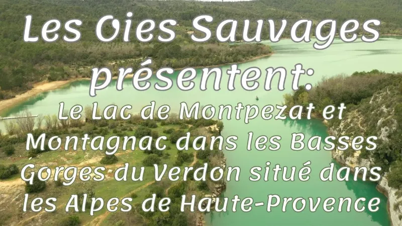
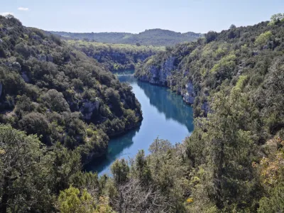
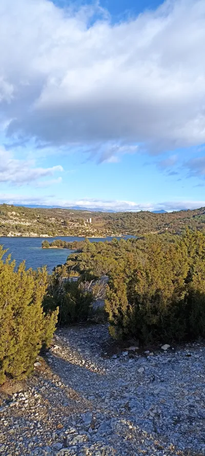
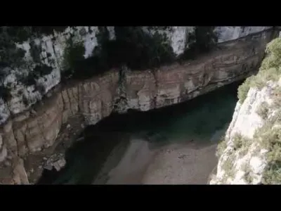
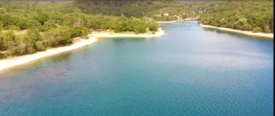
Description: Lac de Montpezat, a gem of the natural and cultural heritage of southern France, invites you to a rich and unforgettable experience. Nestled between two charming villages, Montagnac and Montpezat, and anchored in the heart of the spectacular Baudinard canyon, this site is a top destination for nature lovers and outdoor enthusiasts.
Lac de Montpezat: a window onto history and natural beauty Lac de Montpezat and Lac d'Artignosc are essential parts of the Baudinard canyon, an area inhabited since prehistoric times. Numerous traces of human occupation since the Neolithic have been found in the caves on the left bank of the Verdon, bearing witness to the region's rich history.
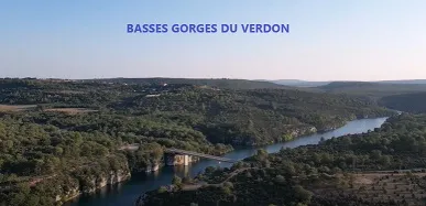
The appeal of this lake goes beyond its historical heritage; it is also a true natural spectacle. Montpezat is located near the lower Verdon gorges, while Montagnac is on the Valensole plateau. This municipality is bounded to the south by the Verdon, at the Baudinard gorges, and extends to Allemagne-en-Provence and the Colostre valley to the north.
Lac de Montpezat: swimming and activities Although swimming is prohibited in Lac de Montpezat because of its cold water springs, this clean and beautiful lake offers other kinds of water adventures. You can rent boats to cruise around the lake, taking in its crystal-clear water and the soothing silence of the surroundings.
Lac de Montpezat fishing: a paradise for anglers Lac de Montpezat is a paradise for anglers. Rich in fish, this place promises a memorable fishing experience. Whether you are a seasoned angler or a beginner, fishing at Lac de Montpezat is a relaxing activity that will let you connect with nature.
Montagnac and Montpezat: picturesque villages A visit to the villages of Montagnac and Montpezat will round off your trip perfectly. Montagnac, locally nicknamed "Montagnac-les-truffes", reflects the gastronomic history of the region. The feast of Saint Anthony, patron saint of truffle growers, is celebrated in the village every year. Montpezat, set on a small promontory, is home to the remains of a castle, offering a glimpse of its historical past.
In short, Lac de Montpezat is much more than a simple body of water. It is a place rich in history, surrounded by breathtaking natural landscapes and dotted with two charming villages. Whether you want to get away in a rowboat, fish peacefully, or simply explore and enjoy the natural and historical beauty, Lac de Montpezat is a destination not to be missed.
Map and restricted areas
Open in the main mapNearby aerodromes
Open aerodromes within 25 km of the spot, heliports included, with their distance and direction from the spot. Near an aerodrome, drone flying is prohibited or height-limited: check the UAS zones map.
| Aerodrome | Type | Distance | Elevation | Difference |
|---|---|---|---|---|
| Puimoisson Airfield | Aerodrome | 16 km NE | 769 m | spot 366 m lower |
| Aérodrome de Vinon | Aerodrome | 24 km W | 275 m | spot 129 m higher |
Aviation weather (METAR and TAF)
LFMC – Le Luc-Le Cannet Airport VFR
METAR
METAR LFMC 211030Z AUTO 28016KT CAVOK 15/06 Q1018
- Wind
- 280°, 30 km/h
- Visibility
- 10 km or more
- Clouds
- –
- Temperature
- 15 °C, dew point 6 °C
- QNH
- 1018 hPa
- Flight category
- VFR: ceiling > 3,000 ft and visibility > 5 mi
TAF
Weather and Kp index
| Day | Weather | Temp. min. / max. | Wind | Rain | Max Kp |
|---|---|---|---|---|---|
| Sat 21 Nov | Fair | 7° / 14° | 15 km/h NW | – | 2 |
| Sun 22 Nov | Clear sky | 8° / 13° | 31 km/h NW | 11 mm | 2 |
| Mon 23 Nov | Partly cloudy | 6° / 11° | 36 km/h NW | – | 4 |
| Tue 24 Nov | Cloudy | 4° / 13° | 19 km/h SE | 0.6 mm | 2 |
| Wed 25 Nov | Cloudy | 7° / 9° | 37 km/h E | 14 mm | – |
| Thu 26 Nov | Partly cloudy | 3° / 11° | 12 km/h N | 14 mm | – |
| Fri 27 Nov | Fair | 3° / 11° | 8 km/h NW | – | – |
Hour by hour: Saturday 21 November
| Time | Weather | Temp. | Wind | Rain | Clouds | Kp |
|---|---|---|---|---|---|---|
| 12:00 | Partly cloudy | 13° | 15 km/h NW | – | 40 % | 2 |
| 13:00 | Fair | 14° | 15 km/h NW | – | 25 % | 1 |
| 14:00 | Partly cloudy | 14° | 15 km/h W | – | 41 % | 1 |
| 15:00 | Partly cloudy | 14° | 15 km/h W | – | 41 % | 1 |
| 16:00 | Partly cloudy | 13° | 15 km/h W | – | 69 % | 2 |
| 17:00 | Partly cloudy | 10° | 10 km/h W | – | 59 % | 2 |
| 18:00 | Partly cloudy | 8° | 10 km/h NW | – | 67 % | 2 |
| 19:00 | Partly cloudy | 8° | 10 km/h NE | – | 86 % | 2 |
| 20:00 | Partly cloudy | 8° | 8 km/h NE | – | 91 % | 2 |
| 21:00 | Partly cloudy | 7° | 8 km/h NE | – | 80 % | 2 |
| 22:00 | Cloudy | 7° | 7 km/h E | – | 100 % | 2 |
Hour by hour: Sunday 22 November
| Time | Weather | Temp. | Wind | Rain | Clouds | Kp |
|---|---|---|---|---|---|---|
| 06:00 | Heavy rain | 12° | 20 km/h SE | 2.1 mm | 100 % | 2 |
| 07:00 | Rain | 12° | 20 km/h SE | 0.6 mm | 100 % | 2 |
| 08:00 | Heavy rain | 12° | 19 km/h SE | 2.4 mm | 100 % | 2 |
| 09:00 | Rain | 11° | 13 km/h S | 0.5 mm | 100 % | 2 |
| 10:00 | Light rain | 12° | 19 km/h W | 0.2 mm | 100 % | 2 |
| 11:00 | Light rain | 12° | 26 km/h W | 0.2 mm | 89 % | 2 |
| 12:00 | Cloudy | 12° | 26 km/h W | – | 92 % | 2 |
| 13:00 | Clear sky | 13° | 29 km/h NW | – | 8 % | 2 |
| 14:00 | Clear sky | 13° | 30 km/h NW | – | 10 % | 2 |
| 15:00 | Fair | 13° | 31 km/h NW | – | 18 % | 2 |
| 16:00 | Clear sky | 12° | 29 km/h NW | – | 10 % | 2 |
| 17:00 | Fair | 11° | 27 km/h NW | – | 27 % | 2 |
| 18:00 | Fair | 10° | 25 km/h W | – | 16 % | 2 |
| 19:00 | Fair | 9° | 24 km/h W | – | 16 % | 2 |
| 20:00 | Clear sky | 8° | 25 km/h W | – | 9 % | 2 |
| 21:00 | Fair | 8° | 26 km/h W | – | 15 % | 2 |
| 22:00 | Fair | 8° | 25 km/h W | – | 27 % | 2 |
Sunrise and sunset
| Day | Dawn | Sunrise | Golden hour | Sunset | Dusk | Day length |
|---|---|---|---|---|---|---|
| Sat 21 Nov | 07:06 | 07:38 | 07:38–08:22 · 16:21–17:05 | 17:05 | 17:37 | 9 h 27 |
| Sun 22 Nov | 07:07 | 07:39 | 07:39–08:23 · 16:20–17:05 | 17:05 | 17:36 | 9 h 25 |
| Mon 23 Nov | 07:09 | 07:40 | 07:40–08:25 · 16:19–17:04 | 17:04 | 17:36 | 9 h 24 |
| Tue 24 Nov | 07:10 | 07:41 | 07:41–08:26 · 16:19–17:03 | 17:03 | 17:35 | 9 h 22 |
| Wed 25 Nov | 07:11 | 07:42 | 07:42–08:27 · 16:18–17:03 | 17:03 | 17:34 | 9 h 20 |
| Thu 26 Nov | 07:12 | 07:44 | 07:44–08:29 · 16:17–17:02 | 17:02 | 17:34 | 9 h 18 |
| Fri 27 Nov | 07:13 | 07:45 | 07:45–08:30 · 16:16–17:02 | 17:02 | 17:34 | 9 h 16 |

Reviews
Log in to review this spot. Log in · Create a free account
No reviews yet. Share yours!