

Roquebrune sur Argens, Lac de l'Aréna
No reviews yet
Have you flown here? Share your experience with other pilots.
+ Write the first reviewDescription
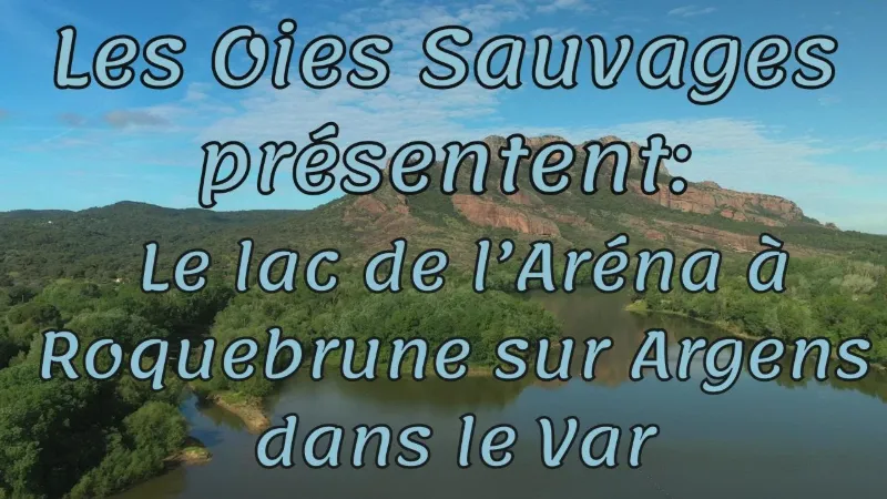
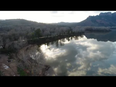
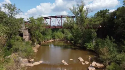
Covering about 30 hectares, the lake is fed by the Argens. It is of great ecological interest: - its western part, covered with reedbeds, provides natural shelter for nesting birds and spawning grounds for fish, - its banks of compacted sand are an ideal habitat for the European bee-eater, which digs its burrows there, - many bird species have been recorded there, in particular the grey heron. After the former quarry was filled with water, a swimming beach and a water sports center were set up. Several sports and activities are allowed, including water skiing, windsurfing and pedal boats. A mini-golf course is also available during the summer season.
Map and restricted areas
Open in the main mapNearby aerodromes
Open aerodromes within 25 km of the spot, heliports included, with their distance and direction from the spot. Near an aerodrome, drone flying is prohibited or height-limited: check the UAS zones map.
| Aerodrome | Type | Distance | Elevation | Difference |
|---|---|---|---|---|
| Hôpital Bonnet Heliport | Heliport | 10 km E | 21 m | spot 9 m lower |
| Fayence Glider Field | Aerodrome | 19 km N | 226 m | spot 214 m lower |
| Base Hydro-ULM de St Tropez | Seaplane base | 20 km S | 0 m | spot 12 m higher |
| Le Luc-Le Cannet Airport | Airport | 21 km W | 81 m | spot 69 m lower |
| Sarl R.C.E Heliport | Heliport | 21 km S | 6 m | spot 5 m higher |
Aviation weather (METAR and TAF)
LFMC – Le Luc-Le Cannet Airport VFR
METAR
METAR LFMC 211100Z AUTO 26011KT CAVOK 17/06 Q1018
- Wind
- 260°, 20 km/h
- Visibility
- 10 km or more
- Clouds
- –
- Temperature
- 17 °C, dew point 6 °C
- QNH
- 1018 hPa
- Flight category
- VFR: ceiling > 3,000 ft and visibility > 5 mi
TAF
Weather and Kp index
| Day | Weather | Temp. min. / max. | Wind | Rain | Max Kp |
|---|---|---|---|---|---|
| Sat 21 Nov | Fair | 8° / 18° | 22 km/h W | – | 2 |
| Sun 22 Nov | Partly cloudy | 10° / 17° | 35 km/h W | 9.0 mm | 2 |
| Mon 23 Nov | Fair | 6° / 15° | 47 km/h W | – | 4 |
| Tue 24 Nov | Cloudy | 6° / 15° | 13 km/h NW | 2.3 mm | 2 |
| Wed 25 Nov | Rain | 10° / 11° | 27 km/h NE | 34 mm | – |
| Thu 26 Nov | Clear sky | 4° / 13° | 15 km/h SW | – | – |
| Fri 27 Nov | Partly cloudy | 2° / 12° | 5 km/h NW | – | – |
Hour by hour: Saturday 21 November
| Time | Weather | Temp. | Wind | Rain | Clouds | Kp |
|---|---|---|---|---|---|---|
| 12:00 | Partly cloudy | 16° | 21 km/h SW | – | 67 % | 2 |
| 13:00 | Fair | 17° | 22 km/h W | – | 27 % | 1 |
| 14:00 | Fair | 18° | 22 km/h W | – | 15 % | 1 |
| 15:00 | Partly cloudy | 18° | 22 km/h W | – | 43 % | 1 |
| 16:00 | Fair | 16° | 19 km/h W | – | 31 % | 2 |
| 17:00 | Partly cloudy | 14° | 18 km/h W | – | 47 % | 2 |
| 18:00 | Partly cloudy | 13° | 16 km/h W | – | 54 % | 2 |
| 19:00 | Partly cloudy | 12° | 12 km/h W | – | 62 % | 2 |
| 20:00 | Partly cloudy | 10° | 9 km/h W | – | 76 % | 2 |
| 21:00 | Partly cloudy | 9° | 9 km/h W | – | 41 % | 2 |
| 22:00 | Cloudy | 8° | 7 km/h NW | – | 97 % | 2 |
Hour by hour: Sunday 22 November
| Time | Weather | Temp. | Wind | Rain | Clouds | Kp |
|---|---|---|---|---|---|---|
| 06:00 | Light rain | 11° | 9 km/h NE | 0.4 mm | 100 % | 2 |
| 07:00 | Heavy rain | 12° | 9 km/h NE | 1.1 mm | 100 % | 2 |
| 08:00 | Heavy rain | 12° | 9 km/h NE | 1.6 mm | 100 % | 2 |
| 09:00 | Heavy rain | 12° | 9 km/h NE | 1.7 mm | 94 % | 2 |
| 10:00 | Rain | 13° | 5 km/h W | 0.5 mm | 91 % | 2 |
| 11:00 | Partly cloudy | 14° | 22 km/h W | – | 45 % | 2 |
| 12:00 | Partly cloudy | 16° | 30 km/h W | – | 54 % | 2 |
| 13:00 | Partly cloudy | 17° | 35 km/h W | – | 43 % | 2 |
| 14:00 | Clear sky | 17° | 32 km/h W | – | 6 % | 2 |
| 15:00 | Clear sky | 17° | 32 km/h W | – | 7 % | 2 |
| 16:00 | Clear sky | 16° | 31 km/h W | – | 10 % | 2 |
| 17:00 | Clear sky | 15° | 30 km/h W | – | 6 % | 2 |
| 18:00 | Clear sky | 14° | 29 km/h W | – | 10 % | 2 |
| 19:00 | Fair | 13° | 31 km/h W | – | 17 % | 2 |
| 20:00 | Fair | 12° | 31 km/h W | – | 20 % | 2 |
| 21:00 | Fair | 12° | 32 km/h W | – | 23 % | 2 |
| 22:00 | Fair | 12° | 33 km/h W | – | 22 % | 2 |
Sunrise and sunset
| Day | Dawn | Sunrise | Golden hour | Sunset | Dusk | Day length |
|---|---|---|---|---|---|---|
| Sat 21 Nov | 07:03 | 07:35 | 07:35–08:19 · 16:20–17:04 | 17:04 | 17:35 | 9 h 29 |
| Sun 22 Nov | 07:05 | 07:36 | 07:36–08:20 · 16:19–17:03 | 17:03 | 17:35 | 9 h 27 |
| Mon 23 Nov | 07:06 | 07:37 | 07:37–08:21 · 16:18–17:03 | 17:03 | 17:34 | 9 h 25 |
| Tue 24 Nov | 07:07 | 07:38 | 07:38–08:23 · 16:18–17:02 | 17:02 | 17:33 | 9 h 23 |
| Wed 25 Nov | 07:08 | 07:39 | 07:39–08:24 · 16:17–17:01 | 17:01 | 17:33 | 9 h 22 |
| Thu 26 Nov | 07:09 | 07:41 | 07:41–08:25 · 16:16–17:01 | 17:01 | 17:32 | 9 h 20 |
| Fri 27 Nov | 07:10 | 07:42 | 07:42–08:27 · 16:15–17:00 | 17:00 | 17:32 | 9 h 18 |


Reviews
Log in to review this spot. Log in · Create a free account
No reviews yet. Share yours!