

Roquefavour Aqueduct
No reviews yet
Have you flown here? Share your experience with other pilots.
+ Write the first reviewDescription
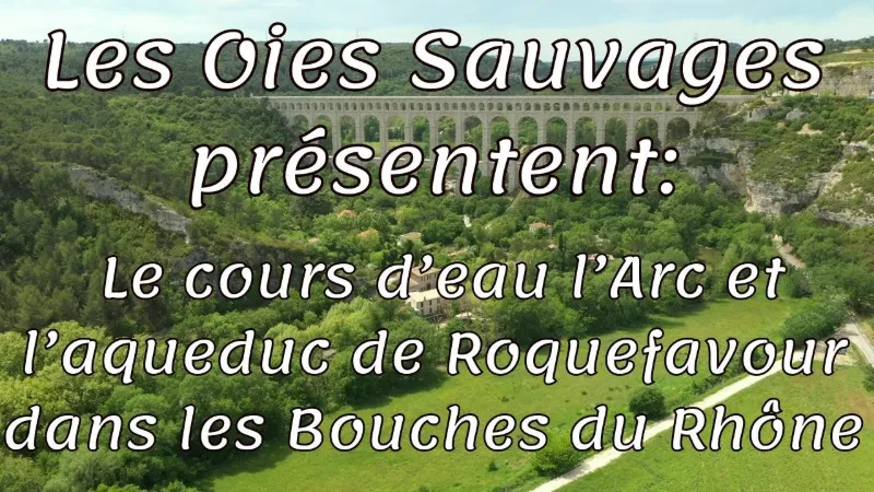
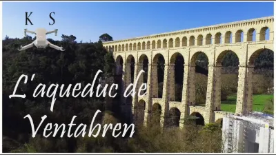
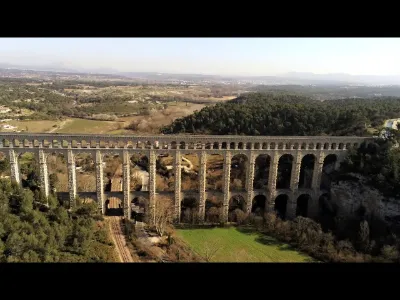
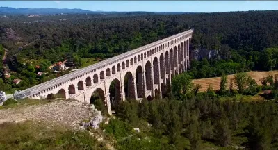
The Arc is a coastal river in the south of France, in the Provence-Alpes-Côte d'Azur region, which rises at the western end of the Var and mainly runs along the Bouches-du-Rhône département through the Aix-en-Provence area, a town it also flows through. It flows into the Étang de Berre. The Arc rises between Saint-Maximin-la-Sainte-Baume and Pourcieux (Var) at an altitude of 493 meters, at the foot of Mont Aurélien (879 m), and flows into the Étang de Berre (Bouches-du-Rhône) through a small delta. It is 82.9 km long with an average gradient of less than 1%. It occupies an east-west oriented depression. If the Romans were still around, they would no doubt proudly claim the Roquefavour aqueduct as their own. Inspired by the Pont du Gard, it is today the largest stone aqueduct bridge in the world. Almost 400 meters long, it has tirelessly carried the water supplying Marseille and its surroundings for more than 170 years. But its history has been far from smooth sailing.
1841, laying of the first stone It all began in 1834 with the decision to bring water to Marseille. The nearest river being the Durance, a project to build a canal was launched. The idea was bold, and many difficulties stood in the way of the life-saving canal: the Côtes range, the Arbois plateau and the Étoile massif. And in 1841 the first stone was laid. The winding route made use of all the engineering of the time to get around natural obstacles. In this way, 18 aqueduct bridges were built to span a stream or river. The Roquefavour aqueduct is undoubtedly the most remarkable structure of its kind, thanks to the quality of its construction and the beauty of its finish, with its 65 arches and 15 arcades.
Criticized, then praised Franz Mayor de Montricher was the architect chosen to build the canal. His plan included an "aqueduct bridge" in the municipality of Ventabren to cross the Arc river, designed as a neo-Roman structure. This "grand bridge" was to be 350 meters long and 51 meters high, at an estimated cost of 500,000 francs. It ended up costing more than 3.7 million francs and rising to nearly 83 meters. Drawing a lot of criticism, it even nearly gave way to an iron bridge! Entrusted to a Swiss engineer, William Fraisse, the project took 7 years of work and mobilized 5,000 workers, including 300 stoneworkers. The blocks used could weigh up to 15 tonnes and came from two stone quarries in the village of Velaux. A 9-kilometer railway line was even built to carry them to the site. On 30 June 1847, the water of the Durance finally crossed the Arc. The Roquefavour aqueduct became an emblematic structure and earned its designer the Légion d'honneur. It is a symbol still recognized today, since it has been listed as a historic monument since 2005. The canal saves Marseille from epidemics The Marseille canal has its origin in the epidemics that ravaged the Phocaean city in 1832. At that time, only the small Huveaune river ran through it, and its irregular and far too weak flow allowed only 75 liters of water per day per person. Great droughts brought this figure down to... 1 liter per day per person. In two years, 3 cholera epidemics followed one another and the mayor Maximin-Dominique Consolat decided "whatever happens and whatever it costs" to bring water to Marseille. A canal was to be built to carry water from the Durance, from the Pertuis bridge to the Palais Longchamp.
On 19 November 1849, the water finally reached the Longchamp plateau, and after 15 years of work from 1839 to 1854, the 80 kilometers - 17 of them underground - gave the more than 360,000 people of Marseille enough drinking water (370 liters per day per person). Work continued until 1869 with the creation of 77 kilometers of pipes and the construction of new storage basins. They provided access to water for the whole territory of Marseille, including the municipalities of Allauch, Aubagne and Plan-de-Cuques.
An exceptional restoration For its age, it is still young. But the Roquefavour aqueduct nevertheless needs a rejuvenating treatment. After emergency work undertaken in 2008 with clearing operations on the arches, a major project began in 2020 to preserve the structure.
Carried out by the Métropole, restoration work will put an end to the damage affecting the structure of the building, curbing the natural deterioration of the stones and protecting the decks from runoff water. An 18-million-euro project that should be completed in 2024.
Map and restricted areas
Open in the main mapNearby aerodromes
Open aerodromes within 25 km of the spot, heliports included, with their distance and direction from the spot. Near an aerodrome, drone flying is prohibited or height-limited: check the UAS zones map.
| Aerodrome | Type | Distance | Elevation | Difference |
|---|---|---|---|---|
| Aix - Les Milles Airport | Aerodrome | 4.7 km E | 112 m | spot 73 m higher |
| Pays d'Aix Medical Center Heliport | Heliport | 11 km E | 222 m | spot 37 m lower |
| Berre/Marignane Seaplane Base | Seaplane base | 11 km SW | 2 m | spot 183 m higher |
| Berre-la-Fare Airfield | Aerodrome | 11 km W | 33 m | spot 152 m higher |
| Marseille Provence Airport | Major airport | 12 km SW | 23 m | spot 163 m higher |
Aviation weather (METAR and TAF)
LFML – Marseille Provence Airport VFR
METAR
METAR LFML 210630Z AUTO VRB03KT CAVOK 08/06 Q1020 NOSIG
- Wind
- Variable, 6 km/h
- Visibility
- 10 km or more
- Clouds
- –
- Temperature
- 8 °C, dew point 6 °C
- QNH
- 1020 hPa
- Flight category
- VFR: ceiling > 3,000 ft and visibility > 5 mi
TAF
TAF LFML 210200Z 2103/2209 VRB05KT CAVOK TX18/2115Z TN08/2107Z BECMG 2119/2121 11010KT -RA BKN025 PROB40 TEMPO 2121/2209 16015G25KT 4000 RA BKN012 BKN025
| Period (local time) | Change | Wind | Visibility | Weather | Clouds |
|---|---|---|---|---|---|
| 21/11 04:00 → 21/11 20:00 | Initial conditions | Variable, 9 km/h | 10 km or more | No significant cloud | |
| 21/11 20:00 → 22/11 10:00 | Becoming | 110°, 19 km/h | 10 km or more | Rain light | Broken (5-7/8) at 2,500 ft (760 m) |
| 21/11 22:00 → 22/11 10:00 | Temporarily, probability 40% | 160°, 28 km/h, gusts 46 km/h | 4.0 km | Rain | Broken (5-7/8) at 1,200 ft (370 m) ; Broken (5-7/8) at 2,500 ft (760 m) |
Weather and Kp index
| Day | Weather | Temp. min. / max. | Wind | Rain | Max Kp |
|---|---|---|---|---|---|
| Sat 21 Nov | Partly cloudy | 8° / 14° | 18 km/h SE | 1.2 mm | 2 |
| Sun 22 Nov | Fair | 10° / 15° | 30 km/h W | 4.7 mm | 2 |
| Mon 23 Nov | Fair | 8° / 13° | 27 km/h NW | – | 4 |
| Tue 24 Nov | Cloudy | 3° / 13° | 15 km/h E | 0.3 mm | 2 |
| Wed 25 Nov | Heavy rain | 8° / 11° | 35 km/h E | 36 mm | – |
| Thu 26 Nov | Fair | 5° / 12° | 6 km/h NE | 0.2 mm | – |
| Fri 27 Nov | Fair | 2° / 10° | 7 km/h NW | – | – |
Hour by hour: Saturday 21 November
| Time | Weather | Temp. | Wind | Rain | Clouds | Kp |
|---|---|---|---|---|---|---|
| 08:00 | Cloudy | 8° | 9 km/h N | – | 99 % | 2 |
| 09:00 | Cloudy | 10° | 10 km/h NW | – | 98 % | 2 |
| 10:00 | Cloudy | 11° | 7 km/h W | – | 98 % | 2 |
| 11:00 | Cloudy | 12° | 7 km/h W | – | 91 % | 2 |
| 12:00 | Partly cloudy | 14° | 8 km/h W | – | 55 % | 2 |
| 13:00 | Partly cloudy | 14° | 10 km/h W | – | 62 % | 1 |
| 14:00 | Partly cloudy | 14° | 10 km/h W | – | 49 % | 1 |
| 15:00 | Partly cloudy | 14° | 10 km/h W | – | 60 % | 1 |
| 16:00 | Fair | 14° | 5 km/h SW | – | 23 % | 2 |
| 17:00 | Partly cloudy | 12° | 4 km/h S | – | 61 % | 2 |
| 18:00 | Cloudy | 11° | 6 km/h SE | – | 94 % | 2 |
| 19:00 | Cloudy | 11° | 8 km/h SE | – | 95 % | 2 |
| 20:00 | Cloudy | 10° | 10 km/h E | – | 100 % | 2 |
| 21:00 | Cloudy | 12° | 12 km/h E | – | 100 % | 2 |
| 22:00 | Light rain | 12° | 14 km/h E | 0.3 mm | 100 % | 2 |
Hour by hour: Sunday 22 November
| Time | Weather | Temp. | Wind | Rain | Clouds | Kp |
|---|---|---|---|---|---|---|
| 06:00 | Rain | 14° | 22 km/h S | 0.5 mm | 100 % | 2 |
| 07:00 | Rain | 14° | 21 km/h S | 0.9 mm | 100 % | 2 |
| 08:00 | Light rain | 14° | 20 km/h SW | 0.2 mm | 100 % | 2 |
| 09:00 | Showers | 14° | 16 km/h W | 0.2 mm | 86 % | 2 |
| 10:00 | Light rain | 14° | 28 km/h W | 0.2 mm | 99 % | 2 |
| 11:00 | Cloudy | 13° | 23 km/h W | – | 99 % | 2 |
| 12:00 | Cloudy | 14° | 24 km/h W | – | 98 % | 2 |
| 13:00 | Fair | 15° | 28 km/h W | – | 14 % | 2 |
| 14:00 | Clear sky | 15° | 30 km/h W | – | 12 % | 2 |
| 15:00 | Clear sky | 15° | 30 km/h W | – | 11 % | 2 |
| 16:00 | Clear sky | 14° | 28 km/h W | – | 9 % | 2 |
| 17:00 | Clear sky | 13° | 24 km/h W | – | 8 % | 2 |
| 18:00 | Clear sky | 12° | 22 km/h W | – | 12 % | 2 |
| 19:00 | Fair | 12° | 22 km/h W | – | 22 % | 2 |
| 20:00 | Fair | 11° | 23 km/h W | – | 23 % | 2 |
| 21:00 | Fair | 11° | 24 km/h W | – | 21 % | 2 |
| 22:00 | Fair | 11° | 23 km/h W | – | 17 % | 2 |
Sunrise and sunset
| Day | Dawn | Sunrise | Golden hour | Sunset | Dusk | Day length |
|---|---|---|---|---|---|---|
| Sat 21 Nov | 07:09 | 07:40 | 07:40–08:24 · 16:25–17:09 | 17:09 | 17:40 | 9 h 29 |
| Sun 22 Nov | 07:10 | 07:41 | 07:41–08:26 · 16:24–17:08 | 17:08 | 17:40 | 9 h 27 |
| Mon 23 Nov | 07:11 | 07:42 | 07:42–08:27 · 16:23–17:08 | 17:08 | 17:39 | 9 h 25 |
| Tue 24 Nov | 07:12 | 07:44 | 07:44–08:28 · 16:23–17:07 | 17:07 | 17:39 | 9 h 23 |
| Wed 25 Nov | 07:13 | 07:45 | 07:45–08:30 · 16:22–17:07 | 17:07 | 17:38 | 9 h 21 |
| Thu 26 Nov | 07:14 | 07:46 | 07:46–08:31 · 16:21–17:06 | 17:06 | 17:38 | 9 h 19 |
| Fri 27 Nov | 07:16 | 07:47 | 07:47–08:32 · 16:20–17:05 | 17:05 | 17:37 | 9 h 18 |

Reviews
Log in to review this spot. Log in · Create a free account
No reviews yet. Share yours!