

Auray, port of St Goustan

No reviews yet
Have you flown here? Share your experience with other pilots.
+ Write the first reviewDescription
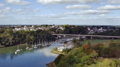
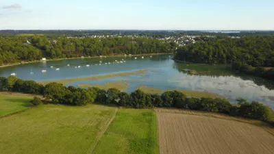
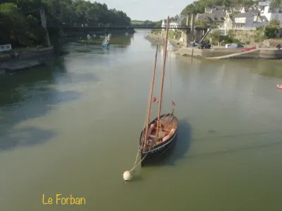
A charming port steeped in history and a major pilgrimage site When crossing the bridge of the dual carriageway between Vannes and Lorient, a pretty little port catches the eye. Nestled at the end of a ria, Saint-Goustan has stood the test of time, keeping its cobbled lanes, its stone bridge, its half-timbered houses and its lively quays. A historic town, Auray also hosts a major pilgrimage site in Brittany. Discovering Auray and the port of Saint-Goustan It's best to avoid high heels when exploring Saint-Goustan. To start, the rampes du Loch, built on the ruins of a fortified castle, descend toward the port. From the shaded terraces of the promenade, the view drops down onto the quays. The most picturesque bank is reached by crossing the 13th-century stone bridge with four arches. The place Saint-Sauveur, with its rounded cobblestones, is framed by handsome half-timbered houses with overhanging upper floors. The steep lanes, broken up by steps, climb up through the district, lined with half-timbered facades. The 15th- and 16th-century houses look respectable, a look that gets a little more rowdy in the evening amid the buzz of the café terraces.
Map and restricted areas
Open in the main mapNearby aerodromes
Open aerodromes within 25 km of the spot, heliports included, with their distance and direction from the spot. Near an aerodrome, drone flying is prohibited or height-limited: check the UAS zones map.
| Aerodrome | Type | Distance | Elevation | Difference |
|---|---|---|---|---|
| Chubert Centre Hospitalier Heliport | Heliport | 17 km E | 10 m | spot 9 m lower |
| Quiberon Airport | Aerodrome | 21 km SW | 11 m | spot 10 m lower |
| Vannes-Meucon Airport | Airport | 21 km NE | 136 m | spot 135 m lower |
Aviation weather (METAR and TAF)
LFRV – Vannes-Meucon Airport LIFR
METAR
METAR LFRV 210630Z AUTO 10004KT 1000 BR VV/// 11/11 Q1016
- Wind
- 100°, 7 km/h
- Visibility
- 1,000 m
- Weather
- Mist
- Clouds
- –
- Temperature
- 11 °C, dew point 11 °C
- QNH
- 1016 hPa
- Flight category
- LIFR: ceiling < 500 ft or visibility < 1 mi
TAF
Weather and Kp index
Sunrise and sunset
| Day | Dawn | Sunrise | Golden hour | Sunset | Dusk | Day length |
|---|---|---|---|---|---|---|
| Sat 21 Nov | 07:52 | 08:26 | 08:26–09:15 · 16:40–17:30 | 17:30 | 18:04 | 9 h 03 |
| Sun 22 Nov | 07:53 | 08:27 | 08:27–09:17 · 16:39–17:29 | 17:29 | 18:03 | 9 h 01 |
| Mon 23 Nov | 07:54 | 08:29 | 08:29–09:18 · 16:38–17:28 | 17:28 | 18:02 | 8 h 59 |
| Tue 24 Nov | 07:56 | 08:30 | 08:30–09:20 · 16:37–17:27 | 17:27 | 18:01 | 8 h 56 |
| Wed 25 Nov | 07:57 | 08:31 | 08:31–09:21 · 16:36–17:26 | 17:26 | 18:01 | 8 h 54 |
| Thu 26 Nov | 07:58 | 08:33 | 08:33–09:23 · 16:35–17:26 | 17:26 | 18:00 | 8 h 52 |
| Fri 27 Nov | 07:59 | 08:34 | 08:34–09:25 · 16:34–17:25 | 17:25 | 18:00 | 8 h 50 |

Reviews
Log in to review this spot. Log in · Create a free account
No reviews yet. Share yours!