

Île d'Arz
No reviews yet
Have you flown here? Share your experience with other pilots.
+ Write the first reviewDescription
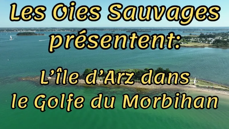
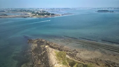
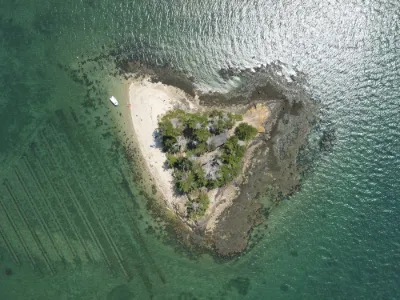
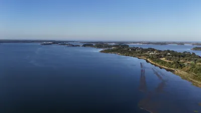
WHAT TO SEE ON ÎLE D'ARZ? With its 16 km of coastal paths (pedestrians only), its cycling route and its magnificent beaches, Île d'Arz, at 330 hectares, is the "nature" island par excellence. It is a paradise for hikers and nature lovers, with a pretty beach or a pretty village always waiting at the end of the path.
In the wild north of the island, home to a great variety of birds, the boundary between land and sea becomes blurred…
In the south, there are multiple viewpoints over the surrounding islands, and a dreamy beach for swimming, windsurfing and kitesurfing.
And in the center, the village, with its charming lanes, its church and its pretty houses. THE ISLAND OF CAPTAINS
From the 17th century on, thanks to the proximity of major ports such as Nantes and Lorient, it was deep-sea sailors who made the island's reputation. It saw generations of sailors and captains born who devoted their lives to maritime trade and coastal shipping. They sailed on ocean-going ships, but also on coasters that they often owned themselves. Carrying grain, barrels of wine, sardines or salt was more lucrative than fishing.
In the 18th century, sailors and captains made up 10% of the island's population. Although conditions have obviously changed a great deal, today young people from the island still carry on this tradition.
But Île d'Arz was also an agricultural island. That was women's work. They were nicknamed the "guardians of the island" because their husbands were at sea. Most families owned a few "sillons", small plots of land. For the more modest families, the harvest helped supplement the sometimes meager pay of the sailors who had left for long months at sea.
The captains' houses
Even though 70% of the island's houses are now second homes, a simple glance at the dwellings and their architecture tells this story of sailors and captains. There are the captains' houses: large, wealthy, with an upper floor. Some very beautiful ones can be seen in the village and in Penero. And there are the simple sailors' houses, much more modest and without an upper floor, generally located in the "bas-villages" (lower villages).
The tide mill
With its dike of more than 300 meters, it has become the emblem of the island. Fully restored by an association, it is in working order. You can see all the machinery that drives the millstone. The dike and the mill were built in the 16th century by the monks of Rhuys Abbey. This tide mill bears witness to the island's agricultural past. In the mid-18th century, there were twelve farms on the island and 170 hectares under cultivation. Each village had its own bread oven.
The Compagnie du Varech warehouse
Now a private holiday center, this building was once used to store salt, then wrack seaweed, also called varech. In 1923 the Société Industrielle du Varech set up a drying center there. The harvested seaweed, an excellent insulator, was used to make mattresses, and in particular the seats of railway carriages. Many women from the island worked there. The harvesting and drying activity continued until just before the Second World War.
The Rudevent salt marshes
They were in operation during the time of the Gabelle (salt tax) and until the widespread adoption of the tin can (mid-19th century). The dike is now largely destroyed. Right nearby, the ruins of Quéléron, the former village of the salt workers, are disappearing into the vegetation.
The old houses of Penero
Beside the sailors' houses and the captains' houses, in the pretty village of Penero you can see two very old houses, one of which, with its dovecote, is a former 16th-century manor.
The Kernoël manor
This former property of Saint-Georges Abbey in Rennes was the home of the island's first republican mayor, Jean-Vincent Touzé du Guernic, assassinated by the Chouans in 1800. At the entrance, there is a very beautiful dovecote.
The priory
This former priory, which belonged to Saint-Gildas de Rhuys Abbey, now houses the island's town hall and school. A fine example of restoration. Until the 1960s, the building had become a farm.
The church
The church of the Nativity of Our Lady celebrated its thousandth anniversary a few years ago. You can see carved sablières (wall-plate beams) and a beam with engoulants (dragon-mouth carvings). Its acoustics are remarkable, and its recently restored organ is of exceptional quality.
The Lious megalithic site
Located at the very south of the island in the Bois de Lious, this megalithic site consists of the remains of a dolmen and a circular enclosure. It bears witness to the life of Neolithic people on the island.
Map and restricted areas
Open in the main mapNearby aerodromes
Open aerodromes within 25 km of the spot, heliports included, with their distance and direction from the spot. Near an aerodrome, drone flying is prohibited or height-limited: check the UAS zones map.
| Aerodrome | Type | Distance | Elevation | Difference |
|---|---|---|---|---|
| Chubert Centre Hospitalier Heliport | Heliport | 10 km NE | 10 m | same altitude as the spot |
| Vannes-Meucon Airport | Airport | 17 km NE | 136 m | spot 130 m lower |
| Quiberon Airport | Aerodrome | 25 km SW | 11 m | spot 5 m lower |
Aviation weather (METAR and TAF)
LFRV – Vannes-Meucon Airport LIFR
METAR
METAR LFRV 210730Z AUTO 10004KT 0450 FG VV/// 10/10 Q1016
- Wind
- 100°, 7 km/h
- Visibility
- 450 m
- Weather
- Fog
- Clouds
- –
- Temperature
- 10 °C, dew point 10 °C
- QNH
- 1016 hPa
- Flight category
- LIFR: ceiling < 500 ft or visibility < 1 mi
TAF
Weather and Kp index
| Day | Weather | Temp. min. / max. | Wind | Rain | Max Kp |
|---|---|---|---|---|---|
| Sat 21 Nov | Cloudy | 11° / 14° | 42 km/h SE | 8.0 mm | 2 |
| Sun 22 Nov | Showers | 11° / 13° | 57 km/h W | 6.8 mm | 2 |
| Mon 23 Nov | Partly cloudy | 8° / 13° | 37 km/h NW | 0.2 mm | 4 |
| Tue 24 Nov | Clear sky | 6° / 12° | 24 km/h S | – | 2 |
| Wed 25 Nov | Light rain | 6° / 7° | 23 km/h NE | 13 mm | – |
| Thu 26 Nov | Partly cloudy | 2° / 5° | 16 km/h NE | – | – |
| Fri 27 Nov | Light rain | 3° / 13° | 31 km/h SW | 16 mm | – |
Hour by hour: Saturday 21 November
| Time | Weather | Temp. | Wind | Rain | Clouds | Kp |
|---|---|---|---|---|---|---|
| 08:00 | Partly cloudy | 11° | 15 km/h E | – | 75 % | 2 |
| 09:00 | Partly cloudy | 11° | 17 km/h E | – | 100 % | 2 |
| 10:00 | Cloudy | 12° | 22 km/h SE | – | 100 % | 2 |
| 11:00 | Cloudy | 12° | 27 km/h SE | – | 100 % | 2 |
| 12:00 | Partly cloudy | 13° | 29 km/h SE | – | 54 % | 2 |
| 13:00 | Cloudy | 13° | 29 km/h SE | – | 99 % | 1 |
| 14:00 | Cloudy | 14° | 32 km/h SE | – | 100 % | 1 |
| 15:00 | Cloudy | 14° | 33 km/h SE | – | 100 % | 1 |
| 16:00 | Cloudy | 14° | 33 km/h SE | – | 100 % | 2 |
| 17:00 | Cloudy | 13° | 33 km/h SE | – | 100 % | 2 |
| 18:00 | Light rain | 13° | 36 km/h SE | 0.2 mm | 100 % | 2 |
| 19:00 | Heavy rain | 13° | 38 km/h SE | 1.6 mm | 100 % | 2 |
| 20:00 | Heavy rain | 12° | 39 km/h SE | 2.8 mm | 100 % | 2 |
| 21:00 | Rain | 12° | 42 km/h SE | 0.4 mm | 100 % | 2 |
| 22:00 | Rain | 12° | 41 km/h SE | 0.5 mm | 100 % | 2 |
Hour by hour: Sunday 22 November
| Time | Weather | Temp. | Wind | Rain | Clouds | Kp |
|---|---|---|---|---|---|---|
| 06:00 | Light rain | 12° | 37 km/h W | 0.2 mm | 100 % | 2 |
| 07:00 | Light rain | 12° | 50 km/h W | 0.3 mm | 100 % | 2 |
| 08:00 | Showers | 12° | 50 km/h W | 0.3 mm | 81 % | 2 |
| 09:00 | Partly cloudy | 12° | 54 km/h W | – | 49 % | 2 |
| 10:00 | Showers | 12° | 50 km/h W | 0.1 mm | 11 % | 2 |
| 11:00 | Showers | 13° | 52 km/h W | 0.1 mm | 23 % | 2 |
| 12:00 | Fair | 13° | 52 km/h W | – | 27 % | 2 |
| 13:00 | Showers | 13° | 57 km/h W | 0.2 mm | 36 % | 2 |
| 14:00 | Showers | 13° | 54 km/h W | 0.2 mm | 20 % | 2 |
| 15:00 | Fair | 13° | 51 km/h W | – | 17 % | 2 |
| 16:00 | Clear sky | 13° | 52 km/h W | – | 4 % | 2 |
| 17:00 | Fair | 12° | 48 km/h W | – | 14 % | 2 |
| 18:00 | Clear sky | 12° | 45 km/h W | – | 4 % | 2 |
| 19:00 | Clear sky | 12° | 45 km/h W | – | 3 % | 2 |
| 20:00 | Clear sky | 11° | 42 km/h W | – | 4 % | 2 |
| 21:00 | Clear sky | 11° | 42 km/h W | – | 1 % | 2 |
| 22:00 | Clear sky | 11° | 40 km/h W | – | 2 % | 2 |
Sunrise and sunset
| Day | Dawn | Sunrise | Golden hour | Sunset | Dusk | Day length |
|---|---|---|---|---|---|---|
| Sat 21 Nov | 07:51 | 08:25 | 08:25–09:14 · 16:40–17:29 | 17:29 | 18:03 | 9 h 04 |
| Sun 22 Nov | 07:52 | 08:26 | 08:26–09:16 · 16:39–17:28 | 17:28 | 18:02 | 9 h 01 |
| Mon 23 Nov | 07:54 | 08:28 | 08:28–09:17 · 16:38–17:27 | 17:27 | 18:02 | 8 h 59 |
| Tue 24 Nov | 07:55 | 08:29 | 08:29–09:19 · 16:37–17:27 | 17:27 | 18:01 | 8 h 57 |
| Wed 25 Nov | 07:56 | 08:31 | 08:31–09:20 · 16:36–17:26 | 17:26 | 18:00 | 8 h 55 |
| Thu 26 Nov | 07:57 | 08:32 | 08:32–09:22 · 16:35–17:25 | 17:25 | 18:00 | 8 h 53 |
| Fri 27 Nov | 07:59 | 08:33 | 08:33–09:24 · 16:34–17:24 | 17:24 | 17:59 | 8 h 51 |
Reviews
Log in to review this spot. Log in · Create a free account
No reviews yet. Share yours!