

Briffoeil
No reviews yet
Have you flown here? Share your experience with other pilots.
+ Write the first reviewDescription
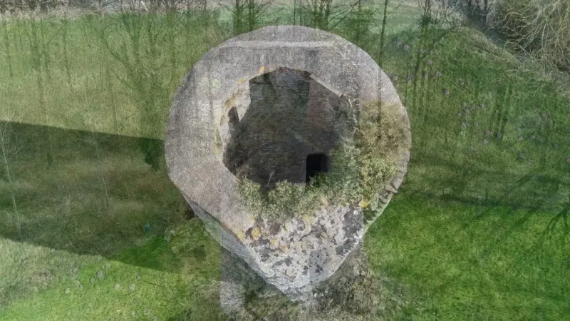
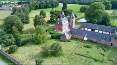
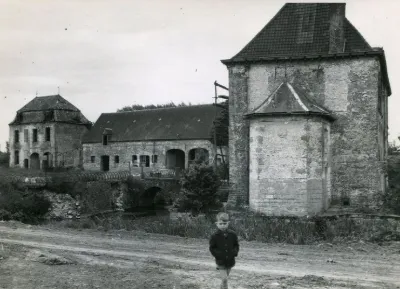
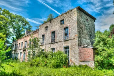
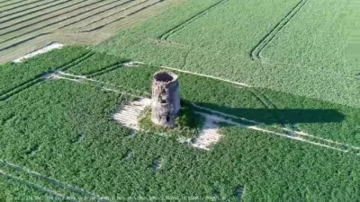
Isolated to the east of the village, the remains of the Briffoeil castle testify to the scale of this remarkable castle complex, built from the 13th century, extended in the 16th and 17th centuries, then gradually abandoned before being demolished at the end of the 19th century. Set in the middle of meadows whose undulations reveal the traces of the vanished parts, these remains today have real scenic quality combined with archaeological and historical value. The castle, mentioned in 1378, as well as the lordship, belonged to the d'Antoing family before passing notably to the Mérode family in the 16th century, and to the Vilain de Gand family in the 17th century. The whole site is known, among other sources, from the Count of Ferraris map, surveyed in the last third of the 18th century. Of the former quadrilateral enclosure surrounded by water and punctuated by five towers, only the northeast corner tower remains, probably dating from the 14th century. Rebuilt in 1477 according to some sources, it is built of sandstone and limestone rubble on a battered base and still has four levels of original bays. The facing also preserves the traces of where the curtain walls began. Nearby, the former coach house built in the 17th century is made of brick on a chamfered base of squared limestone rubble. Only one complete arch remains, shaped as a basket-handle arch edged with a double archivolt, the rest of the building being in ruins. It formed the end of the outbuilding wing, set parallel to that of the main residence inside the enclosure. The Saint-Georges chapel, formerly attached to the back of the residential wing, is documented in 1636. Built on a hexagonal plan and topped with a pavilion roof under a Renaissance-style slate bulb lantern, it is built of brick and limestone on a chamfered base, sheathed with corner quoins and lit by windows in the Gothic tradition. Following the demolition of the residential wing, a small neo-Gothic porch was added to the front. Very close by, a 16th- or 17th-century pillory made of limestone and decorated with a Renaissance-style lion's head stands facing a small well with a circular base in cut stone, topped with late masonry under a tiled lean-to roof. Finally, a small semi-enclosed group of buildings from the 17th or 18th century, reworked in the 19th century, once formed part of the castle's entrance block. It was converted into a farm before being turned into a dwelling. It is characterized by two blocks of limestone rubble buildings linked by an arched gateway and covered with roofs with overhanging gables.
Map and restricted areas
Open in the main mapAviation weather (METAR and TAF)
LFQQ – Lille-Lesquin Airport IFR
METAR
METAR LFQQ 210730Z AUTO 13001KT 2400 1200E R26/2500U R08/3700D BR NSC 00/00 Q1019 BECMG CAVOK
- Wind
- 130°, 2 km/h
- Visibility
- 2.4 km
- Weather
- Mist
- Clouds
- –
- Temperature
- 0 °C, dew point 0 °C
- QNH
- 1019 hPa
- Flight category
- IFR: ceiling 500–1,000 ft or visibility 1–3 mi
TAF
TAF LFQQ 210500Z 2106/2212 VRB04KT CAVOK PROB40 2106/2108 4000 BR BECMG 2108/2110 17005KT PROB40 2117/2120 4000 BR BKN009 PROB30 2120/2124 BKN013 BECMG 2200/2202 09007KT
| Period (local time) | Change | Wind | Visibility | Weather | Clouds |
|---|---|---|---|---|---|
| 21/11 07:00 → 21/11 09:00 | Initial conditions | Variable, 7 km/h | 10 km or more | No significant weather | No significant cloud |
| 21/11 07:00 → 21/11 09:00 | probability 40% | 4.0 km | Mist | ||
| 21/11 09:00 → 22/11 01:00 | Becoming | 170°, 9 km/h | 10 km or more | No significant weather | No significant cloud |
| 21/11 18:00 → 21/11 21:00 | probability 40% | 4.0 km | Mist | Broken (5-7/8) at 900 ft (270 m) | |
| 21/11 21:00 → 22/11 01:00 | probability 30% | Broken (5-7/8) at 1,300 ft (400 m) | |||
| 22/11 01:00 → 22/11 13:00 | Becoming | 090°, 13 km/h | 10 km or more | No significant weather | No significant cloud |
Weather and Kp index
Sunrise and sunset
| Day | Dawn | Sunrise | Golden hour | Sunset | Dusk | Day length |
|---|---|---|---|---|---|---|
| Sat 21 Nov | 07:33 | 08:10 | 08:10–09:04 · 15:59–16:53 | 16:53 | 17:30 | 8 h 42 |
| Sun 22 Nov | 07:35 | 08:12 | 08:12–09:06 · 15:58–16:52 | 16:52 | 17:29 | 8 h 40 |
| Mon 23 Nov | 07:36 | 08:13 | 08:13–09:08 · 15:57–16:51 | 16:51 | 17:28 | 8 h 37 |
| Tue 24 Nov | 07:38 | 08:15 | 08:15–09:09 · 15:55–16:50 | 16:50 | 17:27 | 8 h 35 |
| Wed 25 Nov | 07:39 | 08:16 | 08:16–09:11 · 15:54–16:49 | 16:49 | 17:26 | 8 h 32 |
| Thu 26 Nov | 07:40 | 08:18 | 08:18–09:13 · 15:53–16:48 | 16:48 | 17:26 | 8 h 30 |
| Fri 27 Nov | 07:42 | 08:19 | 08:19–09:15 · 15:52–16:48 | 16:48 | 17:25 | 8 h 28 |
Reviews
Log in to review this spot. Log in · Create a free account
No reviews yet. Share yours!