

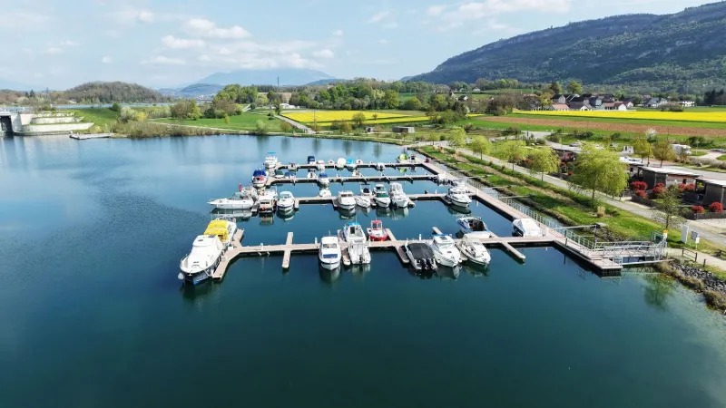
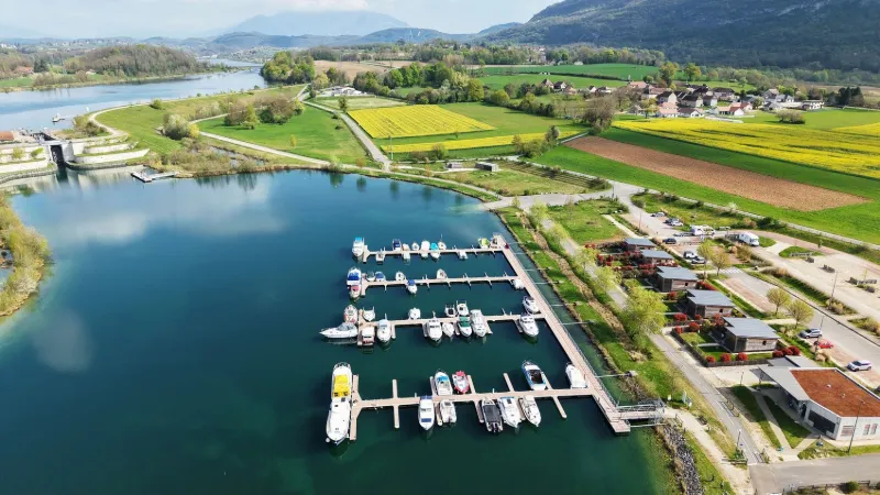
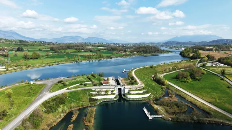
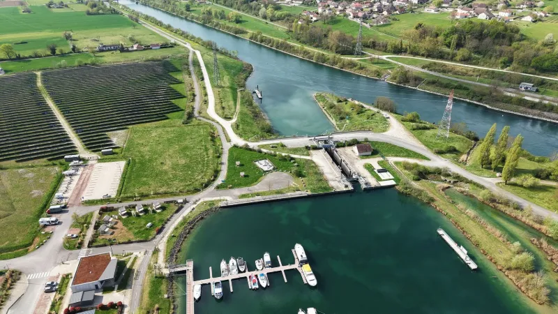
The port of Virignin
No reviews yet
Have you flown here? Share your experience with other pilots.
+ Write the first reviewDescription
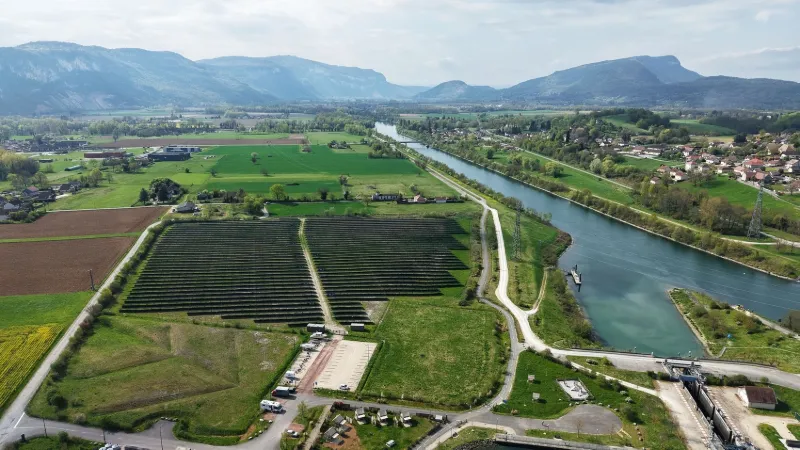
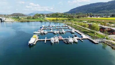
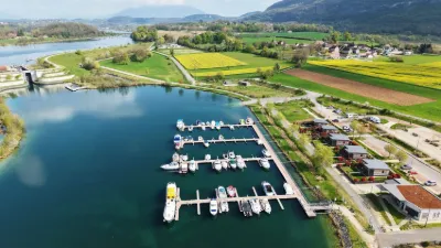
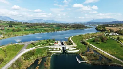
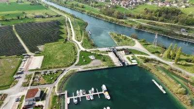
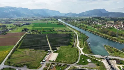
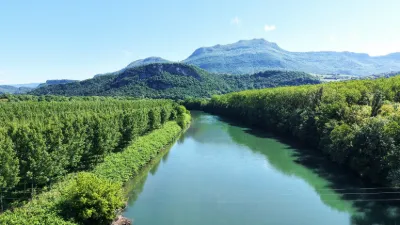
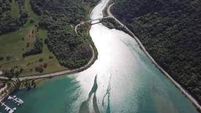
On the border between the Ain and Savoie departments, a marina with all services has been built on the new Rhône, as the river is navigable for more than 70 kilometers between Seyssel, the Bregnier-Cordon dam and Lac du Bourget. → WARNING The Belley dam is a No Fly Zone, so it is not possible to fly over it. Close to BELLEY.
Map and restricted areas
Open in the main mapNearby aerodromes
Open aerodromes within 25 km of the spot, heliports included, with their distance and direction from the spot. Near an aerodrome, drone flying is prohibited or height-limited: check the UAS zones map.
| Aerodrome | Type | Distance | Elevation | Difference |
|---|---|---|---|---|
| Belley - Peyrieu Airfield | Aerodrome | 3.5 km S | 225 m | same altitude as the spot |
| Lavours | Aerodrome | 9.5 km NE | 234 m | spot 7 m lower |
| Base Hydro-ULM Rhône Lavours | Seaplane base | 11 km NE | 239 m | spot 12 m lower |
| Chambéry-Savoie Airport | Airport | 17 km SE | 237 m | spot 10 m lower |
| Hôtel Ariana Heliport | Heliport | 17 km E | 247 m | spot 20 m lower |
Aviation weather (METAR and TAF)
LFLB – Chambéry-Savoie Airport VFR
METAR
METAR LFLB 211100Z AUTO 14003KT 080V200 9999 SCT015 BKN060 12/09 Q1021 NOSIG
- Wind
- 140°, 6 km/h
- Visibility
- 10 km or more
- Clouds
- Scattered (3-4/8) at 1,500 ft (460 m) ; Broken (5-7/8) at 6,000 ft (1830 m)
- Temperature
- 12 °C, dew point 9 °C
- QNH
- 1021 hPa
- Flight category
- VFR: ceiling > 3,000 ft and visibility > 5 mi
TAF
TAF LFLB 210800Z 2109/2209 VRB03KT 9999 SCT050 BECMG 2122/2124 RA BKN050 TEMPO 2203/2209 3000 RA SCT012 BKN020 SCT040TCU BECMG 2205/2207 20010KT
| Period (local time) | Change | Wind | Visibility | Weather | Clouds |
|---|---|---|---|---|---|
| 21/11 10:00 → 21/11 23:00 | Initial conditions | Variable, 6 km/h | 10 km or more | Scattered (3-4/8) at 5,000 ft (1520 m) | |
| 21/11 23:00 → 22/11 06:00 | Becoming | Variable, 6 km/h | 10 km or more | Rain | Broken (5-7/8) at 5,000 ft (1520 m) |
| 22/11 04:00 → 22/11 10:00 | Temporarily | 3.0 km | Rain | Scattered (3-4/8) at 1,200 ft (370 m) ; Broken (5-7/8) at 2,000 ft (610 m) ; Scattered (3-4/8) at 4,000 ft (1220 m) (towering cumulus) | |
| 22/11 06:00 → 22/11 10:00 | Becoming | 200°, 19 km/h | 10 km or more | Rain | Broken (5-7/8) at 5,000 ft (1520 m) |
Weather and Kp index
Sunrise and sunset
| Day | Dawn | Sunrise | Golden hour | Sunset | Dusk | Day length |
|---|---|---|---|---|---|---|
| Sat 21 Nov | 07:12 | 07:45 | 07:45–08:32 · 16:14–17:01 | 17:01 | 17:34 | 9 h 16 |
| Sun 22 Nov | 07:14 | 07:46 | 07:46–08:33 · 16:13–17:00 | 17:00 | 17:33 | 9 h 13 |
| Mon 23 Nov | 07:15 | 07:48 | 07:48–08:35 · 16:13–17:00 | 17:00 | 17:32 | 9 h 11 |
| Tue 24 Nov | 07:16 | 07:49 | 07:49–08:36 · 16:12–16:59 | 16:59 | 17:32 | 9 h 09 |
| Wed 25 Nov | 07:17 | 07:50 | 07:50–08:38 · 16:11–16:58 | 16:58 | 17:31 | 9 h 07 |
| Thu 26 Nov | 07:18 | 07:51 | 07:51–08:39 · 16:10–16:57 | 16:57 | 17:31 | 9 h 05 |
| Fri 27 Nov | 07:20 | 07:53 | 07:53–08:40 · 16:09–16:57 | 16:57 | 17:30 | 9 h 04 |

Reviews
Log in to review this spot. Log in · Create a free account
No reviews yet. Share yours!