

Le Garlaban
No reviews yet
Have you flown here? Share your experience with other pilots.
+ Write the first reviewDescription
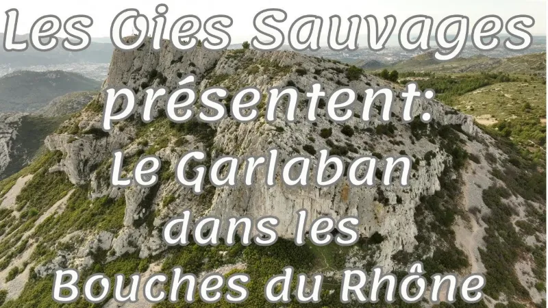
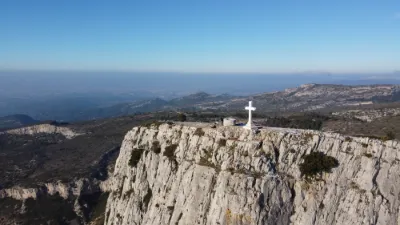
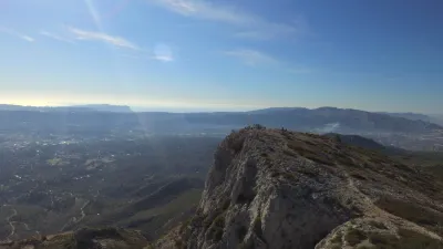
Hills and small valleys carpeted with garrigue Made up of limestone rock, the massif peaks at 731 meters above sea level at the Butte des Pinsots. However, it takes its name from another prominence, the Garlaban, whose distinctive shape and gleaming white cliffs catch the eye. Other summits also draw attention and have evocative names. Tête Ronde owes its name to its rounded shape, while the Grande Tête Rouge refers to the color of its bauxite-rich soil. The Taoumé peak, for its part, is famous for the cave that runs right through it.
The Garlaban massif once had large wooded areas and vast pine forests, which remain in some small valleys and on some slopes with woods of Aleppo pine, Scots pine, holm oak and downy oak. Garrigue now rules its hills, made up of low-growing plants, mostly fragrant: a hike in the Garlaban massif intoxicates you with the scents of juniper, rosemary, thyme and kermes oak.
Map and restricted areas
Open in the main mapNearby aerodromes
Open aerodromes within 25 km of the spot, heliports included, with their distance and direction from the spot. Near an aerodrome, drone flying is prohibited or height-limited: check the UAS zones map.
| Aerodrome | Type | Distance | Elevation | Difference |
|---|---|---|---|---|
| Zi Les Paluds Heliport | Heliport | 6.5 km SE | 116 m | spot 470 m higher |
| Hôpital La Timone Heliport | Heliport | 13 km W | 42 m | spot 544 m higher |
| Nord Heliport | Heliport | 16 km W | 187 m | spot 399 m higher |
| Marseille Hydro | Seaplane base | 17 km W | 0 m | spot 586 m higher |
| Base Hydro-ULM de La Ciotat | Seaplane base | 19 km S | 0 m | spot 586 m higher |
Aviation weather (METAR and TAF)
LFML – Marseille Provence Airport VFR
METAR
METAR LFML 210700Z AUTO 13004KT CAVOK 08/06 Q1020 NOSIG
- Wind
- 130°, 7 km/h
- Visibility
- 10 km or more
- Clouds
- –
- Temperature
- 8 °C, dew point 6 °C
- QNH
- 1020 hPa
- Flight category
- VFR: ceiling > 3,000 ft and visibility > 5 mi
TAF
TAF LFML 210200Z 2103/2209 VRB05KT CAVOK TX18/2115Z TN08/2107Z BECMG 2119/2121 11010KT -RA BKN025 PROB40 TEMPO 2121/2209 16015G25KT 4000 RA BKN012 BKN025
| Period (local time) | Change | Wind | Visibility | Weather | Clouds |
|---|---|---|---|---|---|
| 21/11 04:00 → 21/11 20:00 | Initial conditions | Variable, 9 km/h | 10 km or more | No significant cloud | |
| 21/11 20:00 → 22/11 10:00 | Becoming | 110°, 19 km/h | 10 km or more | Rain light | Broken (5-7/8) at 2,500 ft (760 m) |
| 21/11 22:00 → 22/11 10:00 | Temporarily, probability 40% | 160°, 28 km/h, gusts 46 km/h | 4.0 km | Rain | Broken (5-7/8) at 1,200 ft (370 m) ; Broken (5-7/8) at 2,500 ft (760 m) |
Weather and Kp index
| Day | Weather | Temp. min. / max. | Wind | Rain | Max Kp |
|---|---|---|---|---|---|
| Sat 21 Nov | Fair | 8° / 14° | 17 km/h E | 0.3 mm | 2 |
| Sun 22 Nov | Clear sky | 10° / 14° | 41 km/h W | 7.4 mm | 2 |
| Mon 23 Nov | Fair | 6° / 12° | 38 km/h NW | – | 4 |
| Tue 24 Nov | Cloudy | 4° / 13° | 24 km/h N | 0.6 mm | 2 |
| Wed 25 Nov | Rain | 8° / 10° | 24 km/h E | 29 mm | – |
| Thu 26 Nov | Partly cloudy | 4° / 12° | 9 km/h NE | 0.8 mm | – |
| Fri 27 Nov | Fair | 3° / 11° | 9 km/h NW | – | – |
Hour by hour: Saturday 21 November
| Time | Weather | Temp. | Wind | Rain | Clouds | Kp |
|---|---|---|---|---|---|---|
| 08:00 | Partly cloudy | 8° | 13 km/h N | – | 99 % | 2 |
| 09:00 | Cloudy | 10° | 15 km/h N | – | 100 % | 2 |
| 10:00 | Cloudy | 11° | 16 km/h NW | – | 100 % | 2 |
| 11:00 | Cloudy | 13° | 15 km/h NW | – | 90 % | 2 |
| 12:00 | Partly cloudy | 14° | 14 km/h W | – | 62 % | 2 |
| 13:00 | Fair | 14° | 14 km/h W | – | 28 % | 1 |
| 14:00 | Partly cloudy | 14° | 13 km/h W | – | 44 % | 1 |
| 15:00 | Partly cloudy | 14° | 12 km/h W | – | 46 % | 1 |
| 16:00 | Partly cloudy | 13° | 9 km/h W | – | 71 % | 2 |
| 17:00 | Partly cloudy | 11° | 7 km/h SW | – | 84 % | 2 |
| 18:00 | Partly cloudy | 10° | 6 km/h SE | – | 71 % | 2 |
| 19:00 | Partly cloudy | 10° | 7 km/h E | – | 100 % | 2 |
| 20:00 | Partly cloudy | 10° | 10 km/h E | – | 77 % | 2 |
| 21:00 | Cloudy | 10° | 12 km/h E | – | 99 % | 2 |
| 22:00 | Cloudy | 10° | 17 km/h E | – | 100 % | 2 |
Hour by hour: Sunday 22 November
| Time | Weather | Temp. | Wind | Rain | Clouds | Kp |
|---|---|---|---|---|---|---|
| 06:00 | Rain | 14° | 24 km/h S | 1.0 mm | 100 % | 2 |
| 07:00 | Heavy rain | 13° | 19 km/h S | 1.4 mm | 100 % | 2 |
| 08:00 | Heavy rain | 13° | 17 km/h SW | 1.4 mm | 100 % | 2 |
| 09:00 | Rain | 13° | 28 km/h W | 0.4 mm | 100 % | 2 |
| 10:00 | Partly cloudy | 13° | 39 km/h W | – | 77 % | 2 |
| 11:00 | Cloudy | 13° | 36 km/h W | – | 98 % | 2 |
| 12:00 | Cloudy | 13° | 36 km/h NW | – | 95 % | 2 |
| 13:00 | Clear sky | 13° | 34 km/h W | – | 8 % | 2 |
| 14:00 | Fair | 14° | 39 km/h NW | – | 15 % | 2 |
| 15:00 | Clear sky | 13° | 37 km/h W | – | 12 % | 2 |
| 16:00 | Fair | 13° | 36 km/h W | – | 13 % | 2 |
| 17:00 | Clear sky | 12° | 35 km/h W | – | 8 % | 2 |
| 18:00 | Fair | 11° | 36 km/h W | – | 14 % | 2 |
| 19:00 | Clear sky | 10° | 37 km/h W | – | 11 % | 2 |
| 20:00 | Clear sky | 10° | 39 km/h W | – | 12 % | 2 |
| 21:00 | Fair | 10° | 41 km/h W | – | 25 % | 2 |
| 22:00 | Fair | 10° | 40 km/h NW | – | 16 % | 2 |
Sunrise and sunset
| Day | Dawn | Sunrise | Golden hour | Sunset | Dusk | Day length |
|---|---|---|---|---|---|---|
| Sat 21 Nov | 07:07 | 07:39 | 07:39–08:23 · 16:25–17:09 | 17:09 | 17:40 | 9 h 30 |
| Sun 22 Nov | 07:09 | 07:40 | 07:40–08:24 · 16:24–17:08 | 17:08 | 17:39 | 9 h 28 |
| Mon 23 Nov | 07:10 | 07:41 | 07:41–08:25 · 16:23–17:07 | 17:07 | 17:39 | 9 h 26 |
| Tue 24 Nov | 07:11 | 07:42 | 07:42–08:27 · 16:22–17:07 | 17:07 | 17:38 | 9 h 24 |
| Wed 25 Nov | 07:12 | 07:43 | 07:43–08:28 · 16:22–17:06 | 17:06 | 17:38 | 9 h 22 |
| Thu 26 Nov | 07:13 | 07:45 | 07:45–08:29 · 16:21–17:06 | 17:06 | 17:37 | 9 h 20 |
| Fri 27 Nov | 07:14 | 07:46 | 07:46–08:31 · 16:20–17:05 | 17:05 | 17:37 | 9 h 19 |


Reviews
Log in to review this spot. Log in · Create a free account
No reviews yet. Share yours!