

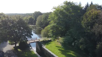
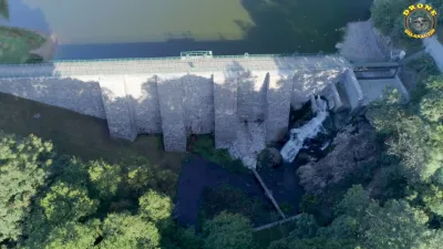
Neulliac locks on the Nantes-Brest canal

No reviews yet
Have you flown here? Share your experience with other pilots.
+ Write the first reviewDescription
The Nantes-Brest canal was created by linking eight rivers. So that boats could go down the hill, 29 locks were built from Pontivy to Hilvern, 12 of them concentrated at the étangs du Roz. The basins known as "étangs" (ponds) are actually water reserves, buffer zones that keep the water level stable during lock operations. England was threatening France with a naval blockade. To deal with it, Napoleon had to organize traffic along inland waterways. In Brittany, Pontivy is a strategic crossroads: the Blavet opens onto Lorient and could be included in the route of the Nantes-Brest canal. The arsenals of Brest, Nantes and Lorient were to be linked. Canalizing the waterways took 26 years of work on the Blavet, from 1806 to 1832.
Map and restricted areas
Open in the main mapNearby aerodromes
Open aerodromes within 25 km of the spot, heliports included, with their distance and direction from the spot. Near an aerodrome, drone flying is prohibited or height-limited: check the UAS zones map.
| Aerodrome | Type | Distance | Elevation | Difference |
|---|---|---|---|---|
| Pontivy Airport | Aerodrome | 14 km SE | 124 m | spot 47 m lower |
Aviation weather (METAR and TAF)
LFRT – Saint-Brieuc-Armor Airport LIFR
METAR
METAR LFRT 211100Z AUTO 15004KT 080V190 9999 OVC002 09/09 Q1014
- Wind
- 150°, 7 km/h
- Visibility
- 10 km or more
- Clouds
- Overcast (8/8) at 200 ft (60 m)
- Temperature
- 9 °C, dew point 9 °C
- QNH
- 1014 hPa
- Flight category
- LIFR: ceiling < 500 ft or visibility < 1 mi
TAF
Weather and Kp index
Sunrise and sunset
| Day | Dawn | Sunrise | Golden hour | Sunset | Dusk | Day length |
|---|---|---|---|---|---|---|
| Sat 21 Nov | 07:53 | 08:28 | 08:28–09:18 · 16:38–17:28 | 17:28 | 18:02 | 9 h 00 |
| Sun 22 Nov | 07:55 | 08:29 | 08:29–09:19 · 16:37–17:27 | 17:27 | 18:02 | 8 h 57 |
| Mon 23 Nov | 07:56 | 08:31 | 08:31–09:21 · 16:36–17:26 | 17:26 | 18:01 | 8 h 55 |
| Tue 24 Nov | 07:57 | 08:32 | 08:32–09:23 · 16:35–17:25 | 17:25 | 18:00 | 8 h 53 |
| Wed 25 Nov | 07:58 | 08:33 | 08:33–09:24 · 16:34–17:25 | 17:25 | 17:59 | 8 h 51 |
| Thu 26 Nov | 08:00 | 08:35 | 08:35–09:26 · 16:33–17:24 | 17:24 | 17:59 | 8 h 48 |
| Fri 27 Nov | 08:01 | 08:36 | 08:36–09:27 · 16:32–17:23 | 17:23 | 17:58 | 8 h 46 |
Reviews
Log in to review this spot. Log in · Create a free account
No reviews yet. Share yours!