

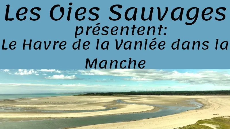
Le havre de la Vanlée
No reviews yet
Have you flown here? Share your experience with other pilots.
+ Write the first reviewDescription
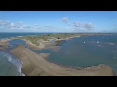
The site is located in the south-west of the Manche department, between Agon-Coutainville and Granville. It lies within the territory of the communes of Bricqueville-sur-Mer, Lingreville and Bréhal.
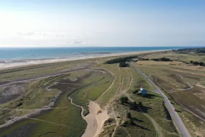
It serves as the estuary of the Vanlée and receives the streams of Les Hardes to the north-east, Pont de Bois to the east and Belle Croix to the south.
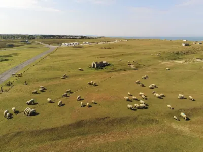
It is crossed by departmental road 375, which is submerged at high spring tides, and by departmental road 592, which crosses the Vanlée on a bridge with tide gates, marking the boundary between the wet meadows and the salt marshes. In the 1950s-1960s, thanks to the tenacity of Bernard Adam, a sheep farmer, it escaped a polder project that would have favored market gardening: the residents around the haven enjoy the inalienable right of common grazing granted by the abbot of Mont-Saint-Michel in 1238 [2].
The Havre de la Vanlée was acquired by the Conservatoire du littoral in 1992 and 1993, through 38 deeds of purchase. It covers 10 hectares. It consists of salt pans and salt meadows (herbus). During spring tides, the sea covers the access road.
It is managed by the commune of Lingreville, the Syndicat mixte des espaces littoraux de la Manche and the Syndicat mixte pour l'équipement touristique de la Manche.
The area is covered by two type 1 natural areas of ecological, faunal and floral interest (ZNIEFF), the Lingreville dunes and the Vanlée estuary, and one type 2 ZNIEFF, the Havre de la Vanlée.
Map and restricted areas
Open in the main mapNearby aerodromes
Open aerodromes within 25 km of the spot, heliports included, with their distance and direction from the spot. Near an aerodrome, drone flying is prohibited or height-limited: check the UAS zones map.
| Aerodrome | Type | Distance | Elevation | Difference |
|---|---|---|---|---|
| Granville Airport | Airport | 4.5 km S | 14 m | spot 7 m lower |
| Donville-Les-Bains Heliport | Heliport | 6.5 km S | 10 m | same altitude as the spot |
| Centre Hospitalier J. Monod Heliport | Heliport | 8.4 km S | 51 m | spot 44 m lower |
| Centre Hospitalier Heliport | Heliport | 15 km NE | 39 m | spot 32 m lower |
| Chausey Heliport | Heliport | 20 km W | 21 m | spot 14 m lower |
Aviation weather (METAR and TAF)
No METAR station within 50 km.
Weather and Kp index
Sunrise and sunset
| Day | Dawn | Sunrise | Golden hour | Sunset | Dusk | Day length |
|---|---|---|---|---|---|---|
| Sat 21 Nov | 07:49 | 08:25 | 08:25–09:16 · 16:29–17:20 | 17:20 | 17:55 | 8 h 54 |
| Sun 22 Nov | 07:51 | 08:26 | 08:26–09:17 · 16:27–17:19 | 17:19 | 17:54 | 8 h 52 |
| Mon 23 Nov | 07:52 | 08:28 | 08:28–09:19 · 16:26–17:18 | 17:18 | 17:53 | 8 h 50 |
| Tue 24 Nov | 07:53 | 08:29 | 08:29–09:21 · 16:25–17:17 | 17:17 | 17:52 | 8 h 47 |
| Wed 25 Nov | 07:55 | 08:30 | 08:30–09:22 · 16:24–17:16 | 17:16 | 17:52 | 8 h 45 |
| Thu 26 Nov | 07:56 | 08:32 | 08:32–09:24 · 16:23–17:15 | 17:15 | 17:51 | 8 h 43 |
| Fri 27 Nov | 07:57 | 08:33 | 08:33–09:26 · 16:22–17:14 | 17:14 | 17:50 | 8 h 41 |

Reviews
Log in to review this spot. Log in · Create a free account
No reviews yet. Share yours!