

HUSELBERG in Husseren Wesserling
No reviews yet
Have you flown here? Share your experience with other pilots.
+ Write the first reviewDescription
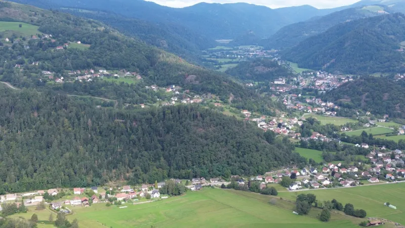
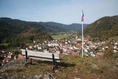
The Huselberg is well known in Husseren-Wesserling! It is an isolated mountain peaking at 706 meters above sea level, in the heart of the Saint-Amarin valley. The Huselberg is one of the highest points in the region and offers a beautiful view of the village of Husseren and the Wesserling Park, partly built on a glacial moraine. It is also a popular hiking spot, with routes such as the "Grand Tour du Huselberg" that let you discover the green landscapes and local history, ideal for a family walk or a contemplative break with a view over the valley.
Map and restricted areas
Open in the main mapNearby aerodromes
Open aerodromes within 25 km of the spot, heliports included, with their distance and direction from the spot. Near an aerodrome, drone flying is prohibited or height-limited: check the UAS zones map.
| Aerodrome | Type | Distance | Elevation | Difference |
|---|---|---|---|---|
| La Tête Des Champs Altiport | Aerodrome | 12 km W | 970 m | spot 353 m lower |
| Ramonchamp ULM | Aerodrome | 17 km W | 577 m | spot 40 m higher |
| Belfort Chaux Airfield | Aerodrome | 23 km SW | 417 m | spot 200 m higher |
Aviation weather (METAR and TAF)
LFGA – Colmar-Houssen Airport VFR
METAR
METAR LFGA 211100Z AUTO VRB02KT 9999 FEW013 BKN037 OVC043 08/06 Q1020
- Wind
- Variable, 4 km/h
- Visibility
- 10 km or more
- Clouds
- Few (1-2/8) at 1,300 ft (400 m) ; Broken (5-7/8) at 3,700 ft (1130 m) ; Overcast (8/8) at 4,300 ft (1310 m)
- Temperature
- 8 °C, dew point 6 °C
- QNH
- 1020 hPa
- Flight category
- VFR: ceiling > 3,000 ft and visibility > 5 mi
TAF
Weather and Kp index
Sunrise and sunset
| Day | Dawn | Sunrise | Golden hour | Sunset | Dusk | Day length |
|---|---|---|---|---|---|---|
| Sat 21 Nov | 07:13 | 07:47 | 07:47–08:36 · 16:00–16:49 | 16:49 | 17:23 | 9 h 02 |
| Sun 22 Nov | 07:14 | 07:48 | 07:48–08:38 · 15:58–16:48 | 16:48 | 17:23 | 8 h 59 |
| Mon 23 Nov | 07:15 | 07:50 | 07:50–08:40 · 15:57–16:47 | 16:47 | 17:22 | 8 h 57 |
| Tue 24 Nov | 07:16 | 07:51 | 07:51–08:41 · 15:56–16:46 | 16:46 | 17:21 | 8 h 55 |
| Wed 25 Nov | 07:18 | 07:52 | 07:52–08:43 · 15:55–16:46 | 16:46 | 17:20 | 8 h 53 |
| Thu 26 Nov | 07:19 | 07:54 | 07:54–08:44 · 15:54–16:45 | 16:45 | 17:20 | 8 h 51 |
| Fri 27 Nov | 07:20 | 07:55 | 07:55–08:46 · 15:53–16:44 | 16:44 | 17:19 | 8 h 49 |



Reviews
Log in to review this spot. Log in · Create a free account
No reviews yet. Share yours!