

Méolans-Revel
No reviews yet
Have you flown here? Share your experience with other pilots.
+ Write the first reviewDescription
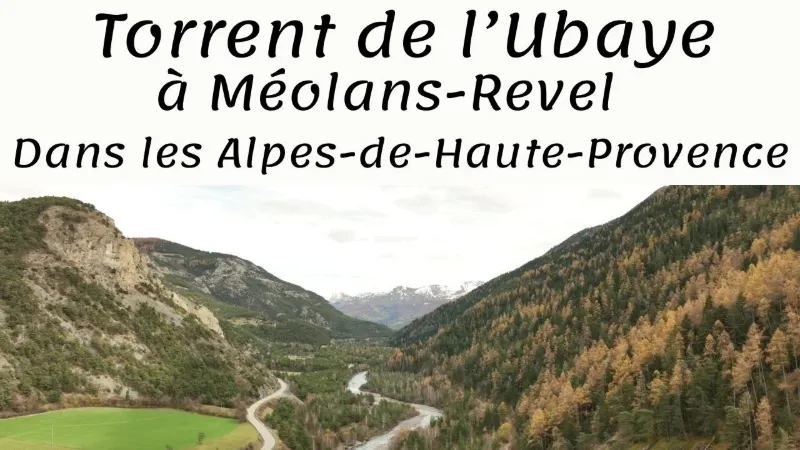
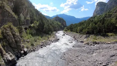
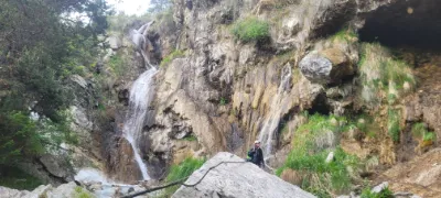
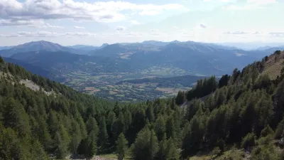
Méolans-Revel charms with its beauty and its privileged location, surrounded by the sunny alpine landscapes of the Ubaye Serre-Ponçon Valley. It is a perfect place to recharge, far from the hustle and bustle of big cities. The Ubaye, in Occitan, is a French torrential river that flows through the Alpes-de-Haute-Provence department, in the Provence-Alpes-Côte d'Azur region. It is a left-bank tributary of the Durance, and therefore a sub-tributary of the Rhône. Very popular for whitewater sports, the river hosted the French kayak championship in 2016. The Ubaye rises in the Alpes-de-Haute-Provence department, on the Italian border, southeast of the Col de Longet at an altitude of 3,076 m below the Col du Loup; it starts as a small stream feeding a small lake upstream of the Vallon du Loup, then feeds the Lac de Longet, located below the pass of the same name. Immediately downstream of this lake, it disappears into a swallow hole at an altitude of 2635 m and reappears at a resurgence fifty meters lower[5]. After a course of 82.7 km[1] it joins the Durance, a confluence that is now submerged in the Serre-Ponçon lake. It gives its name to the Ubaye Valley. Its main tributary is the Ubayette, which rises at the Lac du Lauzanier.
Map and restricted areas
Open in the main mapNearby aerodromes
Open aerodromes within 25 km of the spot, heliports included, with their distance and direction from the spot. Near an aerodrome, drone flying is prohibited or height-limited: check the UAS zones map.
| Aerodrome | Type | Distance | Elevation | Difference |
|---|---|---|---|---|
| Barcelonnette - Saint-Pons Airfield | Aerodrome | 7.9 km E | 1,132 m | spot 17 m higher |
| Seyne les Alpes Glider Field | Aerodrome | 13 km SW | 1,200 m | spot 51 m lower |
| Vars Helistrip | Heliport | 22 km NE | 2,163 m | spot 1,014 m lower |
Aviation weather (METAR and TAF)
No METAR station within 50 km.
Weather and Kp index
| Day | Weather | Temp. min. / max. | Wind | Rain | Max Kp |
|---|---|---|---|---|---|
| Sat 21 Nov | Clear sky | -1° / 9° | 7 km/h N | – | 2 |
| Sun 22 Nov | Heavy rain | 1° / 6° | 20 km/h NW | 30 mm | 2 |
| Mon 23 Nov | Partly cloudy | -10° / 2° | 21 km/h NW | – | 4 |
| Tue 24 Nov | Cloudy | -11° / 7° | 9 km/h E | 3.1 mm | 2 |
| Wed 25 Nov | Snow | -1° / 1° | 10 km/h E | 24 mm | – |
| Thu 26 Nov | Cloudy | -6° / 3° | 4 km/h SE | 0.1 mm | – |
| Fri 27 Nov | Fair | -14° / 4° | 5 km/h SE | – | – |
Hour by hour: Saturday 21 November
| Time | Weather | Temp. | Wind | Rain | Clouds | Kp |
|---|---|---|---|---|---|---|
| 12:00 | Fair | 8° | 7 km/h N | – | 30 % | 2 |
| 13:00 | Clear sky | 9° | 7 km/h NW | – | 10 % | 1 |
| 14:00 | Clear sky | 9° | 7 km/h W | – | 8 % | 1 |
| 15:00 | Fair | 9° | 6 km/h W | – | 23 % | 1 |
| 16:00 | Partly cloudy | 7° | 4 km/h NW | – | 59 % | 2 |
| 17:00 | Partly cloudy | 5° | 1 km/h N | – | 72 % | 2 |
| 18:00 | Partly cloudy | 3° | 3 km/h E | – | 82 % | 2 |
| 19:00 | Partly cloudy | 2° | 4 km/h SE | – | 88 % | 2 |
| 20:00 | Partly cloudy | 0° | 4 km/h E | – | 69 % | 2 |
| 21:00 | Partly cloudy | -1° | 4 km/h SE | – | 76 % | 2 |
| 22:00 | Cloudy | -1° | 6 km/h SE | – | 100 % | 2 |
Hour by hour: Sunday 22 November
| Time | Weather | Temp. | Wind | Rain | Clouds | Kp |
|---|---|---|---|---|---|---|
| 06:00 | Heavy rain | 4° | 12 km/h SE | 1.0 mm | 100 % | 2 |
| 07:00 | Heavy rain | 5° | 15 km/h SE | 2.1 mm | 100 % | 2 |
| 08:00 | Heavy rain | 5° | 12 km/h SE | 3.3 mm | 100 % | 2 |
| 09:00 | Heavy rain | 5° | 8 km/h SE | 3.9 mm | 100 % | 2 |
| 10:00 | Heavy rain | 5° | 8 km/h SW | 4.2 mm | 100 % | 2 |
| 11:00 | Heavy rain | 6° | 12 km/h SW | 2.1 mm | 100 % | 2 |
| 12:00 | Heavy rain | 5° | 15 km/h W | 1.2 mm | 100 % | 2 |
| 13:00 | Heavy rain | 5° | 13 km/h W | 1.1 mm | 100 % | 2 |
| 14:00 | Rain | 4° | 19 km/h W | 0.6 mm | 99 % | 2 |
| 15:00 | Rain | 4° | 20 km/h NW | 0.9 mm | 98 % | 2 |
| 16:00 | Rain | 3° | 17 km/h W | 0.5 mm | 100 % | 2 |
| 17:00 | Light rain | 2° | 17 km/h W | 0.4 mm | 90 % | 2 |
| 18:00 | Sleet | 2° | 16 km/h W | 0.2 mm | 100 % | 2 |
| 19:00 | Sleet | 2° | 19 km/h W | 0.2 mm | 95 % | 2 |
| 20:00 | Sleet | 1° | 17 km/h W | 0.2 mm | 99 % | 2 |
| 21:00 | Sleet | 1° | 19 km/h W | 0.3 mm | 100 % | 2 |
| 22:00 | Sleet | 1° | 18 km/h NW | 1.0 mm | 100 % | 2 |
Sunrise and sunset
| Day | Dawn | Sunrise | Golden hour | Sunset | Dusk | Day length |
|---|---|---|---|---|---|---|
| Sat 21 Nov | 07:06 | 07:38 | 07:38–08:23 · 16:17–17:02 | 17:02 | 17:34 | 9 h 24 |
| Sun 22 Nov | 07:07 | 07:39 | 07:39–08:24 · 16:16–17:01 | 17:01 | 17:33 | 9 h 22 |
| Mon 23 Nov | 07:08 | 07:40 | 07:40–08:26 · 16:15–17:00 | 17:00 | 17:32 | 9 h 20 |
| Tue 24 Nov | 07:10 | 07:42 | 07:42–08:27 · 16:14–17:00 | 17:00 | 17:32 | 9 h 18 |
| Wed 25 Nov | 07:11 | 07:43 | 07:43–08:29 · 16:13–16:59 | 16:59 | 17:31 | 9 h 16 |
| Thu 26 Nov | 07:12 | 07:44 | 07:44–08:30 · 16:13–16:58 | 16:58 | 17:31 | 9 h 14 |
| Fri 27 Nov | 07:13 | 07:45 | 07:45–08:31 · 16:12–16:58 | 16:58 | 17:30 | 9 h 12 |

Reviews
Log in to review this spot. Log in · Create a free account
No reviews yet. Share yours!