

Heritage
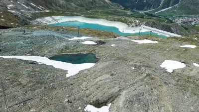
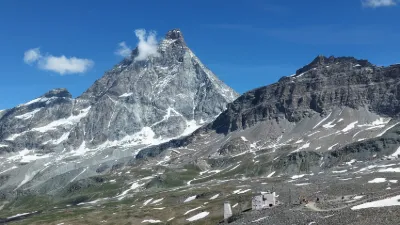
Laghi delle Cime Bianche – Valtournenche
No reviews yet
Have you flown here? Share your experience with other pilots.
+ Write the first reviewDescription
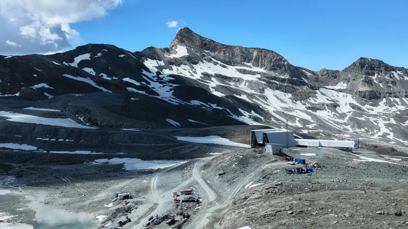
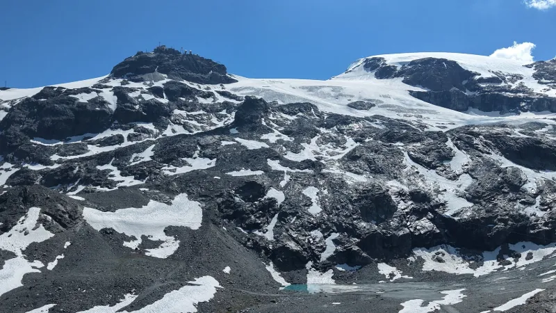
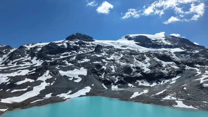
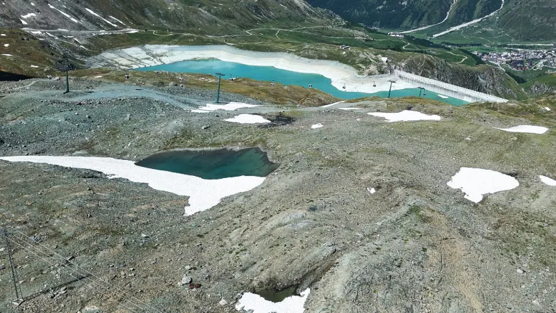
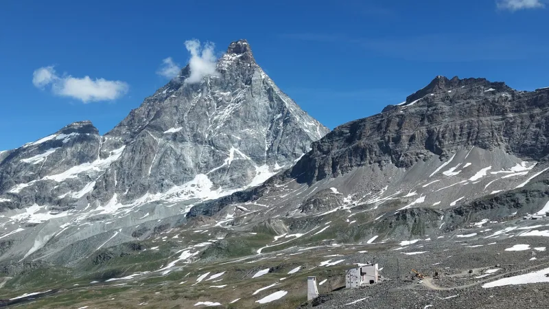
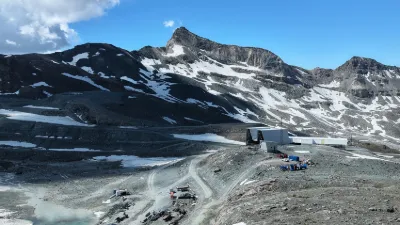
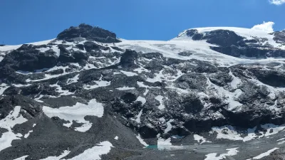
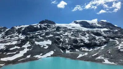
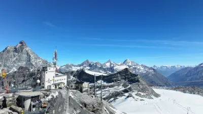
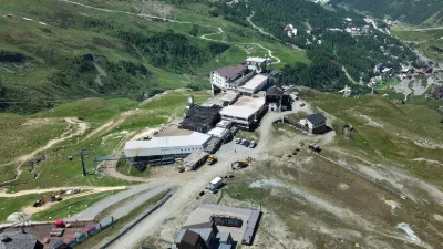
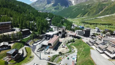
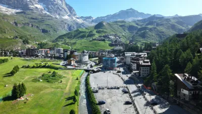
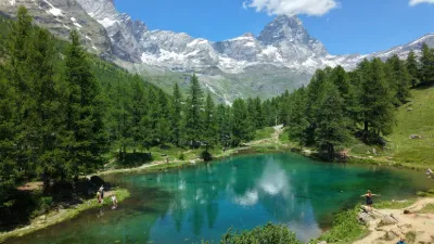
An intermediate lift station between Breuil-Cervinia and the Testa Grigia, the Laghi delle Cime Bianche site (2,831 m) is also the starting point of superb hikes to discover pretty emerald-colored lakes. The majestic peak of the Matterhorn dominates the whole area. Near VALTOURNENCHE
Map and restricted areas
Open in the main mapAviation weather (METAR and TAF)
LSGS – Sion Airport VFR
METAR
METAR LSGS 221850Z AUTO VRB01KT 9999 -RA BKN/// 05/04 Q1010
- Wind
- Variable, 2 km/h
- Visibility
- 10 km or more
- Weather
- Rain light
- Clouds
- –
- Temperature
- 5 °C, dew point 4 °C
- QNH
- 1010 hPa
- Flight category
- VFR: ceiling > 3,000 ft and visibility > 5 mi
TAF
TAF LSGS 221425Z 2215/2224 VRB02KT 9000 -RA FEW010 OVC025 TEMPO 2215/2224 4000 RA BR BKN012
| Period (local time) | Change | Wind | Visibility | Weather | Clouds |
|---|---|---|---|---|---|
| 22/11 16:00 → 23/11 01:00 | Initial conditions | Variable, 4 km/h | 9 km | Rain light | Few (1-2/8) at 1,000 ft (300 m) ; Overcast (8/8) at 2,500 ft (760 m) |
| 22/11 16:00 → 23/11 01:00 | Temporarily | 4.0 km | Rain ; mist | Broken (5-7/8) at 1,200 ft (370 m) |
Weather and Kp index
| Day | Weather | Temp. min. / max. | Wind | Rain | Max Kp |
|---|---|---|---|---|---|
| Sun 22 Nov | Snow | -6° / -5° | 14 km/h NW | 4.4 mm | 1 |
| Mon 23 Nov | Cloudy | -13° / -6° | 14 km/h NW | 4.2 mm | 4 |
| Tue 24 Nov | Cloudy | -16° / -7° | 7 km/h N | 3.5 mm | 2 |
| Wed 25 Nov | Snow | -10° / -8° | 9 km/h NE | 13 mm | 2 |
| Thu 26 Nov | Cloudy | -13° / -9° | 6 km/h N | 1.0 mm | – |
| Fri 27 Nov | Cloudy | -19° / -11° | 6 km/h N | 1.1 mm | – |
| Sat 28 Nov | Clear sky | -21° / -9° | 6 km/h N | – | – |
Hour by hour: Sunday 22 November
| Time | Weather | Temp. | Wind | Rain | Clouds | Kp |
|---|---|---|---|---|---|---|
| 20:00 | Snow | -5° | 14 km/h NW | 1.1 mm | 99 % | 1 |
| 21:00 | Snow | -6° | 14 km/h NW | 1.2 mm | 100 % | 1 |
| 22:00 | Snow | -6° | 13 km/h NW | 1.2 mm | 100 % | 1 |
Hour by hour: Monday 23 November
| Time | Weather | Temp. | Wind | Rain | Clouds | Kp |
|---|---|---|---|---|---|---|
| 06:00 | Snow | -8° | 10 km/h NW | 0.4 mm | 100 % | 2 |
| 07:00 | Snow | -8° | 11 km/h NW | 0.1 mm | 99 % | 2 |
| 08:00 | Snow | -9° | 10 km/h NW | 0.1 mm | 98 % | 2 |
| 09:00 | Cloudy | -8° | 9 km/h NW | – | 98 % | 2 |
| 10:00 | Cloudy | -8° | 8 km/h NW | – | 91 % | 2 |
| 11:00 | Cloudy | -7° | 7 km/h NW | – | 90 % | 2 |
| 12:00 | Cloudy | -7° | 7 km/h W | – | 90 % | 2 |
| 13:00 | Cloudy | -6° | 8 km/h W | – | 92 % | 4 |
| 14:00 | Cloudy | -6° | 7 km/h W | – | 90 % | 4 |
| 15:00 | Cloudy | -7° | 7 km/h NW | – | 88 % | 4 |
| 16:00 | Cloudy | -7° | 8 km/h NW | – | 90 % | 4 |
| 17:00 | Cloudy | -8° | 7 km/h N | – | 91 % | 4 |
| 18:00 | Partly cloudy | -8° | 7 km/h N | – | 81 % | 4 |
| 19:00 | Fog | -8° | 6 km/h N | – | 66 % | 3 |
| 20:00 | Fog | -9° | 6 km/h NW | – | 66 % | 3 |
| 21:00 | Fog | -9° | 6 km/h N | – | 80 % | 3 |
| 22:00 | Fog | -10° | 7 km/h N | – | 83 % | 2 |
Sunrise and sunset
| Day | Dawn | Sunrise | Golden hour | Sunset | Dusk | Day length |
|---|---|---|---|---|---|---|
| Sun 22 Nov | 07:06 | 07:39 | 07:39–08:26 · 16:05–16:52 | 16:52 | 17:25 | 9 h 12 |
| Mon 23 Nov | 07:07 | 07:40 | 07:40–08:28 · 16:04–16:51 | 16:51 | 17:24 | 9 h 10 |
| Tue 24 Nov | 07:09 | 07:42 | 07:42–08:29 · 16:03–16:50 | 16:50 | 17:23 | 9 h 08 |
| Wed 25 Nov | 07:10 | 07:43 | 07:43–08:31 · 16:02–16:50 | 16:50 | 17:23 | 9 h 06 |
| Thu 26 Nov | 07:11 | 07:44 | 07:44–08:32 · 16:01–16:49 | 16:49 | 17:22 | 9 h 04 |
| Fri 27 Nov | 07:12 | 07:45 | 07:45–08:33 · 16:00–16:48 | 16:48 | 17:22 | 9 h 02 |
| Sat 28 Nov | 07:13 | 07:47 | 07:47–08:35 · 16:00–16:48 | 16:48 | 17:21 | 9 h 00 |
Reviews
Log in to review this spot. Log in · Create a free account
No reviews yet. Share yours!