

The Croix de Chamrousse
No reviews yet
Have you flown here? Share your experience with other pilots.
+ Write the first reviewDescription
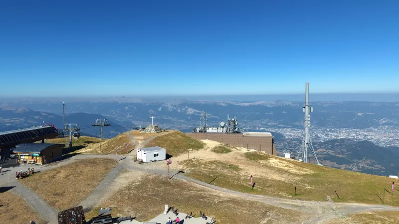
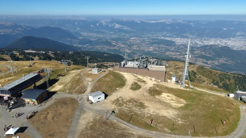
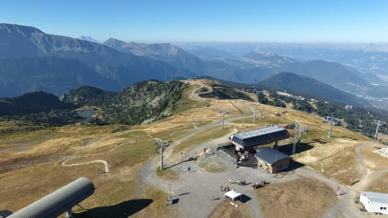
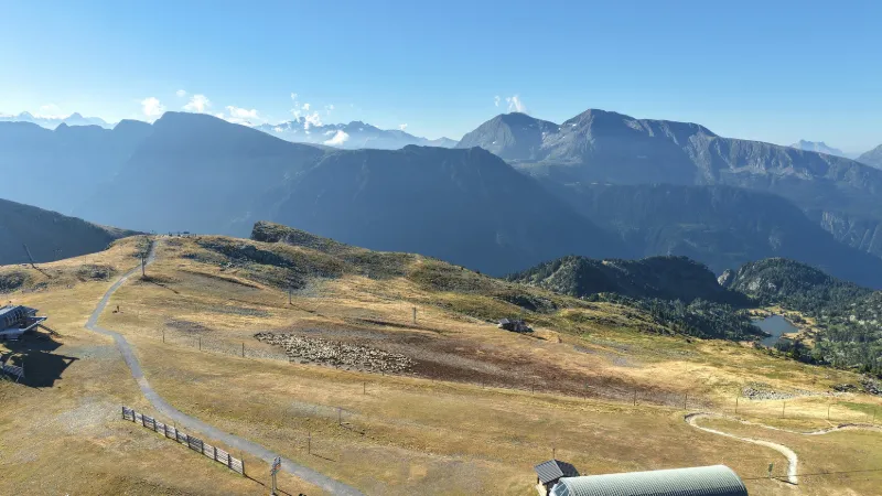
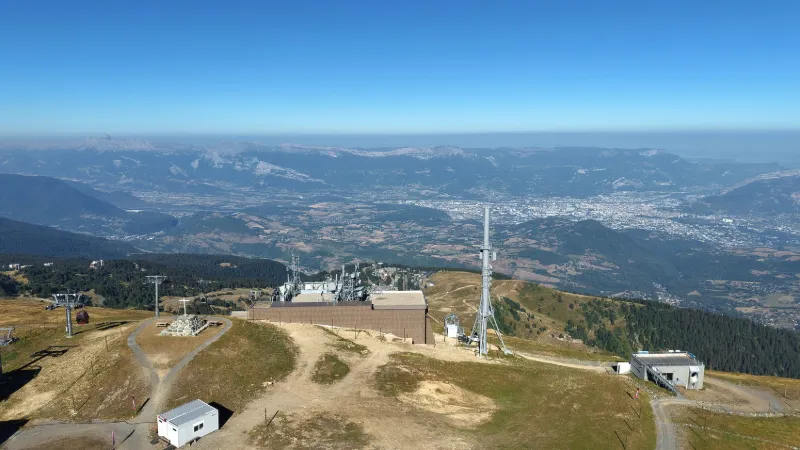
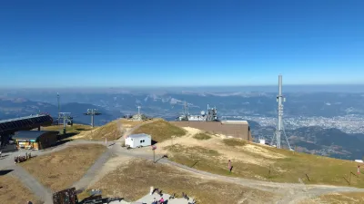
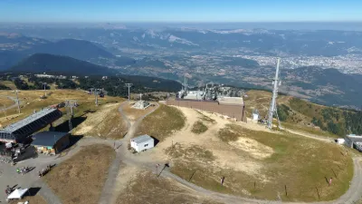
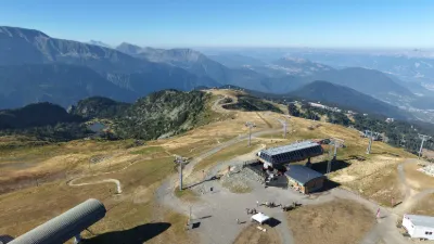
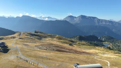
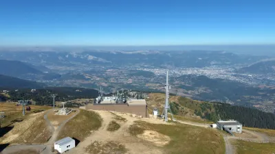
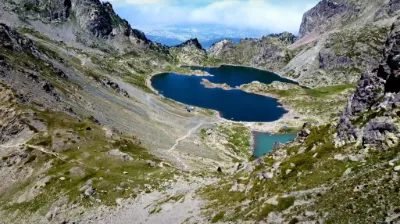
The Croix de Chamrousse, one of the greatest viewpoints in the Alps, can be reached on foot or by the La Croix gondola from the resort at Chamrousse 1650 – Recoin. Located at 2250m altitude, it overlooks the resort and the Grenoble valley. There you will find a weather station, the third highest in Europe, and a monumental cross. The history of this cross is little known, but it is nonetheless one of the emblematic places of Chamrousse. It dates back to the 17th century and was originally made of wood. Roman medals were discovered at its foot. From here the view is superb over the Belledonne range and the Grenoble valley. Close to GRENOBLE
Map and restricted areas
Open in the main mapNearby aerodromes
Open aerodromes within 25 km of the spot, heliports included, with their distance and direction from the spot. Near an aerodrome, drone flying is prohibited or height-limited: check the UAS zones map.
| Aerodrome | Type | Distance | Elevation | Difference |
|---|---|---|---|---|
| Altiport du Col De Belledonne | Aerodrome | 7.5 km NE | 2,800 m | spot 660 m lower |
| Aérodrome de Grenoble Le Versoud | Aerodrome | 11 km NW | 220 m | spot 1,920 m higher |
| Altiport L'Alpe d'Huez - Henri GIRAUD | Aerodrome | 14 km E | 1,860 m | spot 280 m higher |
| Hôpital Nord Heliport | Heliport | 15 km NW | 218 m | spot 1,922 m higher |
| Quartier-Reynies Heliport | Heliport | 18 km W | 220 m | spot 1,920 m higher |
Aviation weather (METAR and TAF)
No METAR station within 50 km.
Weather and Kp index
| Day | Weather | Temp. min. / max. | Wind | Rain | Max Kp |
|---|---|---|---|---|---|
| Sat 21 Nov | Fair | -4° / 4° | 6 km/h SE | – | 2 |
| Sun 22 Nov | Snow | -5° / 0° | 10 km/h SE | 42 mm | 2 |
| Mon 23 Nov | Snow | -6° / -4° | 11 km/h E | 7.3 mm | 4 |
| Tue 24 Nov | Cloudy | -11° / 1° | 6 km/h E | 0.5 mm | 2 |
| Wed 25 Nov | Snow | -6° / -2° | 5 km/h SE | 23 mm | – |
| Thu 26 Nov | Partly cloudy | -7° / -2° | 3 km/h SE | 0.9 mm | – |
| Fri 27 Nov | Fair | -14° / -2° | 5 km/h SE | – | – |
Hour by hour: Saturday 21 November
| Time | Weather | Temp. | Wind | Rain | Clouds | Kp |
|---|---|---|---|---|---|---|
| 11:00 | Fair | 1° | 3 km/h NE | – | 20 % | 2 |
| 12:00 | Fair | 3° | 3 km/h N | – | 16 % | 2 |
| 13:00 | Fair | 4° | 5 km/h N | – | 21 % | 1 |
| 14:00 | Fair | 4° | 5 km/h NW | – | 26 % | 1 |
| 15:00 | Partly cloudy | 4° | 4 km/h NW | – | 42 % | 1 |
| 16:00 | Fair | 2° | 2 km/h NW | – | 35 % | 2 |
| 17:00 | Cloudy | -0° | 2 km/h E | – | 88 % | 2 |
| 18:00 | Cloudy | -2° | 3 km/h SE | – | 90 % | 2 |
| 19:00 | Cloudy | -3° | 4 km/h SE | – | 95 % | 2 |
| 20:00 | Partly cloudy | -4° | 4 km/h SE | – | 84 % | 2 |
| 21:00 | Cloudy | -4° | 5 km/h SE | – | 88 % | 2 |
| 22:00 | Cloudy | -4° | 6 km/h SE | – | 98 % | 2 |
Hour by hour: Sunday 22 November
| Time | Weather | Temp. | Wind | Rain | Clouds | Kp |
|---|---|---|---|---|---|---|
| 06:00 | Snow | -1° | 8 km/h SE | 2.2 mm | 100 % | 2 |
| 07:00 | Snow | -0° | 9 km/h SE | 3.1 mm | 100 % | 2 |
| 08:00 | Snow | 0° | 8 km/h SE | 3.9 mm | 100 % | 2 |
| 09:00 | Snow | -0° | 7 km/h SE | 4.9 mm | 100 % | 2 |
| 10:00 | Snow | -0° | 8 km/h SE | 4.2 mm | 100 % | 2 |
| 11:00 | Snow | 0° | 6 km/h S | 1.7 mm | 100 % | 2 |
| 12:00 | Snow | 0° | 6 km/h SW | 2.0 mm | 100 % | 2 |
| 13:00 | Snow | 0° | 8 km/h W | 1.2 mm | 96 % | 2 |
| 14:00 | Snow | -0° | 9 km/h W | 2.3 mm | 100 % | 2 |
| 15:00 | Snow | -1° | 8 km/h NW | 2.2 mm | 99 % | 2 |
| 16:00 | Snow | -2° | 8 km/h NW | 1.0 mm | 99 % | 2 |
| 17:00 | Snow | -2° | 8 km/h NW | 0.5 mm | 77 % | 2 |
| 18:00 | Snow | -2° | 7 km/h NE | 0.8 mm | 74 % | 2 |
| 19:00 | Snow | -3° | 8 km/h NE | 0.8 mm | 100 % | 2 |
| 20:00 | Snow | -3° | 8 km/h NE | 1.5 mm | 58 % | 2 |
| 21:00 | Snow | -4° | 5 km/h E | 1.7 mm | 90 % | 2 |
| 22:00 | Snow | -4° | 7 km/h N | 1.8 mm | 100 % | 2 |
Sunrise and sunset
| Day | Dawn | Sunrise | Golden hour | Sunset | Dusk | Day length |
|---|---|---|---|---|---|---|
| Sat 21 Nov | 07:10 | 07:42 | 07:42–08:28 · 16:16–17:02 | 17:02 | 17:34 | 9 h 19 |
| Sun 22 Nov | 07:11 | 07:44 | 07:44–08:30 · 16:15–17:01 | 17:01 | 17:34 | 9 h 17 |
| Mon 23 Nov | 07:13 | 07:45 | 07:45–08:31 · 16:14–17:01 | 17:01 | 17:33 | 9 h 15 |
| Tue 24 Nov | 07:14 | 07:46 | 07:46–08:33 · 16:13–17:00 | 17:00 | 17:32 | 9 h 13 |
| Wed 25 Nov | 07:15 | 07:47 | 07:47–08:34 · 16:13–16:59 | 16:59 | 17:32 | 9 h 11 |
| Thu 26 Nov | 07:16 | 07:49 | 07:49–08:35 · 16:12–16:59 | 16:59 | 17:31 | 9 h 09 |
| Fri 27 Nov | 07:17 | 07:50 | 07:50–08:37 · 16:11–16:58 | 16:58 | 17:31 | 9 h 08 |


Reviews
Log in to review this spot. Log in · Create a free account
No reviews yet. Share yours!