

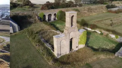
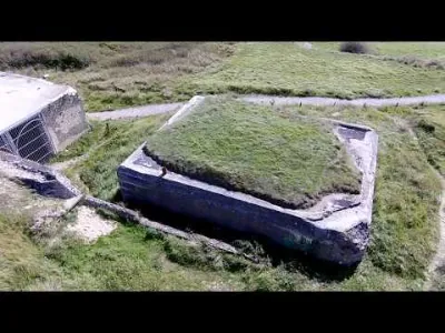
German Railway Artillery Battery - Sangatte: Le fond de la Forge

No reviews yet
Have you flown here? Share your experience with other pilots.
+ Write the first reviewDescription
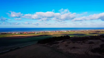
- La Cimenterie, starting point for hikes to the Fond de la Forge, a historic World War II (WW2) site. - A first factory was set up here during the 19th-century trials to dig a tunnel under the English Channel, before going on to produce lime and cement. - The site was used by the German army to install a heavy railway artillery battery. Located above the Channel Tunnel and entirely broken up today, which suggests deliberate destruction by the German army. - La Cimenterie, starting point for hikes to the Fond de la Forge, a historic World War II (WW2) site, now hosts a motocross track
Map and restricted areas
Open in the main mapNearby aerodromes
Open aerodromes within 25 km of the spot, heliports included, with their distance and direction from the spot. Near an aerodrome, drone flying is prohibited or height-limited: check the UAS zones map.
| Aerodrome | Type | Distance | Elevation | Difference |
|---|---|---|---|---|
| Coquelles Eurotunnel Heliport | Heliport | 1.9 km SE | 9 m | spot 36 m higher |
| Saint-Inglevert Aerodrome | Aerodrome | 6.0 km SW | 117 m | spot 72 m lower |
| Calais-Dunkerque Airport | Airport | 13 km E | 4 m | spot 41 m higher |
Aviation weather (METAR and TAF)
LFAC – Calais-Dunkerque Airport VFR
METAR
METAR LFAC 211130Z AUTO 11004KT CAVOK 10/04 Q1019
- Wind
- 110°, 7 km/h
- Visibility
- 10 km or more
- Clouds
- –
- Temperature
- 10 °C, dew point 4 °C
- QNH
- 1019 hPa
- Flight category
- VFR: ceiling > 3,000 ft and visibility > 5 mi
TAF
Weather and Kp index
Sunrise and sunset
| Day | Dawn | Sunrise | Golden hour | Sunset | Dusk | Day length |
|---|---|---|---|---|---|---|
| Sat 21 Nov | 07:42 | 08:19 | 08:19–09:13 · 16:04–16:59 | 16:59 | 17:36 | 8 h 40 |
| Sun 22 Nov | 07:43 | 08:20 | 08:20–09:15 · 16:03–16:58 | 16:58 | 17:35 | 8 h 37 |
| Mon 23 Nov | 07:45 | 08:22 | 08:22–09:17 · 16:02–16:57 | 16:57 | 17:34 | 8 h 34 |
| Tue 24 Nov | 07:46 | 08:23 | 08:23–09:19 · 16:00–16:56 | 16:56 | 17:33 | 8 h 32 |
| Wed 25 Nov | 07:47 | 08:25 | 08:25–09:21 · 15:59–16:55 | 16:55 | 17:32 | 8 h 29 |
| Thu 26 Nov | 07:49 | 08:26 | 08:26–09:22 · 15:58–16:54 | 16:54 | 17:32 | 8 h 27 |
| Fri 27 Nov | 07:50 | 08:28 | 08:28–09:24 · 15:57–16:53 | 16:53 | 17:31 | 8 h 25 |
Reviews
Log in to review this spot. Log in · Create a free account
No reviews yet. Share yours!