

The Pas de Roland

No reviews yet
Have you flown here? Share your experience with other pilots.
+ Write the first reviewDescription
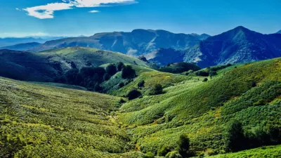
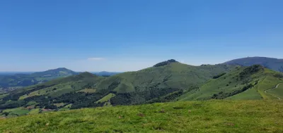
Getting there from Itxassou is very easy. I strongly recommend parking your car in the village, because the winding road leading to the Pas de Roland has no parking spaces. You will find several small car parks in the village center, including one near the stunning Saint-Fructueux church, dating from the 17th century and now listed as a historic monument. Then follow the road for about 1 km, admiring the panorama over the Atharri hill, before reaching the forest and the banks of the Nive.
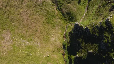
Along a low stone wall, the gorge reveals itself in all its splendor, with its clear, fast-flowing water, surrounded by wooded hills rising to more than 300 m. Here, magic is everywhere… in the turquoise reflections of the river, around the bends of the path overlooked by centuries-old trees and lush nature. After 2 km of walking, I reach the famous Pas de Roland, which marks the last few meters of this enchanting walk: a huge rock with a narrow passage running through a hole cut into the stone. According to legend, Roland, Charlemagne's nephew, passed through this site in August 778, riding toward the pass that would allow him to drive the Saracens (in reality the Basque Vasconne militia) back into Spain with the help of his army. However, a huge impassable rock blocked his way. One legend says this cavity was made by a kick from Roland's horse's hoof. Another tells that, unable to continue, Roland raised his sword (named Durandal) and cut a passage himself to get past this obstacle with his soldiers. Legendary myth, or a natural subsidence widened by people to make way for a mule track? The mystery remains. Sadly, the legend also says that the brave Roland met his death shortly after this episode, on 12 August 778 at the pass known as the "Col de Roncevaux" at the foot of Spain, during a clash with the Saracens.
Map and restricted areas
Open in the main mapNearby aerodromes
Open aerodromes within 25 km of the spot, heliports included, with their distance and direction from the spot. Near an aerodrome, drone flying is prohibited or height-limited: check the UAS zones map.
| Aerodrome | Type | Distance | Elevation | Difference |
|---|---|---|---|---|
| Itxassou Airfield | Aerodrome | 3.1 km NW | 185 m | spot 25 m higher |
| Centre Hospitalier De La Côte Basque Heliport | Heliport | 20 km N | 23 m | spot 187 m higher |
| Biarritz-Anglet-Bayonne Airport | Airport | 20 km NW | 75 m | spot 135 m higher |
Aviation weather (METAR and TAF)
LFBZ – Biarritz-Anglet-Bayonne Airport VFR
METAR
METAR LFBZ 210630Z AUTO 18004KT 130V230 9999 FEW069 OVC110 15/08 Q1017 NOSIG
- Wind
- 180°, 7 km/h
- Visibility
- 10 km or more
- Clouds
- Few (1-2/8) at 6,900 ft (2100 m) ; Overcast (8/8) at 11,000 ft (3350 m)
- Temperature
- 15 °C, dew point 8 °C
- QNH
- 1017 hPa
- Flight category
- VFR: ceiling > 3,000 ft and visibility > 5 mi
TAF
TAF LFBZ 210500Z 2106/2206 VRB03KT 9999 BKN060 BECMG 2108/2110 18010KT TEMPO 2115/2121 18015G25KT 4000 -RA BKN030 TEMPO 2121/2202 18015G30KT 4000 -RA BKN030 TEMPO 2202/2206 28015G40KT 3000 SHRA BKN015TCU
| Period (local time) | Change | Wind | Visibility | Weather | Clouds |
|---|---|---|---|---|---|
| 21/11 07:00 → 21/11 09:00 | Initial conditions | Variable, 6 km/h | 10 km or more | Broken (5-7/8) at 6,000 ft (1830 m) | |
| 21/11 09:00 → 22/11 07:00 | Becoming | 180°, 19 km/h | 10 km or more | Broken (5-7/8) at 6,000 ft (1830 m) | |
| 21/11 16:00 → 21/11 22:00 | Temporarily | 180°, 28 km/h, gusts 46 km/h | 4.0 km | Rain light | Broken (5-7/8) at 3,000 ft (910 m) |
| 21/11 22:00 → 22/11 03:00 | Temporarily | 180°, 28 km/h, gusts 56 km/h | 4.0 km | Rain light | Broken (5-7/8) at 3,000 ft (910 m) |
| 22/11 03:00 → 22/11 07:00 | Temporarily | 280°, 28 km/h, gusts 74 km/h | 3.0 km | Showers of rain | Broken (5-7/8) at 1,500 ft (460 m) (towering cumulus) |
Weather and Kp index
Sunrise and sunset
| Day | Dawn | Sunrise | Golden hour | Sunset | Dusk | Day length |
|---|---|---|---|---|---|---|
| Sat 21 Nov | 07:35 | 08:06 | 08:06–08:50 · 16:53–17:37 | 17:37 | 18:08 | 9 h 30 |
| Sun 22 Nov | 07:36 | 08:08 | 08:08–08:52 · 16:52–17:36 | 17:36 | 18:07 | 9 h 28 |
| Mon 23 Nov | 07:38 | 08:09 | 08:09–08:53 · 16:51–17:35 | 17:35 | 18:06 | 9 h 26 |
| Tue 24 Nov | 07:39 | 08:10 | 08:10–08:54 · 16:50–17:35 | 17:35 | 18:06 | 9 h 24 |
| Wed 25 Nov | 07:40 | 08:11 | 08:11–08:56 · 16:49–17:34 | 17:34 | 18:05 | 9 h 22 |
| Thu 26 Nov | 07:41 | 08:12 | 08:12–08:57 · 16:49–17:33 | 17:33 | 18:05 | 9 h 21 |
| Fri 27 Nov | 07:42 | 08:14 | 08:14–08:58 · 16:48–17:33 | 17:33 | 18:04 | 9 h 19 |
Reviews
Log in to review this spot. Log in · Create a free account
No reviews yet. Share yours!