

Lake Saints-Peyres

No reviews yet
Have you flown here? Share your experience with other pilots.
+ Write the first reviewDescription
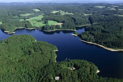
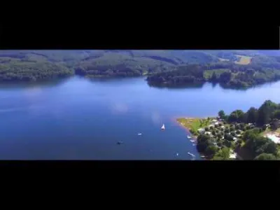
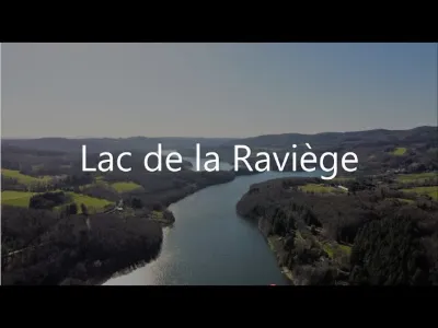
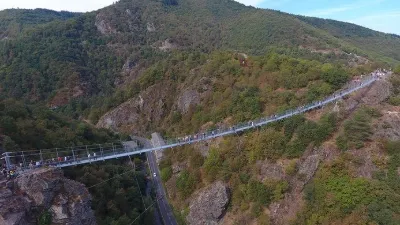
Lake Saints-Peyres, located in the Tarn in Occitanie, spans the communes of Le Vintrou, Lasfaillades, Anglès and Saint-Amans-Valtoret. This artificial lake is often compared to a Canadian lake 🇨🇦, and attracts anglers, nature lovers, and people who enjoy water and wide open spaces.
Map and restricted areas
Open in the main mapNearby aerodromes
Open aerodromes within 25 km of the spot, heliports included, with their distance and direction from the spot. Near an aerodrome, drone flying is prohibited or height-limited: check the UAS zones map.
| Aerodrome | Type | Distance | Elevation | Difference |
|---|---|---|---|---|
| Castres-Mazamet Airport | Airport | 18 km W | 240 m | spot 436 m higher |
| Centre Hospitalier Heliport | Heliport | 23 km W | 196 m | spot 480 m higher |
Aviation weather (METAR and TAF)
LFCK – Castres-Mazamet Airport VFR
METAR
METAR LFCK 171330Z AUTO 08006KT 020V110 9999 FEW038 SCT100 BKN120 15/13 Q1005 TEMPO VRB15G25KT 4000 SHRA BKN018 BKN040TCU FEW070CB
- Wind
- 080°, 11 km/h
- Visibility
- 10 km or more
- Clouds
- Few (1-2/8) at 3,800 ft (1160 m) ; Scattered (3-4/8) at 10,000 ft (3050 m) ; Broken (5-7/8) at 12,000 ft (3660 m)
- Temperature
- 15 °C, dew point 13 °C
- QNH
- 1005 hPa
- Flight category
- VFR: ceiling > 3,000 ft and visibility > 5 mi
TAF
TAF LFCK 171100Z 1712/1721 12004KT CAVOK TEMPO 1712/1721 VRB15G25KT 4000 SHRA BKN018 BKN040TCU FEW070CB
| Period (local time) | Change | Wind | Visibility | Weather | Clouds |
|---|---|---|---|---|---|
| 17/11 13:00 → 17/11 22:00 | Initial conditions | 120°, 7 km/h | 10 km or more | No significant weather | No significant cloud |
| 17/11 13:00 → 17/11 22:00 | Temporarily | Variable, 28 km/h, gusts 46 km/h | 4.0 km | Showers of rain | Broken (5-7/8) at 1,800 ft (550 m) ; Broken (5-7/8) at 4,000 ft (1220 m) (towering cumulus) ; Few (1-2/8) at 7,000 ft (2130 m) (cumulonimbus) |
Weather and Kp index
Sunrise and sunset
| Day | Dawn | Sunrise | Golden hour | Sunset | Dusk | Day length |
|---|---|---|---|---|---|---|
| Tue 17 Nov | 07:15 | 07:46 | 07:46–08:30 · 16:40–17:24 | 17:24 | 17:54 | 9 h 37 |
| Wed 18 Nov | 07:17 | 07:48 | 07:48–08:31 · 16:39–17:23 | 17:23 | 17:54 | 9 h 35 |
| Thu 19 Nov | 07:18 | 07:49 | 07:49–08:33 · 16:38–17:22 | 17:22 | 17:53 | 9 h 33 |
| Fri 20 Nov | 07:19 | 07:50 | 07:50–08:34 · 16:37–17:21 | 17:21 | 17:52 | 9 h 30 |
| Sat 21 Nov | 07:20 | 07:51 | 07:51–08:35 · 16:36–17:20 | 17:20 | 17:52 | 9 h 28 |
| Sun 22 Nov | 07:21 | 07:53 | 07:53–08:37 · 16:35–17:20 | 17:20 | 17:51 | 9 h 27 |
| Mon 23 Nov | 07:22 | 07:54 | 07:54–08:38 · 16:34–17:19 | 17:19 | 17:50 | 9 h 25 |

Reviews
Log in to review this spot. Log in · Create a free account
No reviews yet. Share yours!