

River island of Lahonce

No reviews yet
Have you flown here? Share your experience with other pilots.
+ Write the first reviewDescription
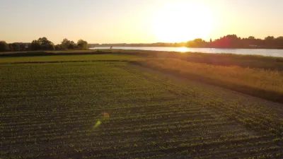
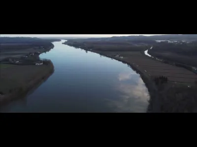
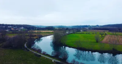
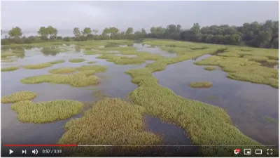
The island of Lahonce (also called Île de Roll) is a French river island located on the Adour river, within the commune of Lahonce in the Pyrénées-Atlantiques department, in the Nouvelle-Aquitaine region. • Geography and access: It is separated from the rest of the commune by a secondary arm of the Adour called the Aiguette. This arm of the river is where the Lahonce marina is located, which hosts a sailing school and pleasure boats. • Preserved environment: The island is part of the Barthes de Lahonce natural area. The barthes are marshy, floodable zones that form the last large wetland on the left bank of the Adour before the Bayonne urban area. • Ecological role: This environment serves as an essential buffer zone against floods and is a very rich ecosystem (habitat for amphibians, insect larvae and many birds) benefiting from environmental protection measures. You can easily explore the surroundings of the island by following the hiking trails laid out through the Bartas de Lahonce.
Map and restricted areas
Open in the main mapNearby aerodromes
Open aerodromes within 25 km of the spot, heliports included, with their distance and direction from the spot. Near an aerodrome, drone flying is prohibited or height-limited: check the UAS zones map.
| Aerodrome | Type | Distance | Elevation | Difference |
|---|---|---|---|---|
| Centre Hospitalier De La Côte Basque Heliport | Heliport | 7.1 km W | 23 m | spot 22 m lower |
| Biarritz-Anglet-Bayonne Airport | Airport | 12 km W | 75 m | spot 74 m lower |
| Itxassou Airfield | Aerodrome | 18 km S | 185 m | spot 184 m lower |
Aviation weather (METAR and TAF)
LFBZ – Biarritz-Anglet-Bayonne Airport VFR
METAR
METAR LFBZ 171330Z AUTO 01007KT 340V050 9999 FEW006 BKN058 OVC074 16/15 Q1003 NOSIG
- Wind
- 010°, 13 km/h
- Visibility
- 10 km or more
- Clouds
- Few (1-2/8) at 600 ft (180 m) ; Broken (5-7/8) at 5,800 ft (1770 m) ; Overcast (8/8) at 7,400 ft (2260 m)
- Temperature
- 16 °C, dew point 15 °C
- QNH
- 1003 hPa
- Flight category
- VFR: ceiling > 3,000 ft and visibility > 5 mi
TAF
TAF LFBZ 171100Z 1712/1812 25008KT 9999 BKN045 TEMPO 1712/1713 4000 SHRA BKN010 BKN030TCU PROB30 TEMPO 1716/1718 4000 -SHRA BKN040TCU TEMPO 1722/1803 22015G25KT TEMPO 1803/1808 29015G30KT 2500 SHRA BKN008 BKN020TCU TEMPO 1808/1810 4000 -SHRA BKN050TCU
| Period (local time) | Change | Wind | Visibility | Weather | Clouds |
|---|---|---|---|---|---|
| 17/11 13:00 → 18/11 13:00 | Initial conditions | 250°, 15 km/h | 10 km or more | Broken (5-7/8) at 4,500 ft (1370 m) | |
| 17/11 13:00 → 17/11 14:00 | Temporarily | 4.0 km | Showers of rain | Broken (5-7/8) at 1,000 ft (300 m) ; Broken (5-7/8) at 3,000 ft (910 m) (towering cumulus) | |
| 17/11 17:00 → 17/11 19:00 | Temporarily, probability 30% | 4.0 km | Showers of rain light | Broken (5-7/8) at 4,000 ft (1220 m) (towering cumulus) | |
| 17/11 23:00 → 18/11 04:00 | Temporarily | 220°, 28 km/h, gusts 46 km/h | |||
| 18/11 04:00 → 18/11 09:00 | Temporarily | 290°, 28 km/h, gusts 56 km/h | 2.5 km | Showers of rain | Broken (5-7/8) at 800 ft (240 m) ; Broken (5-7/8) at 2,000 ft (610 m) (towering cumulus) |
| 18/11 09:00 → 18/11 11:00 | Temporarily | 4.0 km | Showers of rain light | Broken (5-7/8) at 5,000 ft (1520 m) (towering cumulus) |
Weather and Kp index
Sunrise and sunset
| Day | Dawn | Sunrise | Golden hour | Sunset | Dusk | Day length |
|---|---|---|---|---|---|---|
| Tue 17 Nov | 07:31 | 08:02 | 08:02–08:45 · 16:56–17:39 | 17:39 | 18:10 | 9 h 37 |
| Wed 18 Nov | 07:32 | 08:03 | 08:03–08:47 · 16:55–17:38 | 17:38 | 18:09 | 9 h 35 |
| Thu 19 Nov | 07:33 | 08:04 | 08:04–08:48 · 16:54–17:38 | 17:38 | 18:09 | 9 h 33 |
| Fri 20 Nov | 07:34 | 08:06 | 08:06–08:50 · 16:53–17:37 | 17:37 | 18:08 | 9 h 31 |
| Sat 21 Nov | 07:36 | 08:07 | 08:07–08:51 · 16:52–17:36 | 17:36 | 18:07 | 9 h 29 |
| Sun 22 Nov | 07:37 | 08:08 | 08:08–08:52 · 16:51–17:35 | 17:35 | 18:07 | 9 h 27 |
| Mon 23 Nov | 07:38 | 08:09 | 08:09–08:54 · 16:50–17:35 | 17:35 | 18:06 | 9 h 25 |


Reviews
Log in to review this spot. Log in · Create a free account
No reviews yet. Share yours!