

The Himalayan footbridge of Saint-Parthem

No reviews yet
Have you flown here? Share your experience with other pilots.
+ Write the first reviewDescription
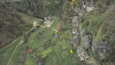
In the heart of the Lot valley, in Aveyron, the Himalayan footbridge of Saint-Parthem now links the two banks of the river in a remarkable natural setting.
180 metres long and 1.40 metres wide, this suspension footbridge rises to about 12 metres above the Lot. Its galvanized steel deck rests on two main cables, while hangers and a wind stabilization system ensure the safety and stability of the structure. With its 40 tonnes of steel, its cables stretched between the two banks and its design with no support in the river, the structure offers a particularly elegant silhouette from the air, perfectly blended into the valley landscape. Parking is free
Map and restricted areas
Open in the main mapNearby aerodromes
Open aerodromes within 25 km of the spot, heliports included, with their distance and direction from the spot. Near an aerodrome, drone flying is prohibited or height-limited: check the UAS zones map.
No known open aerodrome within 25 km.
Aviation weather (METAR and TAF)
LFCR – Rodez-Marcillac Airport IFR
METAR
METAR LFCR 171330Z AUTO 19005KT 170V230 9999 OVC009 13/11 Q1005 TEMPO BKN011
- Wind
- 190°, 9 km/h
- Visibility
- 10 km or more
- Clouds
- Overcast (8/8) at 900 ft (270 m)
- Temperature
- 13 °C, dew point 11 °C
- QNH
- 1005 hPa
- Flight category
- IFR: ceiling 500–1,000 ft or visibility 1–3 mi
TAF
TAF LFCR 171100Z 1712/1812 23010KT 9999 BKN018 TEMPO 1712/1717 -RA BKN011 TEMPO 1712/1714 4000 RA BKN005 TEMPO 1720/1803 3000 -RADZ BKN005 BKN011 TEMPO 1803/1808 3000 RA BKN006 TEMPO 1803/1806 27015G28KT TEMPO 1808/1811 BKN008 TEMPO 1811/1812 26015G28KT 4000 SHRA BKN017TCU
| Period (local time) | Change | Wind | Visibility | Weather | Clouds |
|---|---|---|---|---|---|
| 17/11 13:00 → 18/11 13:00 | Initial conditions | 230°, 19 km/h | 10 km or more | Broken (5-7/8) at 1,800 ft (550 m) | |
| 17/11 13:00 → 17/11 18:00 | Temporarily | Rain light | Broken (5-7/8) at 1,100 ft (340 m) | ||
| 17/11 13:00 → 17/11 15:00 | Temporarily | 4.0 km | Rain | Broken (5-7/8) at 500 ft (150 m) | |
| 17/11 21:00 → 18/11 04:00 | Temporarily | 3.0 km | Rain light ; drizzle light | Broken (5-7/8) at 500 ft (150 m) ; Broken (5-7/8) at 1,100 ft (340 m) | |
| 18/11 04:00 → 18/11 09:00 | Temporarily | 3.0 km | Rain | Broken (5-7/8) at 600 ft (180 m) | |
| 18/11 04:00 → 18/11 07:00 | Temporarily | 270°, 28 km/h, gusts 52 km/h | |||
| 18/11 09:00 → 18/11 12:00 | Temporarily | Broken (5-7/8) at 800 ft (240 m) | |||
| 18/11 12:00 → 18/11 13:00 | Temporarily | 260°, 28 km/h, gusts 52 km/h | 4.0 km | Showers of rain | Broken (5-7/8) at 1,700 ft (520 m) (towering cumulus) |
Weather and Kp index
Sunrise and sunset
| Day | Dawn | Sunrise | Golden hour | Sunset | Dusk | Day length |
|---|---|---|---|---|---|---|
| Tue 17 Nov | 07:18 | 07:50 | 07:50–08:35 · 16:37–17:21 | 17:21 | 17:53 | 9 h 31 |
| Wed 18 Nov | 07:20 | 07:51 | 07:51–08:36 · 16:36–17:20 | 17:20 | 17:52 | 9 h 29 |
| Thu 19 Nov | 07:21 | 07:53 | 07:53–08:38 · 16:35–17:20 | 17:20 | 17:51 | 9 h 26 |
| Fri 20 Nov | 07:22 | 07:54 | 07:54–08:39 · 16:34–17:19 | 17:19 | 17:51 | 9 h 24 |
| Sat 21 Nov | 07:23 | 07:55 | 07:55–08:41 · 16:33–17:18 | 17:18 | 17:50 | 9 h 22 |
| Sun 22 Nov | 07:25 | 07:57 | 07:57–08:42 · 16:32–17:17 | 17:17 | 17:49 | 9 h 20 |
| Mon 23 Nov | 07:26 | 07:58 | 07:58–08:44 · 16:31–17:17 | 17:17 | 17:49 | 9 h 18 |




Reviews
Log in to review this spot. Log in · Create a free account
No reviews yet. Share yours!