

Notre-Dame de Commiers Dam - Saint-Martin-de-la-Cluze
No reviews yet
Have you flown here? Share your experience with other pilots.
+ Write the first reviewDescription
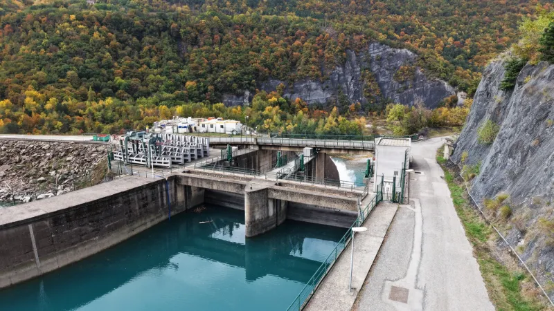
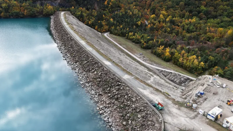
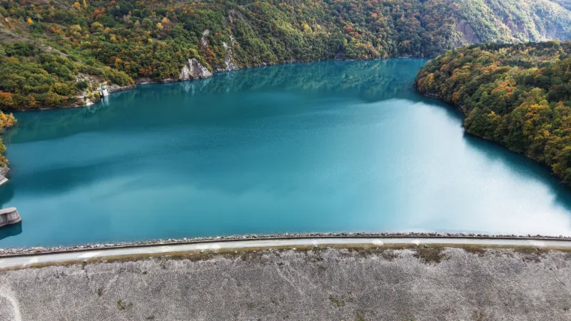
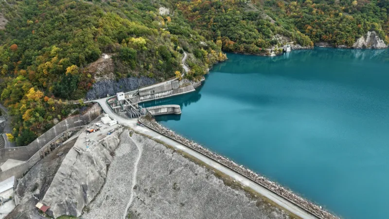
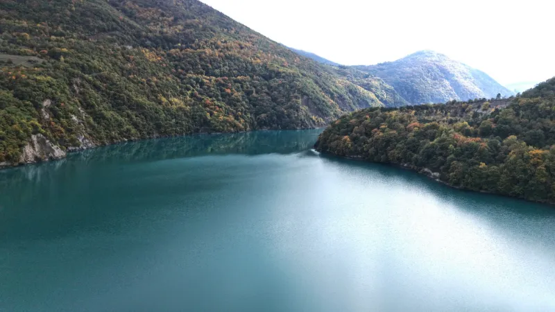
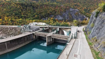
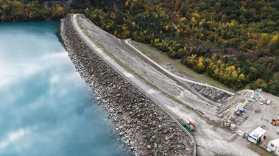
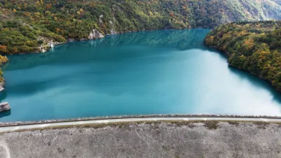
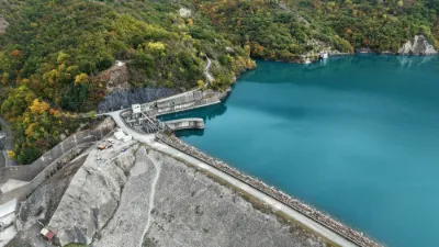
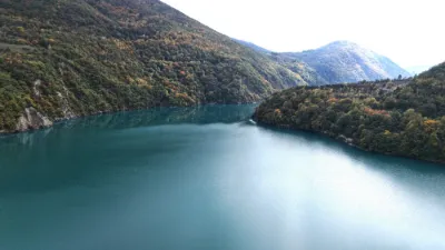
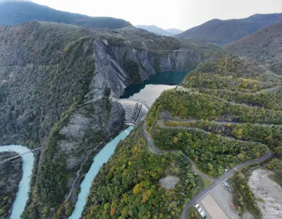
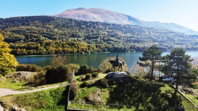
The Notre-Dame de Commiers hydraulic dam, 350 metres long and 40.5 metres high, is located in the commune of Saint-Martin-de-la-Cluze. It is an earth dam with an inclined core. Its height is 41 metres, and the reservoir volume is 34 million m³. The time between a failure of the Notre-Dame de Commiers dam and the arrival of the flood wave in Grenoble would be 4 hours, and the wave would be 4 to 6 metres high.
Near GRENOBLE
Map and restricted areas
Open in the main mapNearby aerodromes
Open aerodromes within 25 km of the spot, heliports included, with their distance and direction from the spot. Near an aerodrome, drone flying is prohibited or height-limited: check the UAS zones map.
| Aerodrome | Type | Distance | Elevation | Difference |
|---|---|---|---|---|
| Quartier-Reynies Heliport | Heliport | 10 km N | 220 m | spot 225 m higher |
| Hôpital Nord Heliport | Heliport | 22 km N | 218 m | spot 227 m higher |
| Mens Airstrip | Aerodrome | 23 km S | 853 m | spot 408 m lower |
| Chateau de Montmeilleur | Aerodrome | 25 km S | 850 m | spot 405 m lower |
Aviation weather (METAR and TAF)
LFLS – Grenoble-Isère Airport VFR
METAR
METAR LFLS 171330Z AUTO 22004KT 170V250 9999 BKN046 BKN060 OVC190 13/11 Q1003
- Wind
- 220°, 7 km/h
- Visibility
- 10 km or more
- Clouds
- Broken (5-7/8) at 4,600 ft (1400 m) ; Broken (5-7/8) at 6,000 ft (1830 m) ; Overcast (8/8) at 19,000 ft (5790 m)
- Temperature
- 13 °C, dew point 11 °C
- QNH
- 1003 hPa
- Flight category
- VFR: ceiling > 3,000 ft and visibility > 5 mi
TAF
TAF LFLS 170200Z 1703/1803 VRB05KT CAVOK PROB30 TEMPO 1703/1708 20012KT TEMPO 1708/1717 20012KT -RA BKN050 PROB40 TEMPO 1708/1717 20015G25KT 4000 RA BKN020 FM171700 20012KT CAVOK TEMPO 1717/1721 20015G25KT PROB40 TEMPO 1800/1803 VRB18G30KT 4000 SHRA BKN050TCU
| Period (local time) | Change | Wind | Visibility | Weather | Clouds |
|---|---|---|---|---|---|
| 17/11 04:00 → 17/11 18:00 | Initial conditions | Variable, 9 km/h | 10 km or more | No significant weather | No significant cloud |
| 17/11 04:00 → 17/11 09:00 | Temporarily, probability 30% | 200°, 22 km/h | |||
| 17/11 09:00 → 17/11 18:00 | Temporarily, probability 40% | 200°, 28 km/h, gusts 46 km/h | 4.0 km | Rain | Broken (5-7/8) at 2,000 ft (610 m) |
| 17/11 09:00 → 17/11 18:00 | Temporarily | 200°, 22 km/h | Rain light | Broken (5-7/8) at 5,000 ft (1520 m) | |
| 17/11 18:00 → 17/11 22:00 | Temporarily | 200°, 28 km/h, gusts 46 km/h | |||
| 17/11 18:00 → 18/11 04:00 | From | 200°, 22 km/h | 10 km or more | No significant weather | No significant cloud |
| 18/11 01:00 → 18/11 04:00 | Temporarily, probability 40% | Variable, 33 km/h, gusts 56 km/h | 4.0 km | Showers of rain | Broken (5-7/8) at 5,000 ft (1520 m) (towering cumulus) |
Weather and Kp index
Sunrise and sunset
| Day | Dawn | Sunrise | Golden hour | Sunset | Dusk | Day length |
|---|---|---|---|---|---|---|
| Tue 17 Nov | 07:06 | 07:38 | 07:38–08:23 · 16:22–17:07 | 17:07 | 17:39 | 9 h 29 |
| Wed 18 Nov | 07:07 | 07:39 | 07:39–08:24 · 16:21–17:06 | 17:06 | 17:38 | 9 h 26 |
| Thu 19 Nov | 07:08 | 07:40 | 07:40–08:26 · 16:20–17:05 | 17:05 | 17:37 | 9 h 24 |
| Fri 20 Nov | 07:09 | 07:42 | 07:42–08:27 · 16:19–17:04 | 17:04 | 17:36 | 9 h 22 |
| Sat 21 Nov | 07:11 | 07:43 | 07:43–08:29 · 16:18–17:03 | 17:03 | 17:35 | 9 h 20 |
| Sun 22 Nov | 07:12 | 07:44 | 07:44–08:30 · 16:17–17:03 | 17:03 | 17:35 | 9 h 18 |
| Mon 23 Nov | 07:13 | 07:45 | 07:45–08:32 · 16:16–17:02 | 17:02 | 17:34 | 9 h 16 |

Reviews
Log in to review this spot. Log in · Create a free account
No reviews yet. Share yours!