

The Révollat cross - La Combe-de-Lancey
No reviews yet
Have you flown here? Share your experience with other pilots.
+ Write the first reviewDescription
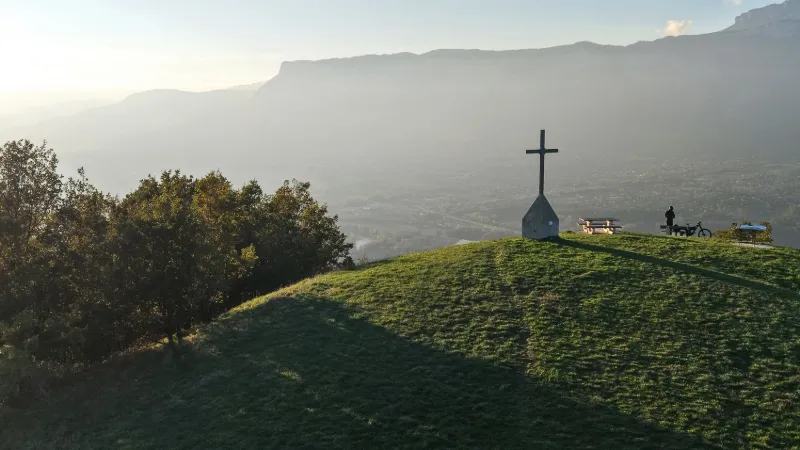
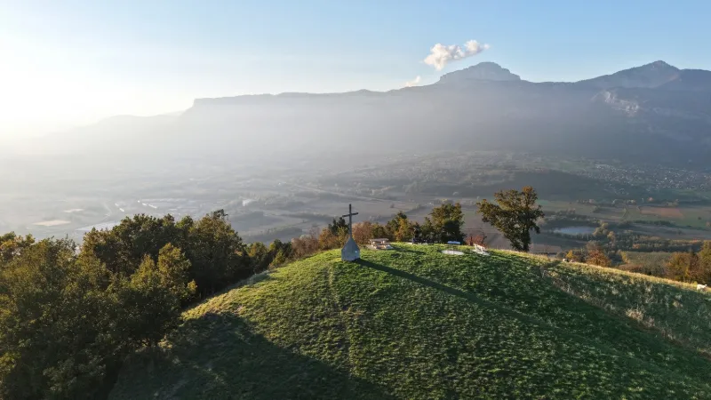
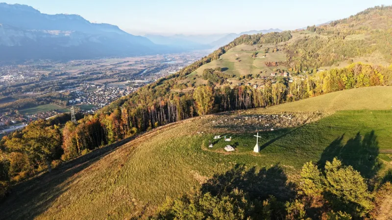
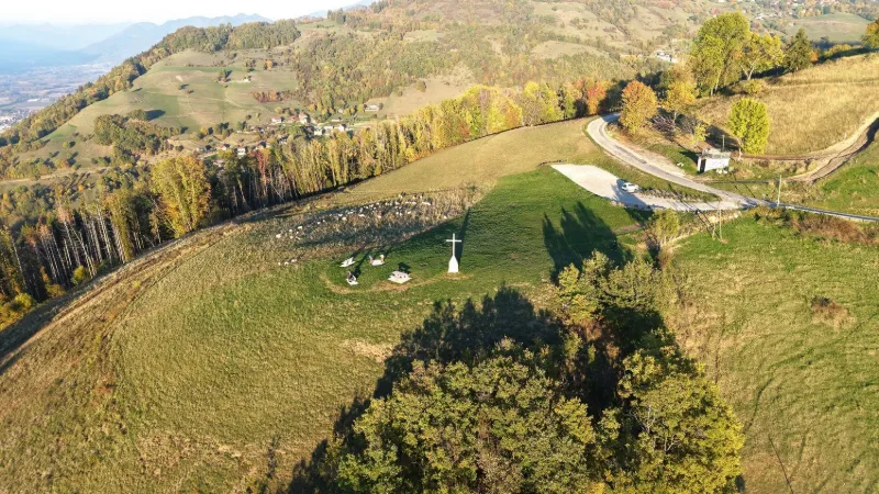
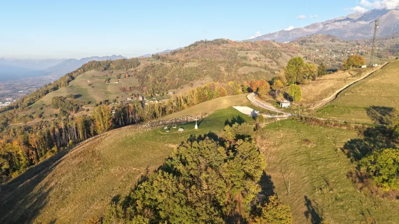
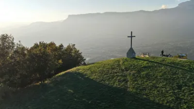
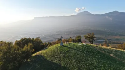
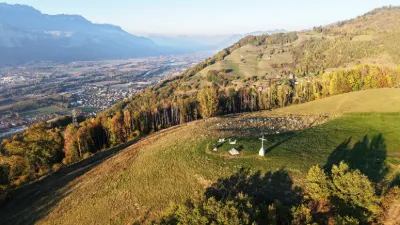
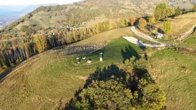
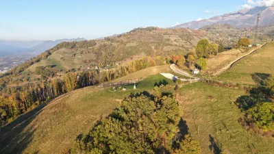
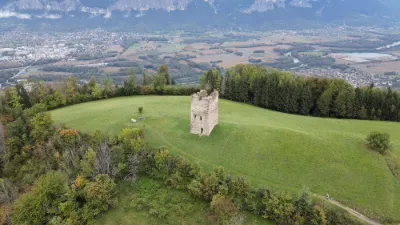
Overlooking the Grésivaudan valley, the Révollat cross stands as a true symbol of local heritage and memory. Erected at the top of a high point offering an exceptional panorama over the region, it has watched over the surrounding valleys for generations. This calvary, rooted in the history of the local inhabitants, once marked paths or key moments in community life. Today, this prime spot attracts history and architecture enthusiasts as well as hikers coming to admire the spectacular view. Near GRENOBLE
Map and restricted areas
Open in the main mapNearby aerodromes
Open aerodromes within 25 km of the spot, heliports included, with their distance and direction from the spot. Near an aerodrome, drone flying is prohibited or height-limited: check the UAS zones map.
| Aerodrome | Type | Distance | Elevation | Difference |
|---|---|---|---|---|
| Aérodrome de Grenoble Le Versoud | Aerodrome | 4.6 km SW | 220 m | spot 458 m higher |
| Altiport du Col De Belledonne | Aerodrome | 10 km SE | 2,800 m | spot 2,122 m lower |
| Hôpital Nord Heliport | Heliport | 13 km W | 218 m | spot 460 m higher |
| Altisurface du Glacier de la Barbaratre | Aerodrome | 20 km SE | 3,008 m | spot 2,330 m lower |
| Altiport L'Alpe d'Huez - Henri GIRAUD | Aerodrome | 22 km SE | 1,860 m | spot 1,182 m lower |
Aviation weather (METAR and TAF)
LFLB – Chambéry-Savoie Airport VFR
METAR
METAR LFLB 171330Z AUTO 21010KT 190V260 9999 FEW045 SCT056 BKN210 13/11 Q1002
- Wind
- 210°, 19 km/h
- Visibility
- 10 km or more
- Clouds
- Few (1-2/8) at 4,500 ft (1370 m) ; Scattered (3-4/8) at 5,600 ft (1710 m) ; Broken (5-7/8) at 21,000 ft (6400 m)
- Temperature
- 13 °C, dew point 11 °C
- QNH
- 1002 hPa
- Flight category
- VFR: ceiling > 3,000 ft and visibility > 5 mi
TAF
TAF LFLB 170200Z 1703/1803 19010KT CAVOK TEMPO 1703/1705 21012G22KT -RA OVC060 BECMG 1707/1709 -RA OVC060 TEMPO 1709/1717 19015G25KT 4000 RA BKN020 OVC040 FM171700 16010KT CAVOK TEMPO 1723/1803 VRB18G30KT 4000 SHRA BKN050TCU
| Period (local time) | Change | Wind | Visibility | Weather | Clouds |
|---|---|---|---|---|---|
| 17/11 04:00 → 17/11 08:00 | Initial conditions | 190°, 19 km/h | 10 km or more | No significant weather | No significant cloud |
| 17/11 04:00 → 17/11 06:00 | Temporarily | 210°, 22 km/h, gusts 41 km/h | Rain light | Overcast (8/8) at 6,000 ft (1830 m) | |
| 17/11 08:00 → 17/11 18:00 | Becoming | 190°, 19 km/h | 10 km or more | Rain light | Overcast (8/8) at 6,000 ft (1830 m) |
| 17/11 10:00 → 17/11 18:00 | Temporarily | 190°, 28 km/h, gusts 46 km/h | 4.0 km | Rain | Broken (5-7/8) at 2,000 ft (610 m) ; Overcast (8/8) at 4,000 ft (1220 m) |
| 17/11 18:00 → 18/11 04:00 | From | 160°, 19 km/h | 10 km or more | No significant weather | No significant cloud |
| 18/11 00:00 → 18/11 04:00 | Temporarily | Variable, 33 km/h, gusts 56 km/h | 4.0 km | Showers of rain | Broken (5-7/8) at 5,000 ft (1520 m) (towering cumulus) |
Weather and Kp index
Sunrise and sunset
| Day | Dawn | Sunrise | Golden hour | Sunset | Dusk | Day length |
|---|---|---|---|---|---|---|
| Tue 17 Nov | 07:05 | 07:37 | 07:37–08:23 · 16:20–17:05 | 17:05 | 17:37 | 9 h 27 |
| Wed 18 Nov | 07:07 | 07:39 | 07:39–08:24 · 16:19–17:04 | 17:04 | 17:36 | 9 h 25 |
| Thu 19 Nov | 07:08 | 07:40 | 07:40–08:26 · 16:18–17:03 | 17:03 | 17:36 | 9 h 23 |
| Fri 20 Nov | 07:09 | 07:41 | 07:41–08:27 · 16:17–17:03 | 17:03 | 17:35 | 9 h 21 |
| Sat 21 Nov | 07:10 | 07:43 | 07:43–08:29 · 16:16–17:02 | 17:02 | 17:34 | 9 h 19 |
| Sun 22 Nov | 07:12 | 07:44 | 07:44–08:30 · 16:15–17:01 | 17:01 | 17:33 | 9 h 17 |
| Mon 23 Nov | 07:13 | 07:45 | 07:45–08:32 · 16:14–17:00 | 17:00 | 17:33 | 9 h 14 |


Reviews
Log in to review this spot. Log in · Create a free account
No reviews yet. Share yours!