

Ile de la Réunion - Tresta Star Wreck
No reviews yet
Have you flown here? Share your experience with other pilots.
+ Write the first reviewDescription
La Réunion. February 2022.
Some stories are written by the ocean in its own way. Stories where man, despite his technology and his certainties, ends up yielding to the power of the elements.
The story of the Tresta Star begins off the coast of Mauritius.
Put into service in 2019, this 74-meter refueling tanker is a relatively recent vessel. Its mission is simple: to supply fuel to the commercial ships transiting through Mauritian waters.
But in February 2022, Cyclone Batsirai is about to upend its fate.
As the port of Port-Louis closes its access to protect itself from the storm, the ship finds itself facing extreme weather conditions. A propulsion failure, violent winds and a raging sea gradually make it lose control of its course.
The ocean becomes uncontrollable.
Carried off by the elements, the Tresta Star drifts toward the coast of La Réunion. Hundreds of kilometers from its home port, its crew can no longer prevent the inevitable.
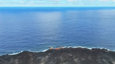
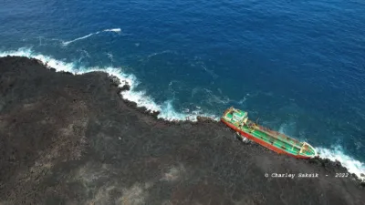
On the evening of February 3, the ship crashes against the volcanic rocks of Le Tremblet, in the commune of Saint-Philippe, in the southeast of La Réunion.
The impact is brutal.
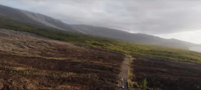
The hull is ripped open. The ship is stuck on a hostile coast, at the foot of a landscape shaped by the lava flows of the Piton de la Fournaise.
But eleven men are still on board.
In the darkness, amid the waves and the rocks, the rescuers must come up with a way to save them. The conditions do not allow a conventional evacuation.
The GRIMP rescuers then set up an exceptional system: a zip line between the land and the ship.
One by one, the eleven sailors are evacuated above the raging waters.
By early morning on February 4, everyone is safe and sound.
A human tragedy has just been avoided.
But another threat appears: pollution.
The Tresta Star still has fuel in its tanks. Specialized teams work in particularly difficult conditions to pump out the pollutants, secure the installations and limit the impact on this exceptional natural environment.
The cleanup ends in March 2022.
Then one question remains: what to do with the ship?
Removing it would be a colossal undertaking. The volcanic rocks, the swell, the difficult access and the condition of the hull make any operation particularly complex.
Solutions are studied, costs are assessed. Refloating and dismantling are considered, but the technical, financial and environmental constraints ultimately win out.
The decision is made: the ship will not be removed.
The ocean will finish the job itself.
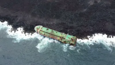
Over the months, the hull cracks, warps and breaks apart. The metal still holds, but time, salt and waves relentlessly carry on their work.
Today, the Tresta Star is no longer really a ship. It has become a steel carcass, stranded at the foot of a volcanic coast, a silent witness to a night when nature reminded us of its power.
It will never sail again.
Its last voyage ended here, on this land of fire and ocean, in La Réunion.
The Tresta Star has not disappeared. It is simplem
Map and restricted areas
Open in the main mapNearby aerodromes
Open aerodromes within 25 km of the spot, heliports included, with their distance and direction from the spot. Near an aerodrome, drone flying is prohibited or height-limited: check the UAS zones map.
No known open aerodrome within 25 km.
Aviation weather (METAR and TAF)
FMEP – Pierrefonds Airport VFR
METAR
METAR FMEP 171330Z AUTO 29008KT 9999 OVC064 28/22 Q1016 NOSIG
- Wind
- 290°, 15 km/h
- Visibility
- 10 km or more
- Clouds
- Overcast (8/8) at 6,400 ft (1950 m)
- Temperature
- 28 °C, dew point 22 °C
- QNH
- 1016 hPa
- Flight category
- VFR: ceiling > 3,000 ft and visibility > 5 mi
TAF
TAF FMEP 171100Z 1712/1721 28012KT 9999 BKN060 BECMG 1712/1714 12008KT BECMG 1715/1717 VRB03KT
| Period (local time) | Change | Wind | Visibility | Weather | Clouds |
|---|---|---|---|---|---|
| 17/11 16:00 → 18/11 01:00 | Initial conditions | 280°, 22 km/h | 10 km or more | Broken (5-7/8) at 6,000 ft (1830 m) | |
| 17/11 16:00 → 17/11 19:00 | Becoming | 120°, 15 km/h | 10 km or more | Broken (5-7/8) at 6,000 ft (1830 m) | |
| 17/11 19:00 → 18/11 01:00 | Becoming | Variable, 6 km/h | 10 km or more | Broken (5-7/8) at 6,000 ft (1830 m) |
Weather and Kp index
Sunrise and sunset
| Day | Dawn | Sunrise | Golden hour | Sunset | Dusk | Day length |
|---|---|---|---|---|---|---|
| Tue 17 Nov | 05:03 | 05:27 | 05:27–05:58 · 18:05–18:36 | 18:36 | 19:00 | 13 h 09 |
| Wed 18 Nov | 05:03 | 05:27 | 05:27–05:58 · 18:06–18:37 | 18:37 | 19:01 | 13 h 10 |
| Thu 19 Nov | 05:03 | 05:26 | 05:26–05:58 · 18:06–18:38 | 18:38 | 19:02 | 13 h 11 |
| Fri 20 Nov | 05:02 | 05:26 | 05:26–05:58 · 18:07–18:38 | 18:38 | 19:02 | 13 h 12 |
| Sat 21 Nov | 05:02 | 05:26 | 05:26–05:57 · 18:08–18:39 | 18:39 | 19:03 | 13 h 12 |
| Sun 22 Nov | 05:02 | 05:26 | 05:26–05:57 · 18:08–18:40 | 18:40 | 19:04 | 13 h 13 |
| Mon 23 Nov | 05:02 | 05:26 | 05:26–05:57 · 18:09–18:40 | 18:40 | 19:04 | 13 h 14 |

Reviews
Log in to review this spot. Log in · Create a free account
No reviews yet. Share yours!