

Tourist site
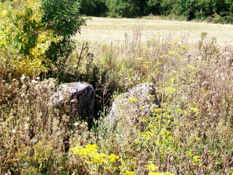
Coppière Dolmen
No reviews yet
Have you flown here? Share your experience with other pilots.
+ Write the first reviewHistory
Map and restricted areas
Open in the main mapRestricted zones
| Zone | Category | Limits | Conditions |
|---|---|---|---|
| Paris 4 | Zone réglementée | 1067 m above sea level → 1372 m above sea level | Vols interdits sauf lorsque the official document of the zone l'autorise explicitement ou avec l'accord du gestionnaire de la zone lorsqu'il est désigné par the official document of the zone |
| Mantes | Zone réglementée | 1067 m above sea level → 1992 m above sea level | Vols interdits sauf lorsque the official document of the zone l'autorise explicitement ou avec l'accord du gestionnaire de la zone lorsqu'il est désigné par the official document of the zone |
| Mantes | Zone réglementée | 1067 m above sea level → 1372 m above sea level | Vols interdits sauf lorsque the official document of the zone l'autorise explicitement ou avec l'accord du gestionnaire de la zone lorsqu'il est désigné par the official document of the zone |
| Paris 5 | Zone réglementée | 1372 m above sea level → 2297 m above sea level | Vols interdits sauf lorsque the official document of the zone l'autorise explicitement ou avec l'accord du gestionnaire de la zone lorsqu'il est désigné par the official document of the zone |
| Mantes | Zone réglementée | 1372 m above sea level → 1992 m above sea level | Vols interdits sauf lorsque the official document of the zone l'autorise explicitement ou avec l'accord du gestionnaire de la zone lorsqu'il est désigné par the official document of the zone |
| Paris 7 | Zone réglementée | 1529 m above sea level → 2907 m above sea level | Vols interdits sauf lorsque the official document of the zone l'autorise explicitement ou avec l'accord du gestionnaire de la zone lorsqu'il est désigné par the official document of the zone |
| Paris 9 | Zone réglementée | 2138 m above sea level → 3821 m above sea level | Vols interdits sauf lorsque the official document of the zone l'autorise explicitement ou avec l'accord du gestionnaire de la zone lorsqu'il est désigné par the official document of the zone |
| Paris 11 | Zone réglementée | 3053 m above sea level → 6259 m above sea level | Vols interdits sauf lorsque the official document of the zone l'autorise explicitement ou avec l'accord du gestionnaire de la zone lorsqu'il est désigné par the official document of the zone |
Nearby aerodromes
Open aerodromes within 25 km of the spot, heliports included, with their distance and direction from the spot. Near an aerodrome, drone flying is prohibited or height-limited: check the UAS zones map.
| Aerodrome | Type | Distance | Elevation |
|---|---|---|---|
| Mantes Chérence Airfield | Aerodrome | 9.4 km S | 156 m |
| Base ULM Les Noyers | Aerodrome | 11 km N | 100 m |
| Base Paramoteurs d' Avernes | Aerodrome | 16 km SE | 139 m |
| Étrépagny Airfield | Aerodrome | 16 km N | 94 m |
| Centre Hospitalier F. Quesnay Heliport | Heliport | 18 km S | 28 m |
Aviation weather (METAR and TAF)
LFPT – Aérodrome de Pontoise - Cormeilles en Vexin VFR
METAR
METAR LFPT 171330Z AUTO 24016KT 210V270 CAVOK 15/09 Q0990
- Wind
- 240°, 30 km/h
- Visibility
- 10 km or more
- Clouds
- –
- Temperature
- 15 °C, dew point 9 °C
- QNH
- 990 hPa
- Flight category
- VFR: ceiling > 3,000 ft and visibility > 5 mi
TAF
Weather and Kp index
| Day | Weather | Temp. min. / max. | Wind | Rain | Max Kp |
|---|---|---|---|---|---|
| Tue 17 Nov | Heavy rain | 10° / 13° | 30 km/h SW | 4.2 mm | 5 |
| Wed 18 Nov | Showers | 10° / 13° | 33 km/h W | 5.8 mm | 5 |
| Thu 19 Nov | Partly cloudy | 8° / 13° | 33 km/h SW | 6.8 mm | 3 |
| Fri 20 Nov | Showers | 9° / 12° | 28 km/h SW | 2.7 mm | 3 |
| Sat 21 Nov | Partly cloudy | 7° / 10° | 26 km/h W | 0.5 mm | – |
| Sun 22 Nov | Cloudy | 6° / 7° | 17 km/h E | 8.6 mm | – |
| Mon 23 Nov | Clear sky | 6° / 11° | 18 km/h W | 2.3 mm | – |
Hour by hour: Tuesday 17 November
| Time | Weather | Temp. | Wind | Rain | Clouds | Kp |
|---|---|---|---|---|---|---|
| 15:00 | Heavy rain | 13° | 25 km/h SW | 1.5 mm | 99 % | 4 |
| 16:00 | Light rain | 12° | 26 km/h SW | 0.3 mm | 98 % | 4 |
| 17:00 | Rain | 12° | 28 km/h SW | 0.4 mm | 100 % | 4 |
| 18:00 | Rain | 12° | 28 km/h SW | 0.9 mm | 100 % | 4 |
| 19:00 | Rain | 11° | 30 km/h SW | 0.5 mm | 100 % | 5 |
| 20:00 | Showers | 11° | 28 km/h SW | 0.6 mm | 66 % | 5 |
| 21:00 | Cloudy | 10° | 26 km/h SW | – | 88 % | 5 |
| 22:00 | Fair | 10° | 26 km/h SW | – | 36 % | 5 |
Hour by hour: Wednesday 18 November
| Time | Weather | Temp. | Wind | Rain | Clouds | Kp |
|---|---|---|---|---|---|---|
| 06:00 | Partly cloudy | 10° | 24 km/h SW | – | 73 % | 4 |
| 07:00 | Partly cloudy | 10° | 24 km/h SW | – | 67 % | 4 |
| 08:00 | Partly cloudy | 10° | 24 km/h SW | – | 58 % | 4 |
| 09:00 | Partly cloudy | 10° | 23 km/h SW | – | 59 % | 4 |
| 10:00 | Partly cloudy | 11° | 24 km/h SW | – | 44 % | 4 |
| 11:00 | Partly cloudy | 12° | 27 km/h SW | – | 49 % | 4 |
| 12:00 | Partly cloudy | 13° | 32 km/h SW | – | 41 % | 4 |
| 13:00 | Showers | 13° | 33 km/h W | 0.2 mm | 44 % | 3 |
| 14:00 | Showers | 13° | 28 km/h W | 0.1 mm | 41 % | 3 |
| 15:00 | Fair | 13° | 25 km/h W | – | 16 % | 3 |
| 16:00 | Clear sky | 13° | 22 km/h SW | – | 6 % | 3 |
| 17:00 | Fair | 12° | 21 km/h SW | – | 23 % | 3 |
| 18:00 | Partly cloudy | 11° | 18 km/h SW | – | 87 % | 3 |
| 19:00 | Partly cloudy | 11° | 19 km/h SW | – | 86 % | 2 |
| 20:00 | Light rain | 10° | 18 km/h SW | 0.2 mm | 98 % | 2 |
| 21:00 | Heavy rain | 10° | 21 km/h S | 1.6 mm | 100 % | 2 |
| 22:00 | Heavy rain | 10° | 20 km/h S | 1.6 mm | 100 % | 2 |
Sunrise and sunset
| Day | Dawn | Sunrise | Golden hour | Sunset | Dusk | Day length |
|---|---|---|---|---|---|---|
| Tue 17 Nov | 07:31 | 08:06 | 08:06–08:57 · 16:20–17:10 | 17:10 | 17:45 | 9 h 03 |
| Wed 18 Nov | 07:33 | 08:08 | 08:08–08:59 · 16:18–17:09 | 17:09 | 17:44 | 9 h 00 |
| Thu 19 Nov | 07:34 | 08:09 | 08:09–09:00 · 16:17–17:08 | 17:08 | 17:43 | 8 h 58 |
| Fri 20 Nov | 07:36 | 08:11 | 08:11–09:02 · 16:16–17:07 | 17:07 | 17:42 | 8 h 55 |
| Sat 21 Nov | 07:37 | 08:12 | 08:12–09:04 · 16:14–17:06 | 17:06 | 17:41 | 8 h 53 |
| Sun 22 Nov | 07:38 | 08:14 | 08:14–09:06 · 16:13–17:05 | 17:05 | 17:40 | 8 h 50 |
| Mon 23 Nov | 07:40 | 08:15 | 08:15–09:07 · 16:12–17:04 | 17:04 | 17:39 | 8 h 48 |

Reviews (0)
Log in to review this spot. Log in · Create a free account
No reviews yet. Share yours!