

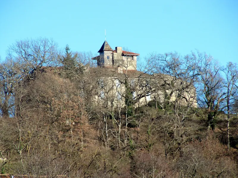
Castle
No reviews yet
Have you flown here? Share your experience with other pilots.
+ Write the first reviewHistory
Le château était entouré de plusieurs enceintes successives dont les traces sont visibles. Il comportait, au nord, une grande tour rectangulaire sans ouverture extérieure dans la partie subsistante, flanquée d'un corps de bâtiment formé d'une salle dont les voûtes reposaient par trois arches en plein cintre sur un pilier central. L'appareil de cette tour, ainsi que celui d'une partie du mur d'enceinte, permettent de situer sa construction antérieurement à celle d'une autre tour plus petite datant sans doute du 12e siècle. Un puits creusé dans le roc occupe le centre de la cour dont l'accès se fait par la seule porte donnant à l'extérieur, au nord-est de l'ensemble. Au 17e siècle, la transformation en résidence d'été donne à l'ensemble son aspect actuel. L'intérieur se présente, dans les parties non ruinées, comme une suite de pièces qui furent assez luxueuses avec des cheminées en bois de style Louis XIII. Selon la tradition locale, Simon de Montfort, après sa victoire sur les Albigeois, aurait contraint les eingeurs de Montégut, ses alliés, à démanteler les tours.
Map and restricted areas
Open in the main mapRestricted zones
Nearby aerodromes
Open aerodromes within 25 km of the spot, heliports included, with their distance and direction from the spot. Near an aerodrome, drone flying is prohibited or height-limited: check the UAS zones map.
| Aerodrome | Type | Distance | Elevation |
|---|---|---|---|
| Aérodrome de Saint-Girons - Antichan | Airport | 3.0 km N | 417 m |
| Altisurface de la Plagne-Bouirex | Aerodrome | 13 km S | 1,600 m |
| Cérizols Balloonport | Balloon port | 17 km N | 400 m |
| Altisurface d'Aleu | Aerodrome | 17 km SE | 1,050 m |
| Altisurface de Balesta Nature | Aerodrome | 21 km NW | 425 m |
Aviation weather (METAR and TAF)
No METAR station within 50 km.
Weather and Kp index
Sunrise and sunset
| Day | Dawn | Sunrise | Golden hour | Sunset | Dusk | Day length |
|---|---|---|---|---|---|---|
| Tue 17 Nov | 07:20 | 07:50 | 07:50–08:33 · 16:48–17:31 | 17:31 | 18:01 | 9 h 40 |
| Wed 18 Nov | 07:21 | 07:52 | 07:52–08:35 · 16:47–17:30 | 17:30 | 18:01 | 9 h 38 |
| Thu 19 Nov | 07:22 | 07:53 | 07:53–08:36 · 16:46–17:29 | 17:29 | 18:00 | 9 h 36 |
| Fri 20 Nov | 07:23 | 07:54 | 07:54–08:38 · 16:45–17:28 | 17:28 | 17:59 | 9 h 34 |
| Sat 21 Nov | 07:24 | 07:55 | 07:55–08:39 · 16:44–17:28 | 17:28 | 17:58 | 9 h 32 |
| Sun 22 Nov | 07:26 | 07:57 | 07:57–08:40 · 16:43–17:27 | 17:27 | 17:58 | 9 h 30 |
| Mon 23 Nov | 07:27 | 07:58 | 07:58–08:42 · 16:42–17:26 | 17:26 | 17:57 | 9 h 28 |
Reviews (0)
Log in to review this spot. Log in · Create a free account
No reviews yet. Share yours!