

Castle
No reviews yet
Have you flown here? Share your experience with other pilots.
+ Write the first reviewHistory
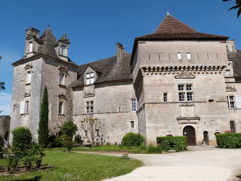
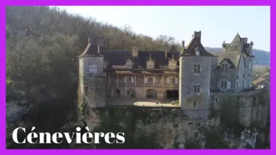
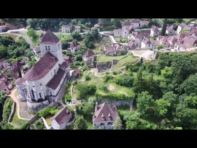
Selon la tradition, le château appartenait à Waïffe duc d'Aquitaine et aurait joué un rôle dans la guerre de ce prince contre Pépin le Bref. Le château se dresse sur un rocher à pic et présente un ensemble de bâtiments irréguliers, flanqués de tours et de terrasses. Un mur qui servait jadis de rempart, relie les écuries à la tour de Gourdon, qui était peut-être le donjon. Devant la porte d'entrée, bâtiment carré appelé corps de garde ou poterne, construit en 1585. Les ouvertures gothiques ont été remplacées par de larges croisées Renaissance. Sur les murailles ont été percées des lucarnes. Une galerie à colonnes contourne, à l'extérieur, le grand salon. Un appartement conserve des traces de peinture murale à fresque représentant la chute d'Icare et le char du soleil, la légende d'Astyanax et l'incendie de Troie, l'enlèvement d'Hélène.
Map and restricted areas
Open in the main mapRestricted zones
Nearby aerodromes
Open aerodromes within 25 km of the spot, heliports included, with their distance and direction from the spot. Near an aerodrome, drone flying is prohibited or height-limited: check the UAS zones map.
| Aerodrome | Type | Distance | Elevation |
|---|---|---|---|
| Cabrerets ULM | Aerodrome | 14 km NW | 359 m |
| Aérodrome de Figeac - Livernon | Aerodrome | 24 km N | 331 m |
| Aérodrome de Villefranche de Rouergue | Aerodrome | 24 km SE | 334 m |
Aviation weather (METAR and TAF)
No METAR station within 50 km.
Weather and Kp index
Sunrise and sunset
| Day | Dawn | Sunrise | Golden hour | Sunset | Dusk | Day length |
|---|---|---|---|---|---|---|
| Tue 17 Nov | 07:20 | 07:52 | 07:52–08:36 · 16:40–17:24 | 17:24 | 17:56 | 9 h 32 |
| Wed 18 Nov | 07:22 | 07:53 | 07:53–08:38 · 16:39–17:23 | 17:23 | 17:55 | 9 h 30 |
| Thu 19 Nov | 07:23 | 07:54 | 07:54–08:39 · 16:37–17:22 | 17:22 | 17:54 | 9 h 27 |
| Fri 20 Nov | 07:24 | 07:56 | 07:56–08:41 · 16:36–17:21 | 17:21 | 17:53 | 9 h 25 |
| Sat 21 Nov | 07:25 | 07:57 | 07:57–08:42 · 16:36–17:21 | 17:21 | 17:52 | 9 h 23 |
| Sun 22 Nov | 07:26 | 07:58 | 07:58–08:44 · 16:35–17:20 | 17:20 | 17:52 | 9 h 21 |
| Mon 23 Nov | 07:28 | 08:00 | 08:00–08:45 · 16:34–17:19 | 17:19 | 17:51 | 9 h 19 |
Reviews (0)
Log in to review this spot. Log in · Create a free account
No reviews yet. Share yours!