

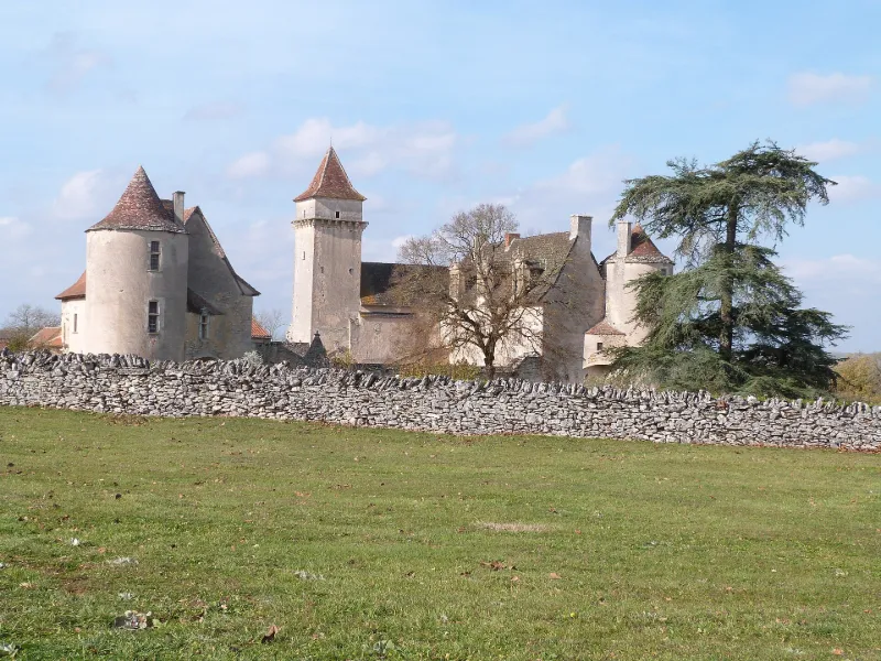
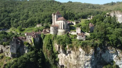
Couanac Castle
No reviews yet
Have you flown here? Share your experience with other pilots.
+ Write the first reviewHistory
Le château se compose de deux corps de logis. Le corps principal, en retour d'angle, est flanqué de deux tours, l'une ronde, l'autre carrée avec rangée de corbeaux de mâchicoulis à sa partie supérieure. Au pied de la tour s'ouvre le portail d'entrée de la chapelle, située en partie sous la tour, laquelle a conservé son transept roman. A l'origine, l'église avait son abside à l'est. Les colonnes de l'arc triomphal prennent naissance dans la crypte et sont surmontées de chapiteaux romans sculptés. Dans la crypte sont inhumés les anciens propriétaires. La façade sud du château, Renaissance, est percée de plusieurs fenêtres à meneaux et de lucarnes surmontées de frontons. Plusieurs salles conservent leurs plafonds à la française. ££Le deuxième corps de bâtiment, dit château Bouscary, se dresse au sud, et est flanqué d'une tour ronde. Dans la cour se trouve le portail d'entrée en segment de cercle, avec encadrement mouluré d'un arbre écoté. Suite à une restauration, l'arc brisé de l'entrée de l'enceinte a été transformé en anse de panier. Dans la cour du château se trouve un puits en partie creusé dans le roc, et couvert par un toit conique.
Map and restricted areas
Open in the main mapRestricted zones
Nearby aerodromes
Open aerodromes within 25 km of the spot, heliports included, with their distance and direction from the spot. Near an aerodrome, drone flying is prohibited or height-limited: check the UAS zones map.
| Aerodrome | Type | Distance | Elevation |
|---|---|---|---|
| Cabrerets ULM | Aerodrome | 18 km NW | 359 m |
| Aérodrome de Cahors-Lalbenque | Airport | 18 km W | 278 m |
Aviation weather (METAR and TAF)
No METAR station within 50 km.
Weather and Kp index
Sunrise and sunset
| Day | Dawn | Sunrise | Golden hour | Sunset | Dusk | Day length |
|---|---|---|---|---|---|---|
| Tue 17 Nov | 07:20 | 07:52 | 07:52–08:36 · 16:40–17:25 | 17:25 | 17:56 | 9 h 32 |
| Wed 18 Nov | 07:22 | 07:53 | 07:53–08:38 · 16:39–17:24 | 17:24 | 17:55 | 9 h 30 |
| Thu 19 Nov | 07:23 | 07:54 | 07:54–08:39 · 16:38–17:23 | 17:23 | 17:54 | 9 h 28 |
| Fri 20 Nov | 07:24 | 07:56 | 07:56–08:41 · 16:37–17:22 | 17:22 | 17:54 | 9 h 26 |
| Sat 21 Nov | 07:25 | 07:57 | 07:57–08:42 · 16:36–17:21 | 17:21 | 17:53 | 9 h 24 |
| Sun 22 Nov | 07:26 | 07:58 | 07:58–08:43 · 16:35–17:20 | 17:20 | 17:52 | 9 h 22 |
| Mon 23 Nov | 07:28 | 07:59 | 07:59–08:45 · 16:34–17:20 | 17:20 | 17:52 | 9 h 20 |
Reviews (0)
Log in to review this spot. Log in · Create a free account
No reviews yet. Share yours!