

Old Suspension Bridge
No reviews yet
Have you flown here? Share your experience with other pilots.
+ Write the first reviewHistory
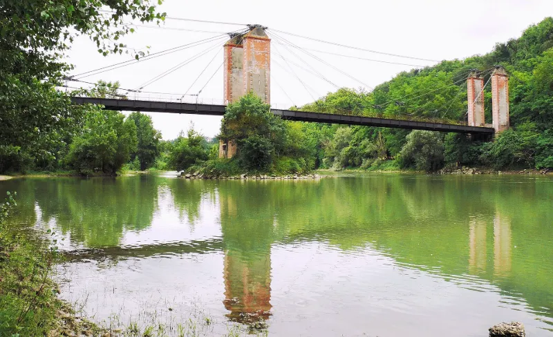
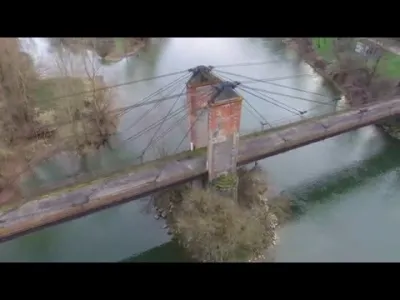
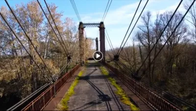
Le premier pont, construit de 1838 à 1842, est détruit par les crues de 1843 et 1875. Un nouveau pont est reconstruit immédiatement après, puis démoli en 1910. Le pont actuel est reconstruit de 1912 à 1914 par l'entreprise de Ferdinand Arnodin, suivant le procédé du commandant du Génie et ingénieur Albert Gisclard destiné à rendre rigides les ponts suspendus. Les épreuves furent réalisées en 1924. Les premiers désordres apparurent en 1938 et les travaux ne furent exécutés qu'en 1943. Long de 173m, l'ouvrage est à trois travées à haubans dont deux piles ont leurs assises dans la Garonne.
Map and restricted areas
Open in the main mapRestricted zones
Nearby aerodromes
Open aerodromes within 25 km of the spot, heliports included, with their distance and direction from the spot. Near an aerodrome, drone flying is prohibited or height-limited: check the UAS zones map.
| Aerodrome | Type | Distance | Elevation |
|---|---|---|---|
| Fromissard ULM | Aerodrome | 7.5 km NE | 96 m |
| Base ULM du Burgaud | Aerodrome | 15 km S | 183 m |
| Aérodrome de Castelsarrasin Moissac | Aerodrome | 16 km N | 74 m |
| Aérodrome Morin - Védrines | Aerodrome | 19 km NE | 107 m |
Aviation weather (METAR and TAF)
LFBO – Toulouse-Blagnac Airport MVFR
METAR
METAR LFBO 171400Z AUTO 10005KT 050V130 9999 FEW008 OVC022 14/14 Q1004 TEMPO 4000 RA BKN010
- Wind
- 100°, 9 km/h
- Visibility
- 10 km or more
- Clouds
- Few (1-2/8) at 800 ft (240 m) ; Overcast (8/8) at 2,200 ft (670 m)
- Temperature
- 14 °C, dew point 14 °C
- QNH
- 1004 hPa
- Flight category
- MVFR: ceiling 1,000–3,000 ft or visibility 3–5 mi
TAF
TAF LFBO 171100Z 1712/1818 18006KT 9999 BKN038 TEMPO 1712/1717 4000 RA BKN010 TEMPO 1717/1720 8000 -RA BKN014 BECMG 1720/1722 CAVOK BECMG 1803/1805 33006KT BECMG 1805/1807 4000 -RA BKN013 BKN040 BECMG 1807/1809 25010KT BECMG 1809/1811 9999 NSW BKN030 BECMG 1816/1818 19006KT CAVOK
| Period (local time) | Change | Wind | Visibility | Weather | Clouds |
|---|---|---|---|---|---|
| 17/11 13:00 → 17/11 21:00 | Initial conditions | 180°, 11 km/h | 10 km or more | Broken (5-7/8) at 3,800 ft (1160 m) | |
| 17/11 13:00 → 17/11 18:00 | Temporarily | 4.0 km | Rain | Broken (5-7/8) at 1,000 ft (300 m) | |
| 17/11 18:00 → 17/11 21:00 | Temporarily | 8 km | Rain light | Broken (5-7/8) at 1,400 ft (430 m) | |
| 17/11 21:00 → 18/11 04:00 | Becoming | 180°, 11 km/h | 10 km or more | No significant weather | No significant cloud |
| 18/11 04:00 → 18/11 06:00 | Becoming | 330°, 11 km/h | 10 km or more | No significant weather | No significant cloud |
| 18/11 06:00 → 18/11 08:00 | Becoming | 330°, 11 km/h | 4.0 km | Rain light | Broken (5-7/8) at 1,300 ft (400 m) ; Broken (5-7/8) at 4,000 ft (1220 m) |
| 18/11 08:00 → 18/11 10:00 | Becoming | 250°, 19 km/h | 4.0 km | Rain light | Broken (5-7/8) at 1,300 ft (400 m) ; Broken (5-7/8) at 4,000 ft (1220 m) |
| 18/11 10:00 → 18/11 17:00 | Becoming | 250°, 19 km/h | 10 km or more | No significant weather | Broken (5-7/8) at 3,000 ft (910 m) |
| 18/11 17:00 → 18/11 19:00 | Becoming | 190°, 11 km/h | 10 km or more | No significant weather | No significant cloud |
Weather and Kp index
Sunrise and sunset
| Day | Dawn | Sunrise | Golden hour | Sunset | Dusk | Day length |
|---|---|---|---|---|---|---|
| Tue 17 Nov | 07:22 | 07:53 | 07:53–08:37 · 16:44–17:28 | 17:28 | 17:59 | 9 h 35 |
| Wed 18 Nov | 07:23 | 07:54 | 07:54–08:38 · 16:43–17:27 | 17:27 | 17:58 | 9 h 32 |
| Thu 19 Nov | 07:24 | 07:55 | 07:55–08:40 · 16:42–17:26 | 17:26 | 17:57 | 9 h 30 |
| Fri 20 Nov | 07:25 | 07:57 | 07:57–08:41 · 16:41–17:25 | 17:25 | 17:57 | 9 h 28 |
| Sat 21 Nov | 07:26 | 07:58 | 07:58–08:42 · 16:40–17:24 | 17:24 | 17:56 | 9 h 26 |
| Sun 22 Nov | 07:28 | 07:59 | 07:59–08:44 · 16:39–17:24 | 17:24 | 17:55 | 9 h 24 |
| Mon 23 Nov | 07:29 | 08:00 | 08:00–08:45 · 16:38–17:23 | 17:23 | 17:55 | 9 h 22 |

Reviews (0)
Log in to review this spot. Log in · Create a free account
No reviews yet. Share yours!