

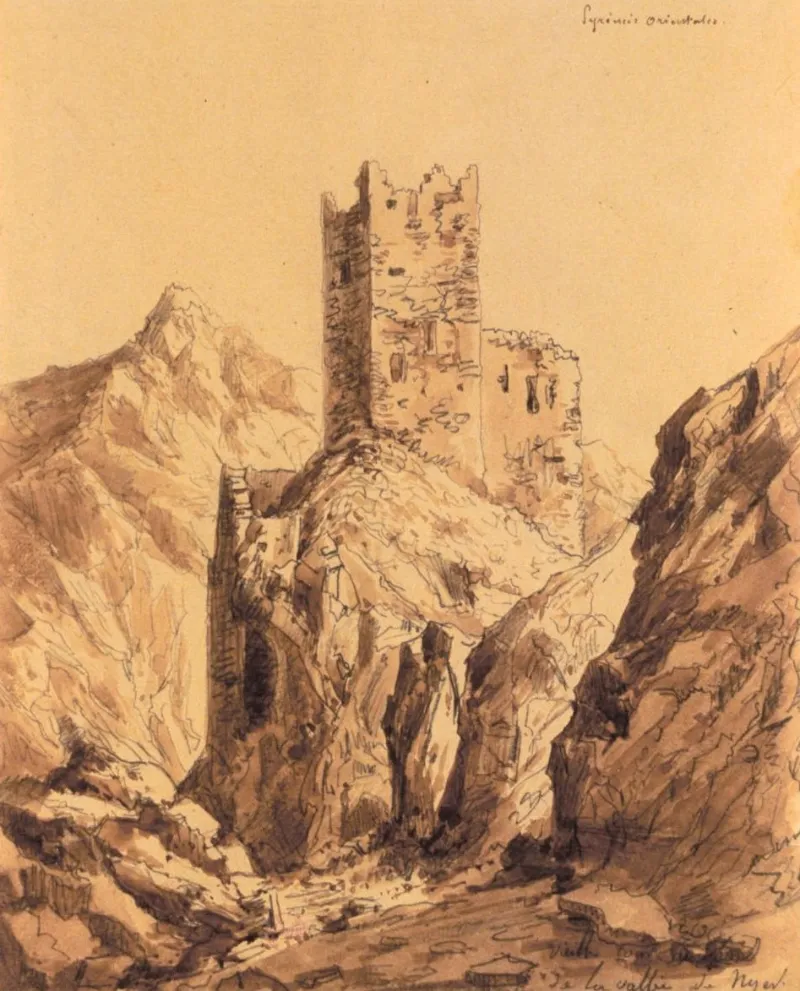
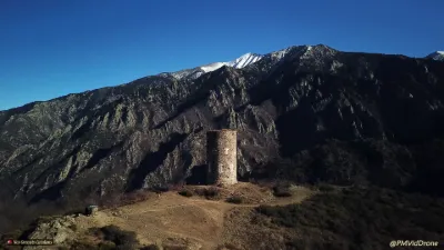
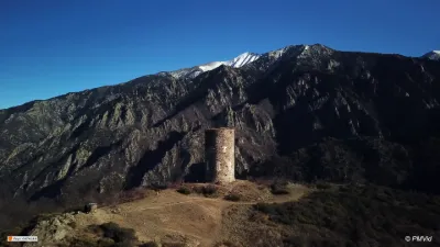
Former Roca d'Anyer Castle
No reviews yet
Have you flown here? Share your experience with other pilots.
+ Write the first reviewHistory
Le territoire de Nyer est mentionné dès 871. Le château est mentionné au siècle suivant. L'ouvrage défendait l'entrée des gorges de la Rivière de Mantet. Le terme "Roca" désigne habituellement, en ces régions, un type primitif de fortification où la défense était assise sur le roc naturel et assurée surtout par les escarpements. Au 14e siècle, la seigneurie de Nyer revient à la maison de Banyuls. La Roca est abandonné au 15e ou 16e siècle et les matériaux utilisés pour la construction d'une chapelle voisine (Notre-Dame de la Roca). Le château ne servit plus de résidence au seigneur mais a conservé ses attributs défensifs et était sans doute pourvu d'une petite garnison durant les périodes troublées. Les éléments les plus anciens (tour) dateraient du 10e siècle. La tour carrée, crénelée en gradins, est renforcée à la base par un épais talus de pierres rapportées, masquant la base de la construction. Les salles superposées, sans escalier, sont pourvues d'archères très courtes, une par niveau dans l'axe des façades. A cette construction a été accolé un mur d'enceinte comportant un chemin de ronde, sans doute au 15e ou 16e siècle. Des murs ruinés relient cette défense à une forte muraille oblique et aux vestiges de l'ancien château.
Map and restricted areas
Open in the main mapRestricted zones
| Zone | Category | Limits | Conditions |
|---|---|---|---|
| Istres | Zone réglementée | 5491 m above sea level → 30766 m above sea level | Vols interdits sauf lorsque the official document of the zone l'autorise explicitement ou avec l'accord du gestionnaire de la zone lorsqu'il est désigné par the official document of the zone |
Nearby aerodromes
Open aerodromes within 25 km of the spot, heliports included, with their distance and direction from the spot. Near an aerodrome, drone flying is prohibited or height-limited: check the UAS zones map.
| Aerodrome | Type | Distance | Elevation |
|---|---|---|---|
| Mont Louis La Quillane Airfield | Aerodrome | 13 km W | 1,710 m |
| Altiport du Col de la Marrano | Aerodrome | 18 km NW | 2,000 m |
| Altisurface de l'Hippopotame | Aerodrome | 20 km W | 1,500 m |
| Mont Llaret Pic d'Aude Airfield | Aerodrome | 21 km W | 2,325 m |
| Mont Llaret Roc d'Aude Airfield | Aerodrome | 22 km W | 2,350 m |
Aviation weather (METAR and TAF)
No METAR station within 50 km.
Weather and Kp index
| Day | Weather | Temp. min. / max. | Wind | Rain | Max Kp |
|---|---|---|---|---|---|
| Tue 17 Nov | Cloudy | 12° / 17° | 16 km/h W | – | 5 |
| Wed 18 Nov | Showers | 9° / 15° | 18 km/h SW | 1.7 mm | 5 |
| Thu 19 Nov | Clear sky | 5° / 14° | 32 km/h SW | 4.4 mm | 3 |
| Fri 20 Nov | Cloudy | 4° / 13° | 9 km/h SW | 0.5 mm | 3 |
| Sat 21 Nov | Cloudy | 5° / 12° | 9 km/h SW | – | – |
| Sun 22 Nov | Partly cloudy | 6° / 11° | 11 km/h W | – | – |
| Mon 23 Nov | Partly cloudy | 3° / 12° | 6 km/h SW | – | – |
Hour by hour: Tuesday 17 November
| Time | Weather | Temp. | Wind | Rain | Clouds | Kp |
|---|---|---|---|---|---|---|
| 15:00 | Cloudy | 17° | 12 km/h W | – | 100 % | 4 |
| 16:00 | Cloudy | 16° | 12 km/h SW | – | 100 % | 4 |
| 17:00 | Cloudy | 15° | 16 km/h W | – | 100 % | 4 |
| 18:00 | Cloudy | 14° | 14 km/h W | – | 98 % | 4 |
| 19:00 | Cloudy | 14° | 12 km/h W | – | 98 % | 5 |
| 20:00 | Cloudy | 13° | 10 km/h SW | – | 95 % | 5 |
| 21:00 | Cloudy | 12° | 10 km/h SW | – | 92 % | 5 |
| 22:00 | Cloudy | 12° | 10 km/h SW | – | 95 % | 5 |
Hour by hour: Wednesday 18 November
| Time | Weather | Temp. | Wind | Rain | Clouds | Kp |
|---|---|---|---|---|---|---|
| 06:00 | Fog | 11° | 7 km/h SW | – | 65 % | 4 |
| 07:00 | Fog | 10° | 6 km/h SW | – | 74 % | 4 |
| 08:00 | Partly cloudy | 9° | 7 km/h SW | – | 59 % | 4 |
| 09:00 | Fair | 12° | 5 km/h SW | – | 38 % | 4 |
| 10:00 | Partly cloudy | 13° | 7 km/h SW | – | 64 % | 4 |
| 11:00 | Cloudy | 14° | 9 km/h SW | – | 98 % | 4 |
| 12:00 | Cloudy | 14° | 10 km/h N | – | 96 % | 4 |
| 13:00 | Showers | 15° | 12 km/h SW | 0.3 mm | 77 % | 3 |
| 14:00 | Showers | 14° | 13 km/h E | 0.4 mm | 79 % | 3 |
| 15:00 | Showers | 14° | 13 km/h N | 0.1 mm | 62 % | 3 |
| 16:00 | Partly cloudy | 13° | 11 km/h W | – | 59 % | 3 |
| 17:00 | Partly cloudy | 13° | 8 km/h SE | – | 62 % | 3 |
| 18:00 | Partly cloudy | 11° | 5 km/h S | – | 80 % | 3 |
| 19:00 | Partly cloudy | 10° | 7 km/h S | – | 77 % | 2 |
| 20:00 | Partly cloudy | 10° | 9 km/h SW | – | 75 % | 2 |
| 21:00 | Partly cloudy | 10° | 13 km/h SW | – | 76 % | 2 |
| 22:00 | Partly cloudy | 10° | 17 km/h SW | – | 51 % | 2 |
Sunrise and sunset
| Day | Dawn | Sunrise | Golden hour | Sunset | Dusk | Day length |
|---|---|---|---|---|---|---|
| Tue 17 Nov | 07:14 | 07:45 | 07:45–08:27 · 16:45–17:27 | 17:27 | 17:57 | 9 h 42 |
| Wed 18 Nov | 07:15 | 07:46 | 07:46–08:28 · 16:44–17:26 | 17:26 | 17:57 | 9 h 40 |
| Thu 19 Nov | 07:16 | 07:47 | 07:47–08:30 · 16:43–17:26 | 17:26 | 17:56 | 9 h 38 |
| Fri 20 Nov | 07:18 | 07:48 | 07:48–08:31 · 16:42–17:25 | 17:25 | 17:55 | 9 h 36 |
| Sat 21 Nov | 07:19 | 07:49 | 07:49–08:33 · 16:41–17:24 | 17:24 | 17:55 | 9 h 34 |
| Sun 22 Nov | 07:20 | 07:51 | 07:51–08:34 · 16:40–17:23 | 17:23 | 17:54 | 9 h 32 |
| Mon 23 Nov | 07:21 | 07:52 | 07:52–08:35 · 16:39–17:23 | 17:23 | 17:54 | 9 h 30 |

Reviews (0)
Log in to review this spot. Log in · Create a free account
No reviews yet. Share yours!