

Castle
No reviews yet
Have you flown here? Share your experience with other pilots.
+ Write the first reviewHistory
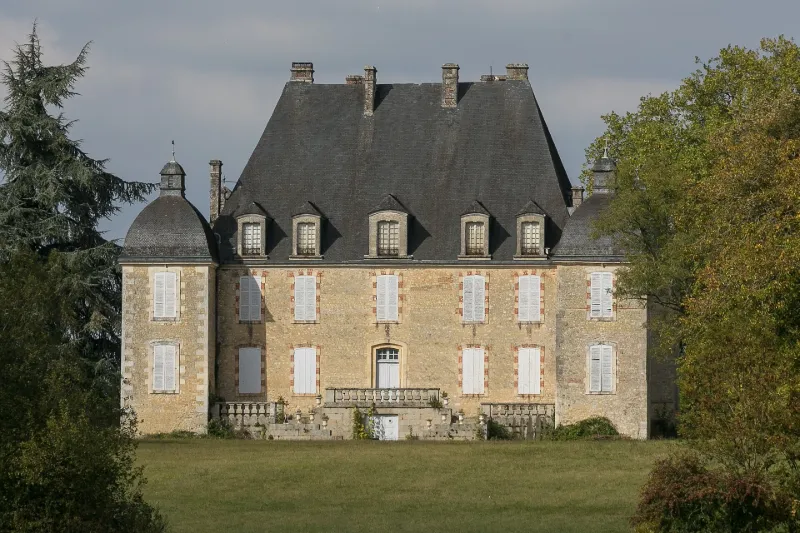
Le château présente un donjon presque carré, flanqué de quatre étroits pavillons d'angle carrés et coiffés de lanternons. L'édifice était entouré de larges fossés. L'édifice connut des travaux intérieurs et extérieurs aux 17e, 18e et 19e siècles. En 1733, mise en place de la cheminée monumentale de la salle d'entrée et des boiseries Régence du grand salon. Les deux tours de l'ouest, dont seuls les soubassements avaient été commencés, furent achevés en 1835. La façade nord fut remaniée au 18e siècle.
Map and restricted areas
Open in the main mapRestricted zones
Nearby aerodromes
Open aerodromes within 25 km of the spot, heliports included, with their distance and direction from the spot. Near an aerodrome, drone flying is prohibited or height-limited: check the UAS zones map.
| Aerodrome | Type | Distance | Elevation |
|---|---|---|---|
| Aérodrome d'Alençon - Valframbert | Aerodrome | 16 km SW | 146 m |
| Aérodrome de Mortagne Au Perche | Aerodrome | 19 km E | 270 m |
| Centre Hospitalier Heliport | Heliport | 19 km SW | 135 m |
Aviation weather (METAR and TAF)
No METAR station within 50 km.
Weather and Kp index
Sunrise and sunset
| Day | Dawn | Sunrise | Golden hour | Sunset | Dusk | Day length |
|---|---|---|---|---|---|---|
| Tue 17 Nov | 07:36 | 08:10 | 08:10–08:59 · 16:28–17:18 | 17:18 | 17:52 | 9 h 07 |
| Wed 18 Nov | 07:37 | 08:11 | 08:11–09:01 · 16:27–17:17 | 17:17 | 17:51 | 9 h 05 |
| Thu 19 Nov | 07:38 | 08:13 | 08:13–09:03 · 16:26–17:16 | 17:16 | 17:50 | 9 h 02 |
| Fri 20 Nov | 07:40 | 08:14 | 08:14–09:05 · 16:24–17:15 | 17:15 | 17:49 | 9 h 00 |
| Sat 21 Nov | 07:41 | 08:16 | 08:16–09:06 · 16:23–17:14 | 17:14 | 17:48 | 8 h 57 |
| Sun 22 Nov | 07:42 | 08:17 | 08:17–09:08 · 16:22–17:13 | 17:13 | 17:48 | 8 h 55 |
| Mon 23 Nov | 07:44 | 08:19 | 08:19–09:10 · 16:21–17:12 | 17:12 | 17:47 | 8 h 52 |

Reviews (0)
Log in to review this spot. Log in · Create a free account
No reviews yet. Share yours!